Photo Mug > Maps and Charts > Early Maps
Photo Mug : Map / Channel Islands 18C


![]()
Home Decor from Mary Evans Picture Library
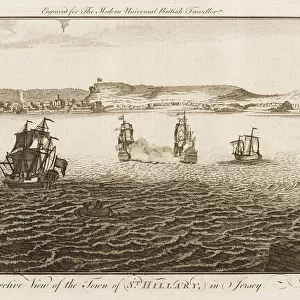
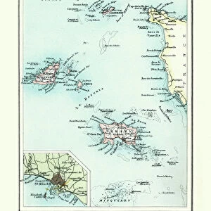
Map / Channel Islands 18C
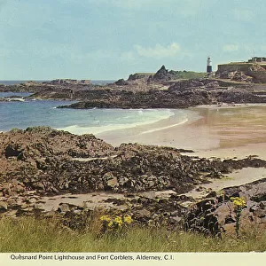
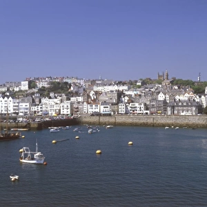
Map of Jersey, Guernsey, Alderney, Sark and the Scilly Isles
Mary Evans Picture Library makes available wonderful images created for people to enjoy over the centuries
Media ID 607569
© Mary Evans Picture Library 2015 - https://copyrighthub.org/s0/hub1/creation/maryevans/MaryEvansPictureID/10059488
Alderney Channel Guernsey Isles Jersey Maps S Ark Scilly
Large Photo Mug (15 oz)
Discover the charm of the Channel Islands with our Media Storehouse Photo Mug! Featuring the beautiful "Map / Channel Islands 18C" image from Mary Evans Picture Library, this mug is a perfect blend of history and function. The intricately detailed map showcases Jersey, Guernsey, Alderney, Sark, and the Scilly Isles in the 1800s, making it a lovely addition to any kitchen or office. Each mug holds your favorite beverage and is a great conversation starter. Bring a piece of the Channel Islands into your daily routine with this unique and captivating mug.
Elevate your coffee or tea experience with our premium white ceramic mug. Its wide, comfortable handle makes drinking easy, and you can rely on it to be both microwave and dishwasher safe. Sold in single units, preview may show both sides of the same mug so you can see how the picture wraps around.
Elevate your coffee or tea experience with our premium white ceramic mug. Its wide, comfortable handle makes drinking easy, and you can rely on it to be both microwave and dishwasher safe. Sold in single units, preview may show both sides of the same mug so you can see how the picture wraps around.
These are individually made so all sizes are approximate
FEATURES IN THESE COLLECTIONS
> Maps and Charts
> Early Maps
> Maps and Charts
> Related Images
EDITORS COMMENTS
This stunning historical print showcases a detailed map of the Channel Islands in the 18th century, including Jersey, Guernsey, Alderney, Sark and the Scilly Isles. The intricate details and vibrant colors bring to life the rich history and significance of these islands in centuries past.
Each island is clearly labeled on the map, allowing viewers to imagine what life was like in this region during this time period. From bustling ports to quaint villages, this map provides a glimpse into the diverse landscapes and communities that existed on these islands hundreds of years ago.
The meticulous craftsmanship of this map is evident in every line and symbol, reflecting the expertise and dedication of cartographers from centuries past. It serves as a reminder of how maps have been essential tools for exploration, navigation, and understanding our world throughout history.
Whether you have a personal connection to these islands or simply appreciate historical artifacts, this print is sure to captivate your imagination and spark curiosity about the stories hidden within its borders. Display it proudly in your home or office as a conversation piece that will transport you back in time to an era filled with discovery and adventure.
MADE IN THE USA
Safe Shipping with 30 Day Money Back Guarantee
FREE PERSONALISATION*
We are proud to offer a range of customisation features including Personalised Captions, Color Filters and Picture Zoom Tools
SECURE PAYMENTS
We happily accept a wide range of payment options so you can pay for the things you need in the way that is most convenient for you
* Options may vary by product and licensing agreement. Zoomed Pictures can be adjusted in the Cart.