Photo Mug > Asia > India > Maps
Photo Mug : Map / Asia / India C1870


![]()
Home Decor from Mary Evans Picture Library
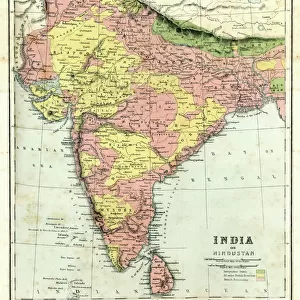
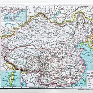
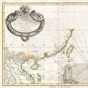
Map / Asia / India C1870
India, showing the various Presidencies under British rule
Mary Evans Picture Library makes available wonderful images created for people to enjoy over the centuries
Media ID 576624
© Mary Evans Picture Library 2015 - https://copyrighthub.org/s0/hub1/creation/maryevans/MaryEvansPictureID/10015675
Large Photo Mug (15 oz)
Introducing the Media Storehouse Photo Mug, a perfect blend of functionality and personalization. This mug features an intriguing historical image of "Map / Asia / India C1870" by Mary Evans Picture Library from Mary Evans Prints Online. This captivating map showcases India during the British colonial era, highlighting various presidencies and territories under British rule. Each sip from this mug brings a piece of history right to your fingertips. The high-quality ceramic material ensures durability, while the vibrant image transfer ensures your custom design stays bright and clear. Make your morning coffee or tea time an educational and enjoyable experience with the Media Storehouse Photo Mug.
Elevate your coffee or tea experience with our premium white ceramic mug. Its wide, comfortable handle makes drinking easy, and you can rely on it to be both microwave and dishwasher safe. Sold in single units, preview may show both sides of the same mug so you can see how the picture wraps around.
Elevate your coffee or tea experience with our premium white ceramic mug. Its wide, comfortable handle makes drinking easy, and you can rely on it to be both microwave and dishwasher safe. Sold in single units, preview may show both sides of the same mug so you can see how the picture wraps around.
These are individually made so all sizes are approximate
FEATURES IN THESE COLLECTIONS
> Mary Evans Prints Online
> Maps
> Asia
> India
> Related Images
> Asia
> Related Images
> Maps and Charts
> Early Maps
> Maps and Charts
> India
> Maps and Charts
> Related Images
> Popular Themes
> Maps and Charts
EDITORS COMMENTS
This print of a historical map of India circa 1870 offers a fascinating glimpse into the country's past, specifically during the time when it was under British rule. The intricate details and borders on the map showcase the various Presidencies that existed at that time, providing valuable insight into the administrative divisions of India during this period.
The map not only serves as a visual representation of India's history but also highlights the influence and impact of British colonialism on the region. It is a reminder of a significant era in Indian history when political power was centralized in different regions under British control.
As we study this map, we are transported back in time to an era where boundaries were defined by colonial powers and cultures intersected in ways that shaped modern-day India. The meticulous craftsmanship and attention to detail on this map reflect both its historical significance and artistic value.
Overall, this print from Mary Evans Picture Library is not just a piece of art but also a valuable educational resource for those interested in exploring India's rich history and understanding how it has evolved over time under British rule.
MADE IN THE USA
Safe Shipping with 30 Day Money Back Guarantee
FREE PERSONALISATION*
We are proud to offer a range of customisation features including Personalised Captions, Color Filters and Picture Zoom Tools
SECURE PAYMENTS
We happily accept a wide range of payment options so you can pay for the things you need in the way that is most convenient for you
* Options may vary by product and licensing agreement. Zoomed Pictures can be adjusted in the Cart.