Photographic Print > Europe > United Kingdom > England > Maps
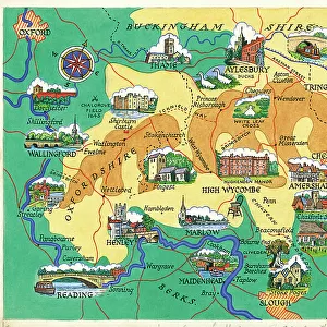
Photographic Print : Map Showing The Coalfields Of Great Britain In The 19th Century. From The National Encyclopaedia, Published C. 1890

![]()
Photo Prints from Design Pics
Map Showing The Coalfields Of Great Britain In The 19th Century. From The National Encyclopaedia, Published C. 1890
Map Showing The Coalfields Of Great Britain In The 19th Century. From The National Encyclopaedia, Published C.1890
Design Pics offers Distinctively Different Imagery representing over 1,500 contributors
Media ID 18200516
© Ken Welsh / Design Pics
Britain Chart Coal Fields Great Mining Coalfield Nineteenth
12"x8" Photo Print
Step back in time with our vintage Map Showing The Coalfields Of Great Britain In The 19th Century, a fascinating historical photograph from the National Encyclopaedia, published around 1890. This captivating image, captured by Ken Welsh from Design Pics, provides a unique glimpse into the rich coal mining history of Great Britain during this era. Perfect for decorating your home or office, this photographic print adds character and charm to any space, igniting conversations about the past. Transport yourself back in time with this intriguing piece of history.
Photo prints are produced on Kodak professional photo paper resulting in timeless and breath-taking prints which are also ideal for framing. The colors produced are rich and vivid, with accurate blacks and pristine whites, resulting in prints that are truly timeless and magnificent. Whether you're looking to display your prints in your home, office, or gallery, our range of photographic prints are sure to impress. Dimensions refers to the size of the paper in inches.
Our Photo Prints are in a large range of sizes and are printed on Archival Quality Paper for excellent colour reproduction and longevity. They are ideal for framing (our Framed Prints use these) at a reasonable cost. Alternatives include cheaper Poster Prints and higher quality Fine Art Paper, the choice of which is largely dependant on your budget.
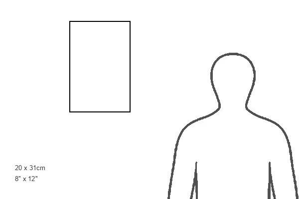
Estimated Product Size is 20.3cm x 30.5cm (8" x 12")
These are individually made so all sizes are approximate
Artwork printed orientated as per the preview above, with portrait (vertical) orientation to match the source image.
FEATURES IN THESE COLLECTIONS
> Europe
> United Kingdom
> England
> Maps
EDITORS COMMENTS
This print showcases a historical treasure - a map revealing the coalfields of Great Britain in the 19th century. Published around 1890, this remarkable piece from The National Encyclopaedia offers an intriguing glimpse into England's rich mining heritage. The map, expertly crafted by Ken Welsh, features intricate details and precise markings that highlight the extensive coalfields scattered across Great Britain. These coalfields served as vital sources of fuel during the industrial revolution, powering factories and propelling Britain's rapid economic growth. As we delve into this visual masterpiece, we are transported back to a time when these sprawling fields were bustling with activity. Imagining the countless miners toiling away underground evokes a sense of admiration for their tireless efforts and resilience. Beyond its historical significance, this print is also aesthetically pleasing. The combination of warm earth tones used to depict the coalfields against a backdrop of muted blues creates an engaging contrast that draws us further into its narrative. Whether you're an avid history enthusiast or simply appreciate fine artistry, this print serves as both an educational tool and a stunning decorative piece. It invites viewers to explore not only Great Britain's vast coal reserves but also its profound impact on shaping society during the 19th century.
MADE IN THE USA
Safe Shipping with 30 Day Money Back Guarantee
FREE PERSONALISATION*
We are proud to offer a range of customisation features including Personalised Captions, Color Filters and Picture Zoom Tools
SECURE PAYMENTS
We happily accept a wide range of payment options so you can pay for the things you need in the way that is most convenient for you
* Options may vary by product and licensing agreement. Zoomed Pictures can be adjusted in the Cart.