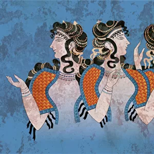
Photographic Print > Historic > Ancient civilizations > Roman Empire > Roman art
Photographic Print : Map of the Eastern Roman Empire (Byzantine Empire) and the Kingdom of the Lombards, 553-774 (Map of byzantine empire and Kingdom of the Lombards, 6th 7th 8th century) Engraving from Houze's "Atlas Universel", 1851 Private collection
 and the Kingdom of the Lombards, 553-774 (Map of byzantine empire and Kingdom of the Lombards, 6th 7th 8th century) Engraving from Houze's 'Atlas Universel', 1851 Private collection")

![]()
Photo Prints From Fine Art Finder
Map of the Eastern Roman Empire (Byzantine Empire) and the Kingdom of the Lombards, 553-774 (Map of byzantine empire and Kingdom of the Lombards, 6th 7th 8th century) Engraving from Houze's "Atlas Universel", 1851 Private collection
ELD4928045 Map of the Eastern Roman Empire (Byzantine Empire) and the Kingdom of the Lombards, 553-774 (Map of byzantine empire and Kingdom of the Lombards, 6th 7th 8th century) Engraving from Houze's "Atlas Universel", 1851 Private collection; (add.info.: Map of the Eastern Roman Empire (Byzantine Empire) and the Kingdom of the Lombards, 553-774 (Map of byzantine empire and Kingdom of the Lombards, 6th 7th 8th century) Engraving from Houze's "Atlas Universel", 1851 Private collection); Photo © The Holbarn Archive
Media ID 38090194
© © The Holbarn Archive / Bridgeman Images
6 6th Vi Vith Century 6th 6th 6th Vi Vith Vith Century 6th Century Atlas Book Byzantine Byzantium C6th Mediterranean Mediterranean Sea Sixth Century Ad Vi Century Vith Century Geographical Map Grece Isadora
10"x8" Photo Print
Explore the rich history of the Eastern Roman Empire and the Kingdom of the Lombards with this stunning photographic print from Media Storehouse. A detailed engraving from Houze's "Atlas Universel" in 1851, this piece is a must-have for any history enthusiast's collection.
Photo prints are produced on Kodak professional photo paper resulting in timeless and breath-taking prints which are also ideal for framing. The colors produced are rich and vivid, with accurate blacks and pristine whites, resulting in prints that are truly timeless and magnificent. Whether you're looking to display your prints in your home, office, or gallery, our range of photographic prints are sure to impress. Dimensions refers to the size of the paper in inches.
Our Photo Prints are in a large range of sizes and are printed on Archival Quality Paper for excellent colour reproduction and longevity. They are ideal for framing (our Framed Prints use these) at a reasonable cost. Alternatives include cheaper Poster Prints and higher quality Fine Art Paper, the choice of which is largely dependant on your budget.
Estimated Image Size (if not cropped) is 25.4cm x 18cm (10" x 7.1")
Estimated Product Size is 25.4cm x 20.3cm (10" x 8")
These are individually made so all sizes are approximate
Artwork printed orientated as per the preview above, with landscape (horizontal) orientation to match the source image.
FEATURES IN THESE COLLECTIONS
> Arts
> Artists
> R
> Roman Roman
> Europe
> Greece
> Related Images
> Europe
> Italy
> Lombardy
> Related Images
> Historic
> Ancient civilizations
> Ancient Greece
> Greek history
> Historic
> Ancient civilizations
> Roman Empire
> Roman art
EDITORS COMMENTS
This stunning engraving from Houze's "Atlas Universel" showcases a detailed map of the Eastern Roman Empire (Byzantine Empire) and the Kingdom of the Lombards during the years 553-774. The intricate lines and symbols on this historical map provide a glimpse into the political landscape of Europe in the 6th, 7th, and 8th centuries.
The Byzantine Empire, known for its rich history and cultural influence, is depicted alongside the Kingdom of the Lombards, highlighting their territorial boundaries and strategic positions. This visual representation offers a window into the complexities of power dynamics and alliances during this time period.
The vibrant colors used in this print bring to life key regions such as Italy, Greece, and other parts of Europe that were integral to these empires. The Mediterranean Sea serves as a connecting point between these two powerful entities, showcasing their reach across land and sea.
As we study this map closely, we can appreciate how geography played a crucial role in shaping history. From trade routes to military campaigns, each detail on this engraving tells a story of conquests and conflicts that defined an era.
This piece from Bridgeman Images is not just a work of art but also a valuable historical document that sheds light on the legacy of civilizations long past.
MADE IN THE USA
Safe Shipping with 30 Day Money Back Guarantee
FREE PERSONALISATION*
We are proud to offer a range of customisation features including Personalised Captions, Color Filters and Picture Zoom Tools
SECURE PAYMENTS
We happily accept a wide range of payment options so you can pay for the things you need in the way that is most convenient for you
* Options may vary by product and licensing agreement. Zoomed Pictures can be adjusted in the Basket.