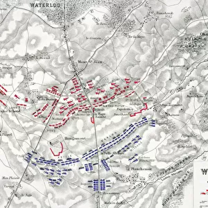
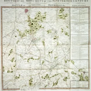
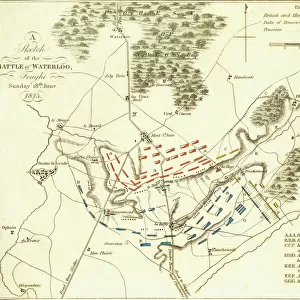
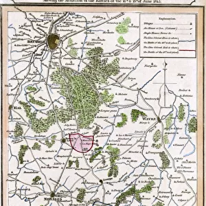
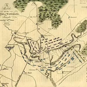
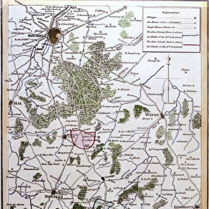
Photographic Print > Historic > Battles > Battle of Waterloo > Map of the Waterloo campaign
Photographic Print : Map of the Battle of Waterloo, Belgium, 18 June 1815


![]()
Photo Prints from Fine Art Storehouse
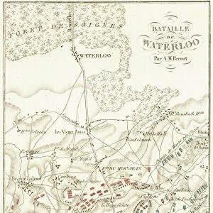
Map of the Battle of Waterloo, Belgium, 18 June 1815
Topographic map of the Battle of Waterloo, Belgium. The defeat of the French army under the command of Napoleon Bonaparte on 18 June 1815 marked the end of the Napoleonic Wars. Wood engraving, published in 1897
Unleash your creativity and transform your space into a visual masterpiece!
ZU_09
Media ID 19990285
10"x10" Photo Print
Discover the historic significance of the Battle of Waterloo with this stunning topographic print from the Media Storehouse range. Created by ZU_09 from the Fine Art Storehouse, this detailed map captures the strategic layout of the Battle of Waterloo, which took place on 18 June 1815 in Belgium. Witness the final defeat of Napoleon Bonaparte's French army, marking the end of the Napoleonic Wars. Bring a piece of historical art into your home or office and relive the stories of one of the most pivotal moments in European history.
Photo prints are produced on Kodak professional photo paper resulting in timeless and breath-taking prints which are also ideal for framing. The colors produced are rich and vivid, with accurate blacks and pristine whites, resulting in prints that are truly timeless and magnificent. Whether you're looking to display your prints in your home, office, or gallery, our range of photographic prints are sure to impress. Dimensions refers to the size of the paper in inches.
Our Photo Prints are in a large range of sizes and are printed on Archival Quality Paper for excellent colour reproduction and longevity. They are ideal for framing (our Framed Prints use these) at a reasonable cost. Alternatives include cheaper Poster Prints and higher quality Fine Art Paper, the choice of which is largely dependant on your budget.
Estimated Image Size (if not cropped) is 23.7cm x 25.4cm (9.3" x 10")
Estimated Product Size is 25.4cm x 25.4cm (10" x 10")
These are individually made so all sizes are approximate
Artwork printed orientated as per the preview above, with portrait (vertical) orientation to match the source image.
FEATURES IN THESE COLLECTIONS
> Fine Art Storehouse
> History
> Battles & Wars
> Battle of Waterloo June 18, 1815
> Fine Art Storehouse
> Map
> Historical Maps
> Europe
> Belgium
> Related Images
> Historic
> Battles
> Battle of Waterloo
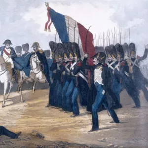
> French Army
> Historic
> Battles
> Battle of Waterloo
> Map of the Waterloo campaign
> Historic
> Battles
> Battle of Waterloo
> Napoleon Bonaparte
> Historic
> Battles
> Related Images
EDITORS COMMENTS
This print showcases a historic artifact that takes us back to the momentous Battle of Waterloo in Belgium on 18 June 1815. The topographic map depicted here provides a detailed layout of the battlefield where the French army, led by none other than Napoleon Bonaparte himself, suffered a decisive defeat. This significant event marked the ultimate conclusion of the Napoleonic Wars, forever altering Europe's political landscape. The wood engraving technique used in this print adds an intriguing vintage touch, emphasizing its historical significance and evoking a sense of nostalgia. Published in 1897, this artwork serves as both a visual representation and a valuable educational tool for history enthusiasts. As we gaze upon this remarkable piece, we are transported back in time to witness one of history's most pivotal moments unfold before our eyes. The intricate details captured within the map allow us to imagine how each troop maneuvered across these very grounds during that fateful day. Whether you are an avid collector or simply appreciate art with historical value, this print is sure to captivate your imagination and spark conversations about one of humanity's defining conflicts – an enduring testament to human resilience and determination against all odds.
MADE IN THE USA
Safe Shipping with 30 Day Money Back Guarantee
FREE PERSONALISATION*
We are proud to offer a range of customisation features including Personalised Captions, Color Filters and Picture Zoom Tools
SECURE PAYMENTS
We happily accept a wide range of payment options so you can pay for the things you need in the way that is most convenient for you
* Options may vary by product and licensing agreement. Zoomed Pictures can be adjusted in the Cart.