Photographic Print > North America > Cuba > Maps
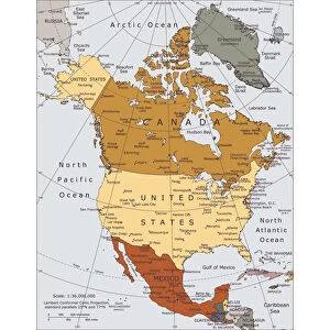
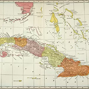
Photographic Print : North America Map. Vintage Map with United States, Canada, Mexico and rivers
![]()

Photo Prints from Fine Art Storehouse
North America Map. Vintage Map with United States, Canada, Mexico and rivers
North America Map with United States, Canada, Mexico and Cuba Map was found: http://legacy.lib.utexas.edu/maps/americas/txu-oclc-71353734-north_america_pol_2006.jpg
Unleash your creativity and transform your space into a visual masterpiece!
Media ID 20249929
10"x8" Photo Print
Discover the rich history of North America with our exquisite vintage map print from Media Storehouse's Fine Art Storehouse collection. This beautifully detailed map depicts the United States, Canada, Mexico, and Cuba, with intricately rendered rivers and geographical features. Transport yourself back in time with this captivating piece of cartographic art, perfect for adding a unique touch to any room in your home or office. Embrace the nostalgia and bring a piece of history into your space.
Photo prints are produced on Kodak professional photo paper resulting in timeless and breath-taking prints which are also ideal for framing. The colors produced are rich and vivid, with accurate blacks and pristine whites, resulting in prints that are truly timeless and magnificent. Whether you're looking to display your prints in your home, office, or gallery, our range of photographic prints are sure to impress. Dimensions refers to the size of the paper in inches.
Our Photo Prints are in a large range of sizes and are printed on Archival Quality Paper for excellent colour reproduction and longevity. They are ideal for framing (our Framed Prints use these) at a reasonable cost. Alternatives include cheaper Poster Prints and higher quality Fine Art Paper, the choice of which is largely dependant on your budget.
Estimated Product Size is 20.3cm x 25.4cm (8" x 10")
These are individually made so all sizes are approximate
Artwork printed orientated as per the preview above, with landscape (horizontal) or portrait (vertical) orientation to match the source image.
FEATURES IN THESE COLLECTIONS
> Fine Art Storehouse
> Map
> Reference Maps
> Maps and Charts
> Related Images
> North America
> Canada
> Maps
> North America
> Canada
> Related Images
> North America
> Cuba
> Maps
> North America
> Cuba
> Related Images
> North America
> Mexico
> Maps
> North America
> Mexico
> Related Images
EDITORS COMMENTS
Discover the rich tapestry of North America with this stunning vintage map print. A true testament to the beauty and diversity of our continent, this meticulously detailed artwork showcases the United States, Canada, Mexico, and even Cuba. Transport yourself back in time as you explore the intricate network of rivers that crisscross these lands. This piece captures both history and geography in a single frame. The aged aesthetic adds a touch of nostalgia, evoking memories of bygone eras when cartography was an art form unto itself. Every line and contour tells a story – from the mighty Mississippi River winding its way through America's heartland to the majestic St. Lawrence River connecting Canada's Great Lakes to the Atlantic Ocean. Whether you're an avid traveler or simply appreciate fine craftsmanship, this North America map print is sure to captivate your imagination. Hang it proudly on your wall as a conversation starter or use it as a reference for planning your next adventure across these vast lands. As part of Fine Art Storehouse's collection, this exquisite print brings together historical significance and artistic flair
MADE IN THE USA
Safe Shipping with 30 Day Money Back Guarantee
FREE PERSONALISATION*
We are proud to offer a range of customisation features including Personalised Captions, Color Filters and Picture Zoom Tools
SECURE PAYMENTS
We happily accept a wide range of payment options so you can pay for the things you need in the way that is most convenient for you
* Options may vary by product and licensing agreement. Zoomed Pictures can be adjusted in the Cart.


