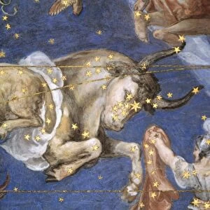
Photographic Print > Italian renaissance art
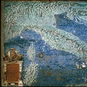
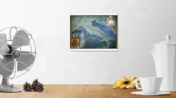
Photographic Print : MAP OF ITALY, c1585. By Ignazio Danti from Sistine Chapel Gallery of Maps


![]()
Photo Prints from Granger
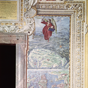
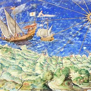
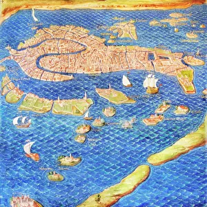
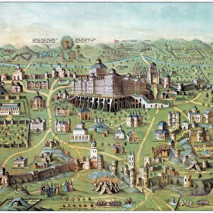
MAP OF ITALY, c1585. By Ignazio Danti from Sistine Chapel Gallery of Maps
MAP OF ITALY, c1585.
By Ignazio Danti from Sistine Chapel Gallery of Maps
Granger holds millions of images spanning more than 25,000 years of world history, from before the Stone Age to the dawn of the Space Age
Media ID 12319654
10"x8" Photo Print
Introducing the captivating "MAP OF ITALY, c1585" from our Media Storehouse collection of Photographic Prints. This exquisite piece, created by Ignazio Danti from the Sistine Chapel Gallery of Maps, transports you back in time to the Renaissance era. The intricate details of this map showcase the vast landscape of Italy during the 16th century, making it a stunning addition to any home or office space. With its rich history and timeless beauty, this photographic print is not just an artwork but a window into the past. Bring a piece of history into your life with Media Storehouse's premium quality prints.
Photo prints are produced on Kodak professional photo paper resulting in timeless and breath-taking prints which are also ideal for framing. The colors produced are rich and vivid, with accurate blacks and pristine whites, resulting in prints that are truly timeless and magnificent. Whether you're looking to display your prints in your home, office, or gallery, our range of photographic prints are sure to impress. Dimensions refers to the size of the paper in inches.
Our Photo Prints are in a large range of sizes and are printed on Archival Quality Paper for excellent colour reproduction and longevity. They are ideal for framing (our Framed Prints use these) at a reasonable cost. Alternatives include cheaper Poster Prints and higher quality Fine Art Paper, the choice of which is largely dependant on your budget.
Estimated Image Size (if not cropped) is 25.4cm x 18.1cm (10" x 7.1")
Estimated Product Size is 25.4cm x 20.3cm (10" x 8")
These are individually made so all sizes are approximate
Artwork printed orientated as per the preview above, with landscape (horizontal) orientation to match the source image.
FEATURES IN THESE COLLECTIONS
> Granger Art on Demand
> Maps
> Arts
> Art Movements
> Renaissance Art
> Arts
> Landscape paintings
> Waterfall and river artworks
> River artworks
> Historic
> Renaissance art
> Italian Renaissance art
> Maps and Charts
> Italy
> Maps and Charts
> Related Images
EDITORS COMMENTS
This print showcases the exquisite "Map of Italy, c1585" created by the talented Italian cartographer Ignazio Danti. This masterpiece is part of the renowned Sistine Chapel Gallery of Maps collection and offers a fascinating glimpse into Renaissance-era geography. Danti's intricate map depicts Italy with remarkable precision, highlighting its diverse regions, cities, and rivers. The attention to detail is truly awe-inspiring as each element is meticulously rendered, capturing the essence of this beautiful country during that period. As we delve into this historical artifact, we are transported back in time to witness Italy's rich cultural heritage unfold before our eyes. From north to south, every corner of this enchanting land comes alive through vibrant colors and delicate strokes. It allows us to trace the path of famous rivers like the Po or Tiber and discover their significance in shaping Italy's history. Beyond its aesthetic appeal, Danti's map serves as a testament to human curiosity and exploration during an era when knowledge was expanding rapidly. It reminds us that maps were not just tools for navigation but also works of art that celebrated both scientific accuracy and artistic expression. Whether you are an admirer of Italian culture or a lover of cartography, this stunning print will undoubtedly captivate your imagination while offering a window into Italy's past like never before.
MADE IN THE USA
Safe Shipping with 30 Day Money Back Guarantee
FREE PERSONALISATION*
We are proud to offer a range of customisation features including Personalised Captions, Color Filters and Picture Zoom Tools
SECURE PAYMENTS
We happily accept a wide range of payment options so you can pay for the things you need in the way that is most convenient for you
* Options may vary by product and licensing agreement. Zoomed Pictures can be adjusted in the Cart.