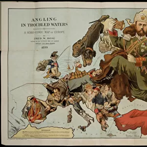
Photographic Print > Europe > United Kingdom > England > London > Art > Theatre
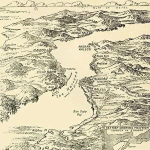
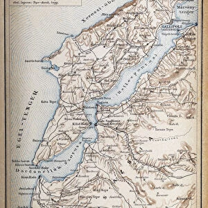
Photographic Print : Map of the Dardanelles and Sea of Marmara, c1914, (1920). Creator: Unknown
. Creator: Unknown")

![]()
Photo Prints from Heritage Images
Map of the Dardanelles and Sea of Marmara, c1914, (1920). Creator: Unknown
Map of the Dardanelles and Sea of Marmara, c1914, (1920). The coastline around parts of Turkey, Bulgaria, the Black Sea and the Aegean during the First World War. From " The Great World War - A History" Volume II, edited by Frank A Mumby. [The Gresham Publishing Company Ltd, London, c1920]
Heritage Images features heritage image collections
Media ID 19175137
© The Print Collector/Heritage Images
Aegean Sea Black Sea Bulgaria Coastline Constantinople Dardanelles Frank Arthur Frank Arthur Mumby Gresham Publishing Co Ltd Gresham Publishing Company Hellespont Istanbul Istanbul Turkey Keystone Archives Mumby Mumby Frank Arthur Sea Of Marmara Stamboul Strait The Great World War A History Theatre Of War Turkey
10"x8" Photo Print
Step back in time with our vintage Map of the Dardanelles and Sea of Marmara from Media Storehouse. This intriguing historical print, dating back to c1914 (1920), provides a fascinating glimpse into the geography of the region during the First World War. The map illustrates the coastline around parts of Turkey, Bulgaria, the Black Sea, and the Aegean Sea, offering a unique perspective on the strategic importance of this area during that time. With intricate detail and a nostalgic charm, this map is an essential addition to any history or geography enthusiast's collection. Note: Creator and publisher information is currently unknown.
Photo prints are produced on Kodak professional photo paper resulting in timeless and breath-taking prints which are also ideal for framing. The colors produced are rich and vivid, with accurate blacks and pristine whites, resulting in prints that are truly timeless and magnificent. Whether you're looking to display your prints in your home, office, or gallery, our range of photographic prints are sure to impress. Dimensions refers to the size of the paper in inches.
Our Photo Prints are in a large range of sizes and are printed on Archival Quality Paper for excellent colour reproduction and longevity. They are ideal for framing (our Framed Prints use these) at a reasonable cost. Alternatives include cheaper Poster Prints and higher quality Fine Art Paper, the choice of which is largely dependant on your budget.
Estimated Product Size is 25.4cm x 20.3cm (10" x 8")
These are individually made so all sizes are approximate
Artwork printed orientated as per the preview above, with landscape (horizontal) or portrait (vertical) orientation to match the source image.
FEATURES IN THESE COLLECTIONS
> Asia
> Turkey
> Related Images
> Europe
> Bulgaria
> Related Images
> Europe
> United Kingdom
> England
> London
> Art
> Theatre
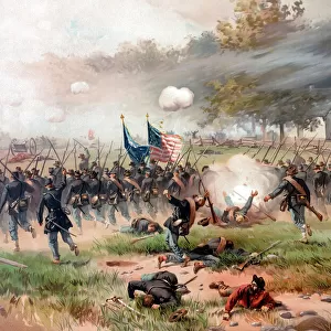
> Historic
> World War I and II
> World War I
> Historic
> World War I and II
> World War II
> Historic
> World War I and II
EDITORS COMMENTS
This print showcases a historical map titled "Map of the Dardanelles and Sea of Marmara, c1914" from the year 1920. The creator remains unknown, but this remarkable piece offers an invaluable glimpse into the coastline surrounding Turkey, Bulgaria, the Black Sea, and the Aegean during World War I. Taken from "The Great World War - A History". Volume II edited by Frank A Mumby, this map serves as a significant reference point for understanding the geographical features that played a crucial role in shaping the events of this tumultuous period. It highlights key locations such as Constantinople (now Istanbul), Dardanelles Strait (Dardanelles), Hellespont (the ancient name for Dardanelles), and Stamboul (another name for Istanbul). As we explore this intricate depiction of coastal areas and countries involved in World War I's theater of war, it becomes evident how strategic these regions were during that time. The map provides valuable insights into military operations conducted in these waters. Preserved by The Print Collector and made available through Heritage Images, this image not only captures our curiosity but also invites us to delve deeper into history. It reminds us of the significance of maps as tools for comprehending past events while appreciating their artistic value.
MADE IN THE USA
Safe Shipping with 30 Day Money Back Guarantee
FREE PERSONALISATION*
We are proud to offer a range of customisation features including Personalised Captions, Color Filters and Picture Zoom Tools
SECURE PAYMENTS
We happily accept a wide range of payment options so you can pay for the things you need in the way that is most convenient for you
* Options may vary by product and licensing agreement. Zoomed Pictures can be adjusted in the Cart.