Pillow > Africa > Egypt > Maps
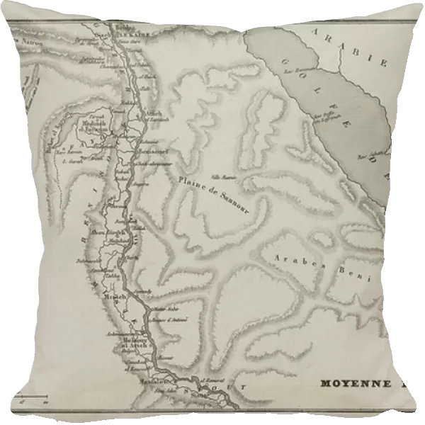
Pillow : Map of the average Egypt during the eastern countryside of Bonaparte, 18th century (engraving)
![]()

Home Decor from Fine Art Finder
Map of the average Egypt during the eastern countryside of Bonaparte, 18th century (engraving)
5944371 Map of the average Egypt during the eastern countryside of Bonaparte, 18th century (engraving); Private Collection; (add.info.: Engraving Map of the Middle Egypt during the Eastern Campaign of Bonaparte Private Collection.); Photo © Photo Josse
Media ID 38342554
© © Josse / Bridgeman Images
Egypt Countryside First Empire Napoleon This Is The First Xixth
18"x18" (46x46cm) Pillow
18"x18" (46x46cm) Faux Suede Pillow with a plush soft feel. Your choice of image fills the front, with a stone colored faux suede back. Flat sewn concealed white zip.
Accessorise your space with decorative, soft pillows
Estimated Product Size is 45.7cm x 45.7cm (18" x 18")
These are individually made so all sizes are approximate
Artwork printed orientated as per the preview above, with landscape (horizontal) or portrait (vertical) orientation to match the source image.
FEATURES IN THESE COLLECTIONS
> Fine Art Finder
> Artists
> School Greek
> Africa
> Egypt
> Related Images
EDITORS COMMENTS
This engraving depicts a map of the average Egypt during Napoleon Bonaparte's eastern campaign in the 18th century. The intricate details and precise lines highlight the strategic importance of this region during one of history's most iconic military campaigns. As we gaze upon this historical artifact, we are transported back in time to witness the conquests and challenges faced by Napoleon and his army as they navigated through the Egyptian countryside.
The black and white contrast adds a sense of nostalgia to the image, emphasizing the gravity of this momentous period in history. The meticulous craftsmanship of this engraving showcases not only the geographical layout of Egypt but also serves as a visual representation of power dynamics and territorial control.
As we study each contour and landmark on this map, we can almost hear the echoes of soldiers marching through deserts and valleys, driven by ambition and determination. This piece is not just a mere depiction of land boundaries; it is a testament to human ingenuity, resilience, and exploration.
Through this print, we gain insight into an era marked by conquests, alliances, betrayals, and triumphs - all encapsulated within the borders of Egypt's eastern countryside during Napoleon's first empire. It is a reminder that history is not just confined to textbooks; it lives on through art that captures moments frozen in time like this remarkable engraving from Photo Josse's private collection.
MADE IN THE USA
Safe Shipping with 30 Day Money Back Guarantee
FREE PERSONALISATION*
We are proud to offer a range of customisation features including Personalised Captions, Color Filters and Picture Zoom Tools
SECURE PAYMENTS
We happily accept a wide range of payment options so you can pay for the things you need in the way that is most convenient for you
* Options may vary by product and licensing agreement. Zoomed Pictures can be adjusted in the Cart.


