Poster Print > Europe > Portugal > Maps
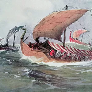
Poster Print : Map of Spain at the times of Germanic Hispania, 409-585 (Map of Spain at the times of Germanic Hispania) Engraving from " Atlas Universel" by Houze, 1851 Private collection
 Engraving from ' Atlas Universel' by Houze, 1851 Private collection")


![]()
Poster Prints from Fine Art Finder
Map of Spain at the times of Germanic Hispania, 409-585 (Map of Spain at the times of Germanic Hispania) Engraving from " Atlas Universel" by Houze, 1851 Private collection
ELD4927919 Map of Spain at the times of Germanic Hispania, 409-585 (Map of Spain at the times of Germanic Hispania) Engraving from " Atlas Universel" by Houze, 1851 Private collection; (add.info.: Map of Spain at the times of Germanic Hispania, 409-585 (Map of Spain at the times of Germanic Hispania) Engraving from " Atlas Universel" by Houze, 1851 Private collection); Photo © The Holbarn Archive
Media ID 38343692
© © The Holbarn Archive / Bridgeman Images
5 5th V Vth Century 5th 5th 5th V Vth Th Century 5th Century 6 6th Vi Vith Century 6th 6th 6th Vi Vith Vith Century 6th Century Barbaric C5th C6th Portugal Portugal Portuguese Portugese Portuguese Portugueses Sixth Century Ad Vi Century Vith Century Vth Century Geographical Map Isadora
18x24 inch Poster Print
"Step back in time to the 5th century with our stunning Map of Spain at the times of Germanic Hispania poster print. This beautiful engraving, taken from Houze's 'Atlas Universel' in 1851, depicts the Iberian Peninsula during a pivotal era when Germanic tribes ruled over much of the region. A fascinating piece of historical cartography, this print is perfect for history buffs and anyone who loves exploring the rich cultural heritage of Spain. Bring a touch of ancient elegance to your home or office with this unique and captivating poster."
Poster prints are budget friendly enlarged prints in standard poster paper sizes. Printed on 150 gsm Matte Paper for a natural feel and supplied rolled in a tube. Great for framing and should last many years. To clean wipe with a microfiber, non-abrasive cloth or napkin. Our Archival Quality Photo Prints and Fine Art Paper Prints are printed on higher quality paper and the choice of which largely depends on your budget.
Poster prints are budget friendly enlarged prints in standard poster paper sizes (A0, A1, A2, A3 etc). Whilst poster paper is sometimes thinner and less durable than our other paper types, they are still ok for framing and should last many years. Our Archival Quality Photo Prints and Fine Art Paper Prints are printed on higher quality paper and the choice of which largely depends on your budget.
Estimated Product Size is 61.6cm x 46.3cm (24.3" x 18.2")
These are individually made so all sizes are approximate
Artwork printed orientated as per the preview above, with landscape (horizontal) orientation to match the source image.
FEATURES IN THESE COLLECTIONS
> Fine Art Finder
> Artists
> Albert Sébille
> Europe
> Portugal
> Related Images
> Europe
> Spain
> Related Images
> Maps and Charts
> Spain
EDITORS COMMENTS
This engraving from the "Atlas Universel" by Houze in 1851 showcases a detailed Map of Spain during the times of Germanic Hispania, spanning from 409 to 585. The intricate lines and markings on this historical map offer a glimpse into the complex geopolitical landscape of Europe during this period.
The borders and territories depicted on this map provide valuable insight into the movements and conquests of various Germanic tribes that shaped the region's history. From the Visigoths to the Suebi, each group left its mark on Spain during these tumultuous centuries.
As we study this engraving, we are transported back in time to witness firsthand how power dynamics shifted and alliances were forged and broken. The strategic importance of Spain as a gateway between Europe and North Africa becomes evident through the placement of cities, rivers, and mountain ranges on this map.
This print serves as a reminder of the rich tapestry of cultures that have influenced Spain over the centuries, leaving behind a legacy that continues to shape its identity today. It is a testament to the enduring connection between geography, history, and human civilization.
MADE IN THE USA
Safe Shipping with 30 Day Money Back Guarantee
FREE PERSONALISATION*
We are proud to offer a range of customisation features including Personalised Captions, Color Filters and Picture Zoom Tools
SECURE PAYMENTS
We happily accept a wide range of payment options so you can pay for the things you need in the way that is most convenient for you
* Options may vary by product and licensing agreement. Zoomed Pictures can be adjusted in the Cart.