Poster Print > Europe > France > Maps
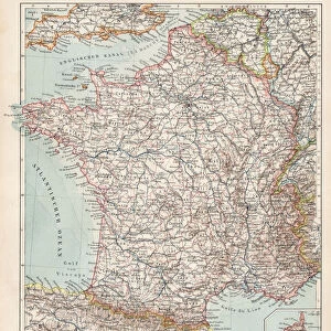
Poster Print : Ecclesiastical Map of France, 1789 and 1802; France in 1791 (colour litho)
![]()

Poster Prints from Fine Art Finder
Ecclesiastical Map of France, 1789 and 1802; France in 1791 (colour litho)
6016389 Ecclesiastical Map of France, 1789 and 1802; France in 1791 (colour litho) by Shepherd, William R. (1871-1934); Private Collection; (add.info.: Ecclesiastical Map of France, 1789 and 1802; France in 1791. Illustration for Historical Atlas by William R Shepherd (3rd and revised edition, University of London Press, 1924).); © Look and Learn
Media ID 25182128
© Look and Learn / Bridgeman Images
1789 1791 1802 Atlas Mythological Figure Pagan Paganism Pagans Polytheism Polytheist
20x30 inch Poster Print
Step back in time with our exquisite Ecclesiastical Map of France print from Media Storehouse. This captivating poster, featuring an intricately detailed map of France from 1789 and 1802, is a stunning representation of the country's ecclesiastical divisions during a pivotal period in its history. Created as a colour lithograph by renowned English publisher Shepherd, this vintage print is a must-have for history enthusiasts, educators, or anyone with an appreciation for fine art. Bring a piece of the past into your home or office with this beautiful and informative addition to your decor.
Poster prints are budget friendly enlarged prints in standard poster paper sizes. Printed on 150 gsm Matte Paper for a natural feel and supplied rolled in a tube. Great for framing and should last many years. To clean wipe with a microfiber, non-abrasive cloth or napkin. Our Archival Quality Photo Prints and Fine Art Paper Prints are printed on higher quality paper and the choice of which largely depends on your budget.
Poster prints are budget friendly enlarged prints in standard poster paper sizes (A0, A1, A2, A3 etc). Whilst poster paper is sometimes thinner and less durable than our other paper types, they are still ok for framing and should last many years. Our Archival Quality Photo Prints and Fine Art Paper Prints are printed on higher quality paper and the choice of which largely depends on your budget.
Estimated Product Size is 51.4cm x 76.8cm (20.2" x 30.2")
These are individually made so all sizes are approximate
Artwork printed orientated as per the preview above, with landscape (horizontal) or portrait (vertical) orientation to match the source image.
FEATURES IN THESE COLLECTIONS
> Fine Art Finder
> Artists
> William R. Shepherd
> Maps and Charts
> Early Maps
> Maps and Charts
> Related Images
> Popular Themes
> Religious Images
EDITORS COMMENTS
This print showcases an Ecclesiastical Map of France, depicting the country during two significant periods in history - 1789 and 1802. The map is beautifully colored using lithography techniques, bringing to life the intricate details and divisions within France at that time. Created by William R. Shepherd for his Historical Atlas, this particular edition was published in 1924 by the University of London Press. It offers a unique perspective on French history, highlighting the religious landscape during these crucial years. The map not only provides geographical information but also delves into mythology and paganism prevalent in French culture at that time. Mythological figures are depicted alongside religious symbols, emphasizing the polytheistic beliefs held by many individuals during this era. As we explore this image further, we can appreciate how it serves as a visual representation of France's rich historical tapestry. From its European roots to its overseas territories and departments, every corner of French culture is touched upon in this comprehensive map. Whether you are a history enthusiast or simply intrigued by maps and mythology, this Ecclesiastical Map of France will undoubtedly transport you back to an era where religion played a pivotal role in shaping society.
MADE IN THE USA
Safe Shipping with 30 Day Money Back Guarantee
FREE PERSONALISATION*
We are proud to offer a range of customisation features including Personalised Captions, Color Filters and Picture Zoom Tools
SECURE PAYMENTS
We happily accept a wide range of payment options so you can pay for the things you need in the way that is most convenient for you
* Options may vary by product and licensing agreement. Zoomed Pictures can be adjusted in the Cart.


