Poster Print > North America > Nicaragua > Lakes > Lake Nicaragua
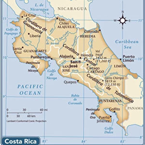
Poster Print : Map of Lake Nicaragua, c.1900 (engraving)
")

![]()
Poster Prints from Fine Art Finder
Map of Lake Nicaragua, c.1900 (engraving)
532783 Map of Lake Nicaragua, c.1900 (engraving); (add.info.: Map of Lake Nicaragua, circa 1900, from the 10th edition of Encyclopaedia Britannica.); Encyclopaedia Britannica/UIG
Media ID 38140584
© Encyclopaedia Britannica/UIG / Bridgeman Images
1900 19th Century Style Atlantic Ocean Costa Rica Cut Out Guidance Illustration Technique Meridian Navigational Equipment Nicaragua Nicaragua Canal Old Fashioned Pacific Ocean Physical Geography The Past Western Script White Background Lake Nicaragua
20x30 inch Poster Print
Explore the beauty and history of Lake Nicaragua with this stunning vintage map poster print. Perfect for adding a touch of sophistication to any room, this piece from Fine Art Finder is sure to impress.
Poster prints are budget friendly enlarged prints in standard poster paper sizes. Printed on 150 gsm Matte Paper for a natural feel and supplied rolled in a tube. Great for framing and should last many years. To clean wipe with a microfiber, non-abrasive cloth or napkin. Our Archival Quality Photo Prints and Fine Art Paper Prints are printed on higher quality paper and the choice of which largely depends on your budget.
Poster prints are budget friendly enlarged prints in standard poster paper sizes (A0, A1, A2, A3 etc). Whilst poster paper is sometimes thinner and less durable than our other paper types, they are still ok for framing and should last many years. Our Archival Quality Photo Prints and Fine Art Paper Prints are printed on higher quality paper and the choice of which largely depends on your budget.
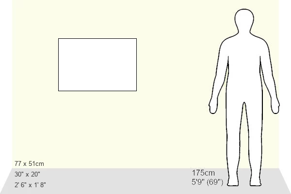
Estimated Product Size is 76.8cm x 51.4cm (30.2" x 20.2")
These are individually made so all sizes are approximate
Artwork printed orientated as per the preview above, with landscape (horizontal) or portrait (vertical) orientation to match the source image.
FEATURES IN THESE COLLECTIONS
> Fine Art Finder
> Temp Classification
> Arts
> Artists
> O
> Oceanic Oceanic
> Maps and Charts
> Related Images
> North America
> Costa Rica
> Maps
> North America
> Costa Rica
> Related Images
> North America
> Nicaragua
> Lakes
> Lake Nicaragua
> North America
> Nicaragua
> Lakes
> Related Images
> North America
> Nicaragua
> Maps
> North America
> Nicaragua
> Related Images
EDITORS COMMENTS
This stunning engraving of a Map of Lake Nicaragua from around 1900 captures the intricate details and historical significance of this Central American region. The map, taken from the 10th edition of Encyclopaedia Britannica, showcases the coastline, navigational equipment, meridians, and physical geography with precision.
The old-fashioned style and Western script used in this map transport us back to a time of exploration and discovery. It serves as a reminder of the importance of maps in guiding travelers across land and sea.
Lake Nicaragua itself is prominently featured on this map, situated between Costa Rica and Nicaragua. The surrounding Pacific Ocean and Atlantic Ocean are also depicted, highlighting the strategic location of this body of water.
With no people present in the image, we are left to appreciate the artistry and craftsmanship that went into creating such a detailed illustration. The horizontal orientation allows for easy viewing and study of all aspects portrayed on this historic map.
Overall, this print is not just a piece of cartography but a window into the past that offers insight into how our ancestors navigated these lands centuries ago.
MADE IN THE USA
Safe Shipping with 30 Day Money Back Guarantee
FREE PERSONALISATION*
We are proud to offer a range of customisation features including Personalised Captions, Color Filters and Picture Zoom Tools
SECURE PAYMENTS
We happily accept a wide range of payment options so you can pay for the things you need in the way that is most convenient for you
* Options may vary by product and licensing agreement. Zoomed Pictures can be adjusted in the Cart.