Poster Print > Europe > United Kingdom > England > Kent > Royal Tunbridge Wells
Poster Print : Royal Tunbridge Wells Kent UK City Street Map


![]()
Poster Prints from Fine Art Storehouse
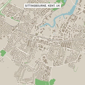
Royal Tunbridge Wells Kent UK City Street Map
Vector Illustration of a City Street Map of Royal Tunbridge Wells, Kent, UK. Included files are EPS (v10) and Hi-Res JPG.
Data courtesy from Ordnance Survey: VectorMap District
https:/ordnancesurvey.co.uk/business-and-government/products/vectormap-district.html
OS OpenData is free to use under the Open Government Licence (OGL).
Contains OS data eCrown copyright and database right 2017.
http:/nationalarchives.gov.uk/doc/open-government-licence/version/3/
Unleash your creativity and transform your space into a visual masterpiece!
Frank Ramspott
Media ID 15055211
© Frank Ramspott, all rights reserved
Aerial View Computer Graphic Directly Above Gray Green Kent Road Map Street Map Text Digitally Generated Image Royal Tunbridge Wells
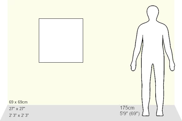
27x27 inch Poster Print
Discover the charm of Royal Tunbridge Wells, Kent with our stunningly detailed City Street Map print from Fine Art Storehouse. This beautiful vector illustration by Frank Ramspott brings the historic city to life, featuring accurate and up-to-date information from Ordnance Survey's VectorMap District. The included EPS (version 10) and high-resolution JPG files ensure a crisp and clear representation of the streets of Royal Tunbridge Wells, making this print a must-have for locals and visitors alike. Bring a piece of the picturesque English town into your home or office today.
Poster prints are budget friendly enlarged prints in standard poster paper sizes. Printed on 150 gsm Matte Paper for a natural feel and supplied rolled in a tube. Great for framing and should last many years. To clean wipe with a microfiber, non-abrasive cloth or napkin. Our Archival Quality Photo Prints and Fine Art Paper Prints are printed on higher quality paper and the choice of which largely depends on your budget.
Poster prints are budget friendly enlarged prints in standard poster paper sizes (A0, A1, A2, A3 etc). Whilst poster paper is sometimes thinner and less durable than our other paper types, they are still ok for framing and should last many years. Our Archival Quality Photo Prints and Fine Art Paper Prints are printed on higher quality paper and the choice of which largely depends on your budget.
Estimated Product Size is 69.2cm x 69.2cm (27.2" x 27.2")
These are individually made so all sizes are approximate
Artwork printed orientated as per the preview above, with landscape (horizontal) or portrait (vertical) orientation to match the source image.
FEATURES IN THESE COLLECTIONS
> Fine Art Storehouse
> Map
> Street Maps
> Aerial Photography
> Related Images
> Arts
> Artists
> W
> Frank Weller
> Arts
> Contemporary art
> Digital artwork
> Street art
> Arts
> Portraits
> Pop art gallery
> Street art portraits
> Arts
> Street art graffiti
> Digital art
> Digital paintings
> Arts
> Street art graffiti
> Digital art
> Vector illustrations
> Europe
> United Kingdom
> England
> Kent
> Green Street Green
> Europe
> United Kingdom
> England
> Kent
> Kent Street
> Europe
> United Kingdom
> England
> Kent
> Royal Tunbridge Wells
> Europe
> United Kingdom
> England
> Kent
> Tunbridge Wells
EDITORS COMMENTS
This stunning print showcases a detailed and vibrant city street map of Royal Tunbridge Wells, located in the picturesque county of Kent, UK. The vector illustration captures the essence of this charming town, with its intricate network of roads and buildings beautifully depicted. The artist has skillfully created this digitally generated image using advanced cartography techniques. Every street, road, and landmark is meticulously designed to provide an accurate representation of the city's layout. The colors used - gray, green, blue, and white - add depth and clarity to the map. With no people present in the image, the focus remains solely on the architectural beauty and urban landscape that Royal Tunbridge Wells offers. This aerial view from directly above allows viewers to appreciate both the physical geography of the area as well as its overall design. It is worth noting that this artwork was made possible through Ordnance Survey's VectorMap District data courtesy. The inclusion of OS OpenData ensures that it can be freely used under Open Government Licence (OGL). Whether you are a resident or visitor to Royal Tunbridge Wells or simply have an appreciation for fine cartography artistry, this print by Frank Ramspott will make a captivating addition to any space.
MADE IN THE USA
Safe Shipping with 30 Day Money Back Guarantee
FREE PERSONALISATION*
We are proud to offer a range of customisation features including Personalised Captions, Color Filters and Picture Zoom Tools
SECURE PAYMENTS
We happily accept a wide range of payment options so you can pay for the things you need in the way that is most convenient for you
* Options may vary by product and licensing agreement. Zoomed Pictures can be adjusted in the Cart.