Poster Print > Europe > United Kingdom > England > London > Hospitals
Poster Print : Map of the Crimea and plan of Sebastopol, 1854. Creator: John Dower


![]()
Poster Prints from Heritage Images
Map of the Crimea and plan of Sebastopol, 1854. Creator: John Dower
Map of the Crimea and plan of Sebastopol, 1854. Crimean War. In the expectation of great sacrifices and severe contests that must attend the attack upon Sebastopol, which is certain to make a most obstinate resistance, the commanders of the expedition have made every arrangement for the wounded, and orders have been sent to Constantinople to keep the hospitals in readiness for the reception of 10, 000 men...No good object could now be obtained by attacking Perekop, as [Russian] troops intended for the defence of the Crimea must already be in the peninsula, and some weeks must elapse before reinforcements from Kherson...can reach Sebastopol. No-one who saw the expedition start was inclined to doubt that it would be successful. New fieldworks have been constructed on the heights around Sebastopol, and the Russians in Odessa do not seem to feel any alarm for the fate of that fortress'. From "Illustrated London News", 1854
Heritage Images features heritage image collections
Media ID 36231449
© The Print Collector/Heritage Images
Black Sea Coastline Crimea Ukraine Crimean War Disputed Territory Dower J Dower John Dower John James J Dower John Dower John James Dower Peninsula Sebastopol Krym Ukraine Sevastopol Ukraine Siege Siege Of Sebastopol Siege Of Sevastopol Territorial Territory
18x24 inch Poster Print
Step back in time with our exclusive Media Storehouse poster prints featuring a captivating map of the Crimea and detailed plan of Sebastopol, as depicted by renowned cartographer John Dower in 1854. This evocative image transports you to the heart of the Crimean War, with an intricate representation of the strategic fortifications of Sebastopol and the surrounding regions. Perfect for history enthusiasts, educators, or anyone seeking to adorn their walls with a piece of historical significance. Bring the past to life with this stunning and authentic print from Heritage Images.
Poster prints are budget friendly enlarged prints in standard poster paper sizes. Printed on 150 gsm Matte Paper for a natural feel and supplied rolled in a tube. Great for framing and should last many years. To clean wipe with a microfiber, non-abrasive cloth or napkin. Our Archival Quality Photo Prints and Fine Art Paper Prints are printed on higher quality paper and the choice of which largely depends on your budget.
Poster prints are budget friendly enlarged prints in standard poster paper sizes (A0, A1, A2, A3 etc). Whilst poster paper is sometimes thinner and less durable than our other paper types, they are still ok for framing and should last many years. Our Archival Quality Photo Prints and Fine Art Paper Prints are printed on higher quality paper and the choice of which largely depends on your budget.
Estimated Product Size is 61.6cm x 46.3cm (24.3" x 18.2")
These are individually made so all sizes are approximate
Artwork printed orientated as per the preview above, with landscape (horizontal) orientation to match the source image.
FEATURES IN THESE COLLECTIONS
> Animals
> Mammals
> Cats (Domestic)
> Russian White
> Arts
> Artists
> W
> John White
> Europe
> Russia
> Related Images
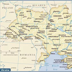
> Europe
> Ukraine
> Related Images
> Europe
> United Kingdom
> England
> London
> Hospitals
EDITORS COMMENTS
This historic map and plan of the Crimea and Sebastopol, created by John Dower in 1854, provides a detailed and intricate view of the strategic landscape during the height of the Crimean War. The map illustrates the Crimean Peninsula, with a particular focus on the city of Sebastopol, the primary objective of the British and French expeditionary forces. At the time, the attack on Sebastopol was anticipated to be a formidable challenge, with the city expected to mount a strong resistance. In preparation for the expected casualties, arrangements had been made for the care of wounded soldiers, with orders sent to Constantinople to prepare hospitals for the reception of 10,000 men. The map reveals the strategic positioning of the Russian forces, with new fortifications constructed on the heights around Sebastopol. The Russians in Odessa, however, did not appear overly concerned for the fate of their fortress, as they believed that troops intended for the defense of the Crimea had already been deployed, and reinforcements from Kherson would take several weeks to arrive. The expedition, which set out with great expectations of success, had constructed new fieldworks around Sebastopol, and the Russians in Odessa seemed complacent about the threat to their fortress. This map offers a fascinating glimpse into the military strategies and geopolitical tensions of the Crimean War, providing valuable context for understanding the complexities of this pivotal moment in history.
MADE IN THE USA
Safe Shipping with 30 Day Money Back Guarantee
FREE PERSONALISATION*
We are proud to offer a range of customisation features including Personalised Captions, Color Filters and Picture Zoom Tools
SECURE PAYMENTS
We happily accept a wide range of payment options so you can pay for the things you need in the way that is most convenient for you
* Options may vary by product and licensing agreement. Zoomed Pictures can be adjusted in the Cart.