Poster Print : Isle of Man, satellite image C013 / 5151

![]()
Poster Prints from Science Photo Library
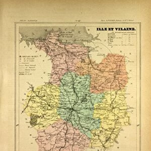
Isle of Man, satellite image C013 / 5151
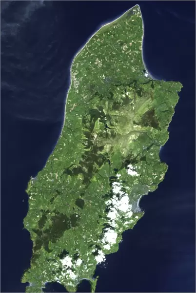
Isle of Man, satellite image. North is towards top left. Visible features include fields and hills (shades of green), beaches and clouds (white), lakes and reservoirs (dark blue), and urban areas (grey). The Isle of Man is a self-governing British Crown Dependency in the Irish Sea between Great Britain and Ireland. It has been inhabited since 6500 BC, with a current population of around 85, 000. It is 52 kilometres long, and 22 kilometres wide at its widest point. The capital and largest town is Douglas (lower right). Image obtained by the Advanced Spaceborne Thermal Emission and Reflection Radiometer (ASTER) on NASAs Terra satellite, on 1 May 2001
Science Photo Library features Science and Medical images including photos and illustrations
Media ID 9195859
© NASA/GSFC/METI/ERSDAC/JAROS/US-JAPAN ASTER SCIENCE TEAM/SCIENCE PHOTO LIBRARY
2001 Agriculture Aster Beach Beaches Cloud Clouds Coast Coastal Country Farming Farms Field Fields From Space Great Britain Harbour Hill Hills Human Geography Infrared Irish Sea Island Land Cover Land Use Optical Physical Geography Port Satellite Satellite Image Terra Terrain Topography Town Towns Vegetation Visible Isle Of Man Mann
20x30 inch Poster Print
Discover the breathtaking beauty of the Isle of Man like never before with our Media Storehouse Poster Prints. Featuring an awe-inspiring satellite image from NASA, this print showcases the island's unique landscape in stunning detail. From the rolling hills and lush green fields to the crystalline lakes and shimmering beaches, every intricate detail is brought to life in high resolution. This mesmerizing image, captured by NASA/GSFC/METI/ERSDAC/JAROS/US-JAPAN ASTER SCIENCE TEAM and sourced from Science Photo Library, is a must-have for any space enthusiast or armchair traveler. Order now and bring the wonders of our planet right into your home or office.
Poster prints are budget friendly enlarged prints in standard poster paper sizes. Printed on 150 gsm Matte Paper for a natural feel and supplied rolled in a tube. Great for framing and should last many years. To clean wipe with a microfiber, non-abrasive cloth or napkin. Our Archival Quality Photo Prints and Fine Art Paper Prints are printed on higher quality paper and the choice of which largely depends on your budget.
Poster prints are budget friendly enlarged prints in standard poster paper sizes (A0, A1, A2, A3 etc). Whilst poster paper is sometimes thinner and less durable than our other paper types, they are still ok for framing and should last many years. Our Archival Quality Photo Prints and Fine Art Paper Prints are printed on higher quality paper and the choice of which largely depends on your budget.
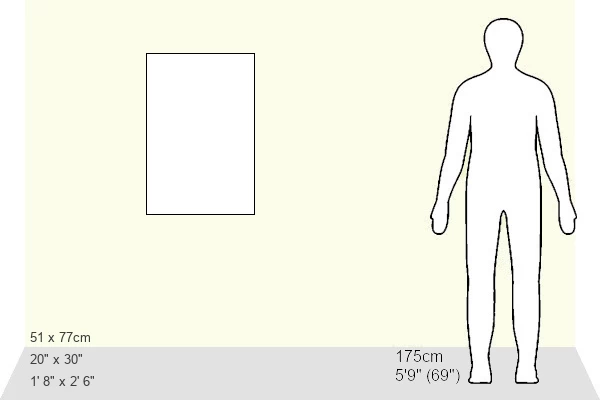
Estimated Product Size is 51.4cm x 76.8cm (20.2" x 30.2")
These are individually made so all sizes are approximate
Artwork printed orientated as per the preview above, with landscape (horizontal) or portrait (vertical) orientation to match the source image.
EDITORS COMMENTS
This print showcases the stunning Isle of Man, a self-governing British Crown Dependency nestled in the Irish Sea between Great Britain and Ireland. Taken on 1 May 2001 by NASA's Terra satellite using the Advanced Spaceborne Thermal Emission and Reflection Radiometer (ASTER), this image offers a bird's-eye view of the island's diverse features. The Isle of Man is rich in natural beauty, as depicted by its lush green fields and rolling hills that dominate much of its landscape. The coastline boasts picturesque beaches meeting the crystal-clear waters of the ocean. Lakes and reservoirs can be seen scattered across the terrain, adding to its charm. Urban areas are represented by shades of grey, with Douglas - the capital and largest town - positioned at the lower right corner. This bustling port town serves as a hub for both commerce and culture on this enchanting island. With a history dating back to 6500 BC, it comes as no surprise that human activity has shaped this land over centuries. Agriculture plays a significant role here, evident from extensive farming visible throughout. The Isle of Man's population stands at around 85,000 people who call this idyllic place home. This remarkable satellite image not only highlights physical geography but also provides insights into land use patterns on this British crown dependency. It serves as a testament to mankind's ability to coexist harmoniously with nature while preserving its inherent beauty for generations to come.
MADE IN THE USA
Safe Shipping with 30 Day Money Back Guarantee
FREE PERSONALISATION*
We are proud to offer a range of customisation features including Personalised Captions, Color Filters and Picture Zoom Tools
SECURE PAYMENTS
We happily accept a wide range of payment options so you can pay for the things you need in the way that is most convenient for you
* Options may vary by product and licensing agreement. Zoomed Pictures can be adjusted in the Cart.