Premium Framed Print > Europe > Italy > Maps
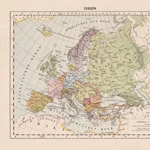
Premium Framed Print : Map of Ancient Italy, southern part. From Historical Atlas, published 1923


![]()
Framed Photos from Design Pics
Map of Ancient Italy, southern part. From Historical Atlas, published 1923
Design Pics offers Distinctively Different Imagery representing over 1,500 contributors
Media ID 24907350
© Ken Welsh
20th Century Cartography Countries Geographical Geography Italian Maps Ancient Italy Southern Part
14"x16" Premium Frame
Contemporary style Premium Wooden Frame with 8"x10" Print. Complete with 2" White Mat and 1.25" thick MDF frame. Printed on 260 gsm premium paper. Glazed with shatter proof UV coated acrylic glass. Backing is paper covered backing with rubber bumpers. Supplied ready to hang with a pre-installed sawtooth/wire hanger. Care Instructions: Spot clean with a damp cloth. Securely packaged in a clear plastic bag and envelope in a reinforced cardboard shipper
FSC Real Wood Frame and Double Mounted with White Conservation Mountboard - Professionally Made and Ready to Hang
Estimated Image Size (if not cropped) is 25.4cm x 20.3cm (10" x 8")
Estimated Product Size is 40.6cm x 35.6cm (16" x 14")
These are individually made so all sizes are approximate
Artwork printed orientated as per the preview above, with landscape (horizontal) orientation to match the source image.
FEATURES IN THESE COLLECTIONS
> Maps and Charts
> Early Maps
> Maps and Charts
> Italy
EDITORS COMMENTS
This print showcases a remarkable piece of history - the "Map of Ancient Italy, southern part". Published in 1923 as part of the Historical Atlas, this vintage map takes us on a journey back in time to explore the geographical wonders and cultural richness of ancient Italy. With intricate details and expert cartography, this archival engraving offers a glimpse into the past, shedding light on the Italian peninsula's diverse regions and their historical significance. From Sicily to Apulia, Calabria to Campania, every corner is meticulously depicted with precision and artistry. The sepia-toned illustration exudes an old-world charm that transports us to an era long gone. It serves as a testament to the craftsmanship involved in creating such detailed maps during the early 20th century. The faded hues add depth and character while evoking nostalgia for bygone times. As we admire this picture from Ken Welsh's collection, we are reminded of how geography shapes civilizations. This visual representation not only educates but also sparks our imagination about life in ancient Italy - its bustling cities, majestic landscapes, and vibrant cultures. Whether you are an enthusiast of historical cartography or simply appreciate vintage artwork that tells stories untold, this print is sure to captivate your senses and transport you through time.
MADE IN THE USA
Safe Shipping with 30 Day Money Back Guarantee
FREE PERSONALISATION*
We are proud to offer a range of customisation features including Personalised Captions, Color Filters and Picture Zoom Tools
SECURE PAYMENTS
We happily accept a wide range of payment options so you can pay for the things you need in the way that is most convenient for you
* Options may vary by product and licensing agreement. Zoomed Pictures can be adjusted in the Cart.