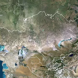
Premium Framed Print > Asia > Kazakhstan > Lakes > Caspian Sea
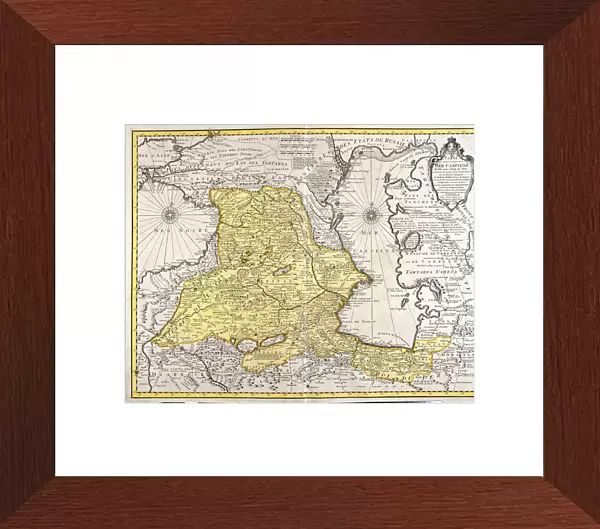
Premium Framed Print : Map of neighboring countries of the Caspian Sea (Russia, Armenia, Persia, Kazakhstan


![]()
Framed Photos from Fine Art Finder
Map of neighboring countries of the Caspian Sea (Russia, Armenia, Persia, Kazakhstan
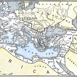
LRI4706723 Map of neighboring countries of the Caspian Sea (Russia, Armenia, Persia, Kazakhstan, Turkmenistan) (etching, 1730) by Delisle, Guillaume (1675-1726); Private Collection; (add.info.: Map of neighboring countries of the Caspian Sea (Russia, Armenia, Persia, Kazakhstan, Turkmenistan) - Strong water extracted from the " New Atlas containing all parts of the world" 1730 by Guillaume de L Isle (1675-1726)); Luisa Ricciarini; French, out of copyright
Media ID 22467706
© Luisa Ricciarini / Bridgeman Images
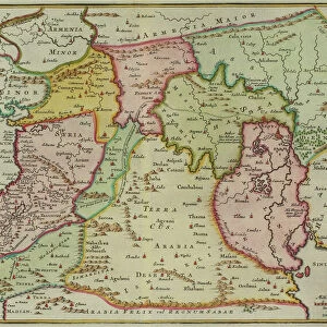
Armenia Armenian Atlas Book Iran Iranian Geographical Map
14"x16" Premium Frame
Contemporary style Premium Wooden Frame with 8"x10" Print. Complete with 2" White Mat and 1.25" thick MDF frame. Printed on 260 gsm premium paper. Glazed with shatter proof UV coated acrylic glass. Backing is paper covered backing with rubber bumpers. Supplied ready to hang with a pre-installed sawtooth/wire hanger. Care Instructions: Spot clean with a damp cloth. Securely packaged in a clear plastic bag and envelope in a reinforced cardboard shipper
FSC Real Wood Frame and Double Mounted with White Conservation Mountboard - Professionally Made and Ready to Hang
Estimated Image Size (if not cropped) is 25.4cm x 20.3cm (10" x 8")
Estimated Product Size is 40.6cm x 35.6cm (16" x 14")
These are individually made so all sizes are approximate
Artwork printed orientated as per the preview above, with landscape (horizontal) orientation to match the source image.
FEATURES IN THESE COLLECTIONS
> Fine Art Finder
> Artists
> Franz Hogenberg
> Fine Art Finder
> Artists
> Guillaume Delisle
> Asia
> Armenia
> Related Images
> Asia
> Iran
> Lakes
> Caspian Sea
> Asia
> Iran
> Related Images
> Asia
> Kazakhstan
> Lakes
> Caspian Sea
> Asia
> Kazakhstan
> Maps
> Asia
> Kazakhstan
> Related Images
> Asia
> Turkmenistan
> Related Images
EDITORS COMMENTS
This print showcases a historical map titled "Map of neighboring countries of the Caspian Sea" created by Guillaume de L'Isle in 1730. The etching depicts the regions surrounding the Caspian Sea, including Russia, Armenia, Persia (now Iran), Kazakhstan, and Turkmenistan. The intricate details and precision of this engraving highlight De L'Isle's expertise as a cartographer during the 18th century. This particular map was extracted from his renowned work called "New Atlas containing all parts of the world". It offers a glimpse into the geographical landscape and political boundaries that existed at that time. Luisa Ricciarini has skillfully captured this piece in her photograph, allowing viewers to appreciate its historical significance. The image transports us back to an era when exploration and discovery were paramount. As we observe this artwork, we are reminded of how maps have always been essential tools for understanding our world. They provide valuable insights into cultural connections, geopolitical relationships, and territorial divisions. Through this photo print, Luisa Ricciarini invites us to delve into history while appreciating the artistry behind these ancient cartographic representations. It serves as a reminder of both our past explorations and our ongoing fascination with mapping out our surroundings.
MADE IN THE USA
Safe Shipping with 30 Day Money Back Guarantee
FREE PERSONALISATION*
We are proud to offer a range of customisation features including Personalised Captions, Color Filters and Picture Zoom Tools
SECURE PAYMENTS
We happily accept a wide range of payment options so you can pay for the things you need in the way that is most convenient for you
* Options may vary by product and licensing agreement. Zoomed Pictures can be adjusted in the Cart.