Premium Framed Print > Europe > Poland > Maps
Premium Framed Print : Map showing the fortifications of Danzig


![]()
Framed Photos from Fine Art Finder
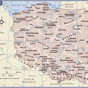
Map showing the fortifications of Danzig
1577233 Map showing the fortifications of Danzig; (add.info.: Map showing the fortifications of Danzig. Dated to 1687.); Universal History Archive/UIG
Media ID 38311170
© Universal History Archive/UIG / Bridgeman Images
1680s Danzig Poland Poland Polish Pole Polish
14"x16" Premium Frame
Contemporary style Premium Wooden Frame with 8"x10" Print. Complete with 2" White Mat and 1.25" thick MDF frame. Printed on 260 gsm premium paper. Glazed with shatter proof UV coated acrylic glass. Backing is paper covered backing with rubber bumpers. Supplied ready to hang with a pre-installed sawtooth/wire hanger. Care Instructions: Spot clean with a damp cloth. Securely packaged in a clear plastic bag and envelope in a reinforced cardboard shipper
FSC Real Wood Frame and Double Mounted with White Conservation Mountboard - Professionally Made and Ready to Hang
Estimated Image Size (if not cropped) is 25.4cm x 20.3cm (10" x 8")
Estimated Product Size is 40.6cm x 35.6cm (16" x 14")
These are individually made so all sizes are approximate
Artwork printed orientated as per the preview above, with landscape (horizontal) orientation to match the source image.
FEATURES IN THESE COLLECTIONS
> Fine Art Finder
> Temp Classification
> Europe
> Poland
> Related Images
> Maps and Charts
> Early Maps
EDITORS COMMENTS
This stunning print showcases a detailed map of the fortifications of Danzig, dating back to 1687. The intricate lines and markings on the map give us a glimpse into the strategic layout of this historic city in Poland.
The fortifications depicted on this map served as a vital defense system for Danzig during the 17th century, protecting the city from potential invaders and ensuring its safety and security. Each wall, tower, and gate shown on the map played a crucial role in safeguarding the inhabitants of Danzig.
As we study this piece of history, we can't help but marvel at the craftsmanship and precision that went into creating such an accurate representation of these fortifications. The attention to detail is truly remarkable, allowing us to imagine what life must have been like within these walls centuries ago.
This print serves as a reminder of the rich cultural heritage and architectural significance of Danzig. It transports us back in time to an era when fortified cities were essential for survival in Europe. We are grateful for this opportunity to explore and appreciate such historical treasures through art like this map print.
MADE IN THE USA
Safe Shipping with 30 Day Money Back Guarantee
FREE PERSONALISATION*
We are proud to offer a range of customisation features including Personalised Captions, Color Filters and Picture Zoom Tools
SECURE PAYMENTS
We happily accept a wide range of payment options so you can pay for the things you need in the way that is most convenient for you
* Options may vary by product and licensing agreement. Zoomed Pictures can be adjusted in the Cart.