Premium Framed Print > Asia > Palestine > Maps
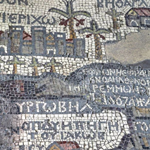
Premium Framed Print : Historical map of Middle Palestine, lithograph, published in 1891


![]()
Framed Photos from Fine Art Storehouse
Historical map of Middle Palestine, lithograph, published in 1891
Historical map of Middle Palestine. Lithograph, published in 1891
Unleash your creativity and transform your space into a visual masterpiece!
ZU_09
Media ID 31919459
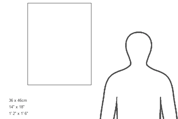
14"x18" Premium Frame
Contemporary style Premium Wooden Frame with 8"x12" Print. Complete with 2" White Mat and 1.25" thick MDF frame. Printed on 260 gsm premium paper. Glazed with shatter proof UV coated acrylic glass. Backing is paper covered backing with rubber bumpers. Supplied ready to hang with a pre-installed sawtooth/wire hanger. Care Instructions: Spot clean with a damp cloth. Securely packaged in a clear plastic bag and envelope in a reinforced cardboard shipper
FSC Real Wood Frame and Double Mounted with White Conservation Mountboard - Professionally Made and Ready to Hang
Estimated Image Size (if not cropped) is 20.3cm x 30.4cm (8" x 12")
Estimated Product Size is 35.6cm x 45.8cm (14" x 18")
These are individually made so all sizes are approximate
Artwork printed orientated as per the preview above, with portrait (vertical) orientation to match the source image.
FEATURES IN THESE COLLECTIONS
> Fine Art Storehouse
> Map
> Historical Maps
> Asia
> Palestine
> Related Images
> Maps and Charts
> Early Maps
> Maps and Charts
> Related Images
EDITORS COMMENTS
This lithograph, titled "Historical map of Middle Palestine" takes us on a visual journey back in time to the year 1891. Created by the talented artist ZU_09, this print offers a glimpse into the intricate cartography and historical significance of the region. The attention to detail is remarkable as every line and contour has been meticulously rendered. The map showcases Middle Palestine, an area rich in history and cultural heritage. From ancient cities like Shechem (now known as Nablus) to other notable landmarks, this artwork provides a comprehensive overview of the region's topography during that era. It allows us to explore various towns, rivers, mountains, and borders that shaped its landscape. As we delve deeper into this lithograph, it becomes evident that it serves not only as a geographical representation but also as an educational tool for understanding past civilizations. The careful labeling of sites highlights their historical importance while offering valuable insights into their respective eras. Whether you are an art enthusiast or a history buff, this print from Fine Art Storehouse will undoubtedly captivate your imagination. Hang it on your wall or use it for research purposes; either way, let yourself be transported through time with this exquisite piece of artistry that celebrates both geography and history in equal measure.
MADE IN THE USA
Safe Shipping with 30 Day Money Back Guarantee
FREE PERSONALISATION*
We are proud to offer a range of customisation features including Personalised Captions, Color Filters and Picture Zoom Tools
SECURE PAYMENTS
We happily accept a wide range of payment options so you can pay for the things you need in the way that is most convenient for you
* Options may vary by product and licensing agreement. Zoomed Pictures can be adjusted in the Cart.