Premium Framed Print > Europe > United Kingdom > England > Related Images
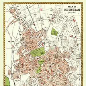
Premium Framed Print : Nottingham map 1884


![]()
Framed Photos from Fine Art Storehouse
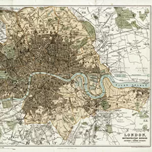
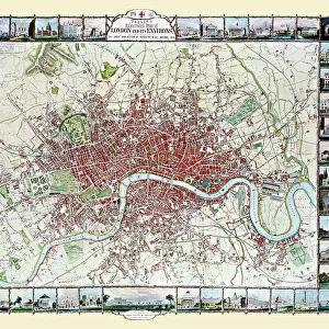
Nottingham map 1884
Encyclopedia Britannica 9th Edition New York Charles Scribners and Sonsl 1884 Vol XVII
Unleash your creativity and transform your space into a visual masterpiece!
THEPALMER
Media ID 14549445
© This content is subject to copyright
14"x16" Premium Frame
Contemporary style Premium Wooden Frame with 8"x10" Print. Complete with 2" White Mat and 1.25" thick MDF frame. Printed on 260 gsm premium paper. Glazed with shatter proof UV coated acrylic glass. Backing is paper covered backing with rubber bumpers. Supplied ready to hang with a pre-installed sawtooth/wire hanger. Care Instructions: Spot clean with a damp cloth. Securely packaged in a clear plastic bag and envelope in a reinforced cardboard shipper
FSC Real Wood Frame and Double Mounted with White Conservation Mountboard - Professionally Made and Ready to Hang
Estimated Image Size (if not cropped) is 20.3cm x 25.4cm (8" x 10")
Estimated Product Size is 35.6cm x 40.6cm (14" x 16")
These are individually made so all sizes are approximate
Artwork printed orientated as per the preview above, with portrait (vertical) orientation to match the source image.
FEATURES IN THESE COLLECTIONS
> Fine Art Storehouse
> Map
> Historical Maps
> Europe
> United Kingdom
> England
> Related Images
> North America
> United States of America
> New York
> Related Images
EDITORS COMMENTS
This print showcases a remarkable piece of history, the "Nottingham map 1884" from the Encyclopedia Britannica 9th Edition. Published in New York by Charles Scribners and Sons in 1884, this particular volume (Vol XVII) offers an intriguing glimpse into the past. The intricate details of this vintage map take us back to a time when Nottingham, England was undergoing significant transformations. The carefully hand-drawn lines and labels on this map provide a fascinating insight into the city's layout during that era. Every street, square, and landmark is meticulously depicted, allowing us to explore Nottingham as it stood over a century ago. It serves as both an educational tool for historians and a nostalgic keepsake for those with ties to this vibrant English city. "ThePALMER" the talented artist behind this stunning print available at Fine Art Storehouse, has skillfully captured every nuance of the original map. The high-quality reproduction ensures that even minute details are visible—inviting viewers to immerse themselves in its rich historical context. Whether you're an avid collector or simply appreciate art that tells stories from days gone by, this exceptional print will undoubtedly become a cherished addition to your collection. Display it proudly on your wall or gift it to someone who shares your passion for history; either way, be prepared for endless conversations about Nottingham's heritage whenever guests lay eyes upon it.
MADE IN THE USA
Safe Shipping with 30 Day Money Back Guarantee
FREE PERSONALISATION*
We are proud to offer a range of customisation features including Personalised Captions, Color Filters and Picture Zoom Tools
SECURE PAYMENTS
We happily accept a wide range of payment options so you can pay for the things you need in the way that is most convenient for you
* Options may vary by product and licensing agreement. Zoomed Pictures can be adjusted in the Cart.