Premium Framed Print > Arts > Landscape paintings > Waterfall and river artworks > River artworks
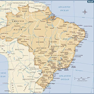
Premium Framed Print : Brazil Map with Rivers and National Flag


Framed Photos from Fine Art Storehouse
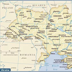
Brazil Map with Rivers and National Flag
Vintage Map of Brazil. Vector Illustration with Rivers and National Flag
Unleash your creativity and transform your space into a visual masterpiece!
Media ID 19813363
Illustration Illustrations Vector Illustrations
14"x16" Premium Frame
Contemporary style Premium Wooden Frame with 8"x10" Print. Complete with 2" White Mat and 1.25" thick MDF frame. Printed on 260 gsm premium paper. Glazed with shatter proof UV coated acrylic glass. Backing is paper covered backing with rubber bumpers. Supplied ready to hang with a pre-installed sawtooth/wire hanger. Care Instructions: Spot clean with a damp cloth. Securely packaged in a clear plastic bag and envelope in a reinforced cardboard shipper
FSC Real Wood Frame and Double Mounted with White Conservation Mountboard - Professionally Made and Ready to Hang
Estimated Image Size (if not cropped) is 20.3cm x 25.4cm (8" x 10")
Estimated Product Size is 35.6cm x 40.6cm (14" x 16")
These are individually made so all sizes are approximate
Artwork printed orientated as per the preview above, with portrait (vertical) orientation to match the source image.
FEATURES IN THESE COLLECTIONS
> Fine Art Storehouse
> Map
> Reference Maps
> Fine Art Storehouse
> Top Sellers - Art Prints
> Arts
> Landscape paintings
> Waterfall and river artworks
> River artworks
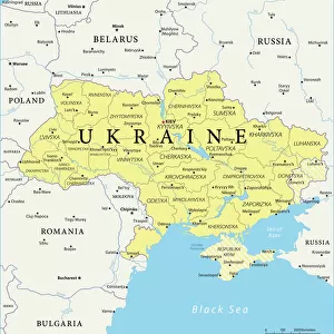
> Europe
> Ukraine
> Related Images
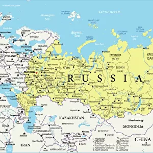
> Maps and Charts
> Popular Maps
> Maps and Charts
> Related Images
> Maps and Charts
> World
EDITORS COMMENTS
This vintage print of a Brazil map showcases the country's rich geography and national pride. The intricate illustration features detailed cartography, highlighting the rivers that crisscross the land. The iconic Brazilian flag proudly waves in the background, symbolizing unity and patriotism. The map encompasses various regions and states, including Amazonas, Bahia, Ceara, Mato Grosso, Para, Rio de Janeiro, Sao Paulo, and many more. It also extends beyond Brazil's borders to include neighboring countries such as Argentina, Bolivia Paraguay, Chile Uruguay , and Venezuela. With its vibrant colors and precise detailing, this vector illustration is not only visually appealing but also informative. It serves as an excellent resource for those interested in exploring Brazil's topography or studying its political boundaries. Whether you are a history enthusiast or simply appreciate fine art prints with cultural significance, this piece will make a stunning addition to any space. Its vertical orientation allows it to seamlessly blend into various settings - from offices to living rooms or even educational institutions
MADE IN THE USA
Safe Shipping with 30 Day Money Back Guarantee
FREE PERSONALISATION*
We are proud to offer a range of customisation features including Personalised Captions, Color Filters and Picture Zoom Tools
SECURE PAYMENTS
We happily accept a wide range of payment options so you can pay for the things you need in the way that is most convenient for you
* Options may vary by product and licensing agreement. Zoomed Pictures can be adjusted in the Cart.