Premium Framed Print > Europe > United Kingdom > England > Herefordshire > Maps
Premium Framed Print : Old Map of Hereford 1806 by Cole and Roper


![]()
Framed Photos from MapSeeker
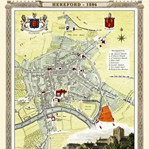
Old Map of Hereford 1806 by Cole and Roper
An attractive and detailed early 19th century reproduction town plan of Hereford 1806. First published by Cole and Roper as a finely engraved series of county maps and town plans which were initially issued in parts and then together as The British Atlas in 1810
Welcome to the Mapseeker Image library and enter an historic gateway to one of the largest on-line collections of Historic Maps, Nostalgic Views, Vista's and Panorama's from a World gone by.
Media ID 20348126
© Mapseeker Publishing Ltd
Cole And Roper Historic Map Old Town Plan Hereford
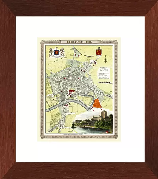
14"x16" Premium Frame
Contemporary style Premium Wooden Frame with 8"x10" Print. Complete with 2" White Mat and 1.25" thick MDF frame. Printed on 260 gsm premium paper. Glazed with shatter proof UV coated acrylic glass. Backing is paper covered backing with rubber bumpers. Supplied ready to hang with a pre-installed sawtooth/wire hanger. Care Instructions: Spot clean with a damp cloth. Securely packaged in a clear plastic bag and envelope in a reinforced cardboard shipper
FSC Real Wood Frame and Double Mounted with White Conservation Mountboard - Professionally Made and Ready to Hang
Estimated Image Size (if not cropped) is 20.3cm x 25.4cm (8" x 10")
Estimated Product Size is 35.6cm x 40.6cm (14" x 16")
These are individually made so all sizes are approximate
Artwork printed orientated as per the preview above, with portrait (vertical) orientation to match the source image.
FEATURES IN THESE COLLECTIONS
> MapSeeker
> British Town And City Plans
> English & Welsh PORTFOLIO
> Arts
> Photorealistic artworks
> Detailed art pieces
> Masterful detailing in art
> Europe
> United Kingdom
> England
> Herefordshire
> Maps
> Maps and Charts
> Early Maps
> Maps and Charts
> Related Images
EDITORS COMMENTS
This print showcases an exquisite reproduction of the "Old Map of Hereford 1806" by Cole and Roper. Dating back to the early 19th century, this town plan offers a fascinating glimpse into the historic city of Hereford. With its attractive and intricate details, this map provides a visual time capsule, allowing viewers to explore the streets and landmarks as they existed over two centuries ago. Originally published as part of a meticulously engraved series of county maps and town plans, it was later included in The British Atlas in 1810. The charm lies in its authenticity; every street corner, building, and alleyway is painstakingly depicted with remarkable accuracy. As one gazes upon this old map of Hereford, it evokes a sense of nostalgia for times gone by. From the bustling city center to the tranquil outskirts, each section reveals unique insights into life during that era. It serves not only as a historical document but also as an artistic masterpiece that captures the essence of Hereford's past. Whether you are an avid historian or simply appreciate fine craftsmanship, this vintage treasure will transport you back in time to experience Hereford's rich heritage firsthand. A must-have for any collector or lover of history alike!
MADE IN THE USA
Safe Shipping with 30 Day Money Back Guarantee
FREE PERSONALISATION*
We are proud to offer a range of customisation features including Personalised Captions, Color Filters and Picture Zoom Tools
SECURE PAYMENTS
We happily accept a wide range of payment options so you can pay for the things you need in the way that is most convenient for you
* Options may vary by product and licensing agreement. Zoomed Pictures can be adjusted in the Cart.