Premium Framed Print > Arts > Photorealistic artworks > Detailed art pieces > Masterful detailing in art
Premium Framed Print : Old Map of Greece with the Ionian Isles 1852 by Henry George Collins


![]()
Framed Photos from MapSeeker
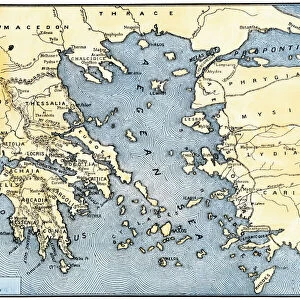
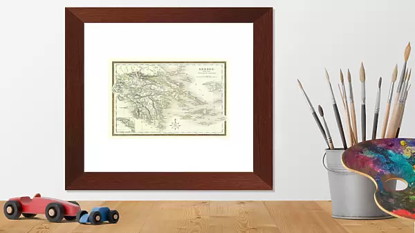
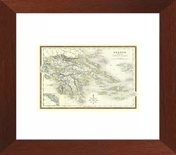
Old Map of Greece with the Ionian Isles 1852 by Henry George Collins
This is a finely detailed map of Greece remastered from a rare Atlas of the World published in 1852 by Henry George Collins. Although these Henry Collins produced maps of the highest quality in his time unfortunately not the same could be said in terms of his business success. His maps were later obtained by the famous Stanford Map Company and used in their publications
Welcome to the Mapseeker Image library and enter an historic gateway to one of the largest on-line collections of Historic Maps, Nostalgic Views, Vista's and Panorama's from a World gone by.
Media ID 20347281
© Mapseeker Publishing Ltd
Collins Collins Atlas Collins Atlas Map Collins Map
14"x18" Premium Frame
Contemporary style Premium Wooden Frame with 8"x12" Print. Complete with 2" White Mat and 1.25" thick MDF frame. Printed on 260 gsm premium paper. Glazed with shatter proof UV coated acrylic glass. Backing is paper covered backing with rubber bumpers. Supplied ready to hang with a pre-installed sawtooth/wire hanger. Care Instructions: Spot clean with a damp cloth. Securely packaged in a clear plastic bag and envelope in a reinforced cardboard shipper
FSC Real Wood Frame and Double Mounted with White Conservation Mountboard - Professionally Made and Ready to Hang
Estimated Image Size (if not cropped) is 30.4cm x 20.3cm (12" x 8")
Estimated Product Size is 45.8cm x 35.6cm (18" x 14")
These are individually made so all sizes are approximate
Artwork printed orientated as per the preview above, with landscape (horizontal) orientation to match the source image.
FEATURES IN THESE COLLECTIONS
> MapSeeker
> Maps of Europe
> Maps of Greece PORTFOLIO
> Arts
> Photorealistic artworks
> Detailed art pieces
> Masterful detailing in art
> Europe
> Greece
> Related Images
> Historic
> Ancient civilizations
> Ancient Greece
> Greek history
> Maps and Charts
> Related Images
> Maps and Charts
> World
EDITORS COMMENTS
This beautifully preserved print showcases an exquisite piece of cartographic artistry - the "Old Map of Greece with the Ionian Isles 1852" by Henry George Collins. Remastered from a rare Atlas of the World published in 1852, this map offers a glimpse into the intricate details and craftsmanship that characterized Collins' work during his time. Despite being renowned for producing maps of unparalleled quality, Collins unfortunately did not achieve similar success in terms of business ventures. However, his exceptional maps found new life when they were acquired by the esteemed Stanford Map Company and incorporated into their own publications. The map itself is a testament to Collins' dedication to accuracy and precision. Every contour line, river course, and coastal feature has been meticulously rendered, providing viewers with an immersive experience as they explore ancient Greece and its surrounding Ionian Isles. From Athens to Sparta, from Corfu to Zakynthos, this map transports us back in time to an era when these lands were steeped in history and mythology. Whether you are a historian tracing the footsteps of ancient civilizations or simply captivated by the beauty of vintage cartography, this print serves as both a decorative piece for your home or office space and a valuable artifact preserving our understanding of Greece's rich cultural heritage.
MADE IN THE USA
Safe Shipping with 30 Day Money Back Guarantee
FREE PERSONALISATION*
We are proud to offer a range of customisation features including Personalised Captions, Color Filters and Picture Zoom Tools
SECURE PAYMENTS
We happily accept a wide range of payment options so you can pay for the things you need in the way that is most convenient for you
* Options may vary by product and licensing agreement. Zoomed Pictures can be adjusted in the Cart.