Rights Managed > Universal Images Group (UIG) > Universal Images Group > Satellite and Aerial > Planet Observer 4
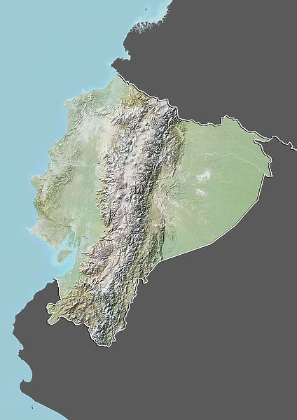
Ecuador, Relief Map With Border and Mask
Filename: 913_03_po03639.jpg
Size: 3511 x 4961 (2.9MB)
Date: 1st March 2012
Source: Universal Images Group (UIG)
© Planet Observer/UIG
![]()

Wall Art and Photo Gifts from Universal Images Group (UIG)
Ecuador, Relief Map With Border and Mask
Relief map of Equator (with border and mask). This image was compiled from data acquired by landsat 5 & 7 satellites combined with elevation data
Universal Images Group (UIG) manages distribution for many leading specialist agencies worldwide
Media ID 9618575
© Planet Observer/UIG
Amazon Region Andes Coastline Ecuador Energy Forest Mountain Mountain Range Natural Ressources Rainforest Relief Map Shore Snow South America Exportation Quito Satellite View
EDITORS COMMENTS
This print showcases the stunning diversity and natural beauty of Ecuador, a country nestled in South America. The relief map, meticulously compiled from data acquired by Landsat 5 & 7 satellites combined with elevation data, offers a unique perspective on Ecuador's topography. From majestic mountains to lush forests and picturesque shores, this image captures the essence of Ecuador's varied landscapes. The snow-capped peaks of the Andes Mountain Range stand tall against the backdrop of vibrant green rainforests that stretch as far as the eye can see. The coastline reveals itself with pristine beaches meeting the crashing waves of the Pacific Ocean. Notably, this relief map also highlights Ecuador's rich natural resources. Oil extraction sites dotting certain areas remind us of its significance in powering global energy needs. However, it is essential to note that commercial use should not be associated with this image. The cityscape of Quito, Ecuador's capital and one of UNESCO's World Heritage Sites, is absent from this photograph. Instead, we are invited to appreciate nature at its finest without any human presence disrupting its serenity. In summary, this visually striking print encapsulates Ecuador's physical geography through satellite imagery and cartography techniques. It serves as a reminder of our planet's remarkable beauty and encourages us to cherish and protect these precious ecosystems for future generations.
MADE IN THE USA
Safe Shipping with 30 Day Money Back Guarantee
FREE PERSONALISATION*
We are proud to offer a range of customisation features including Personalised Captions, Color Filters and Picture Zoom Tools
SECURE PAYMENTS
We happily accept a wide range of payment options so you can pay for the things you need in the way that is most convenient for you
* Options may vary by product and licensing agreement. Zoomed Pictures can be adjusted in the Cart.

