Canvas Print > Europe > France > Paris > Maps
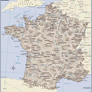
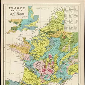
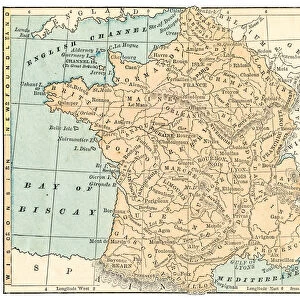
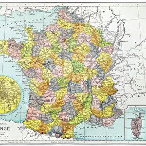
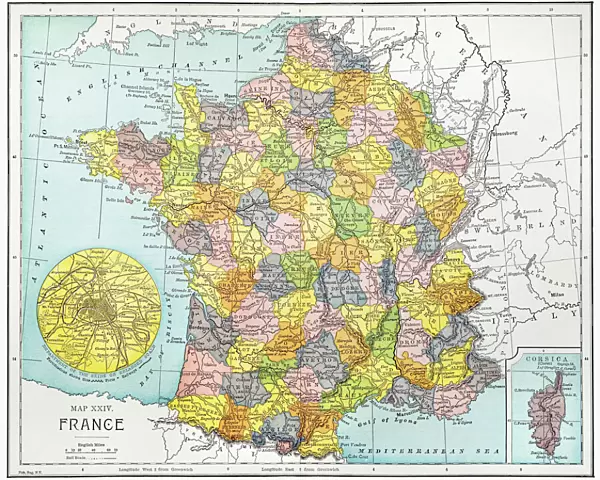
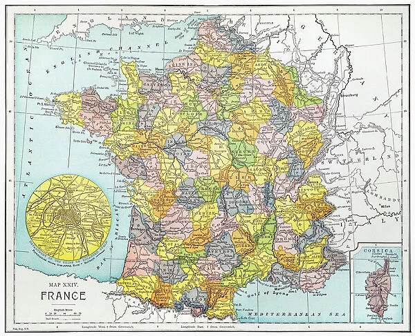
Canvas Print : MAP OF FRANCE, c1900. With inset detail of Paris and surrounding area


![]()
Canvas Prints from Granger
MAP OF FRANCE, c1900. With inset detail of Paris and surrounding area
Granger holds millions of images spanning more than 25,000 years of world history, from before the Stone Age to the dawn of the Space Age
Media ID 6622393
20"x16" (51x41cm) Canvas Print
Discover the rich history and intricate details of France with our exquisite Canvas Print of "MAP OF FRANCE, c1900. With inset detail of Paris and surrounding area," from The Granger Collection through Granger Art on Demand. This captivating vintage map transports you back in time, showcasing France's geographical landscape during the early 20th century. The inset detail of Paris and its surrounding area provides an enchanting glimpse into the city's past, making this a stunning addition to any home or office. With our high-quality canvas prints, you'll enjoy vibrant colors, sharp details, and long-lasting durability. Bring history to life and add a touch of timeless elegance to your space with this beautiful piece.
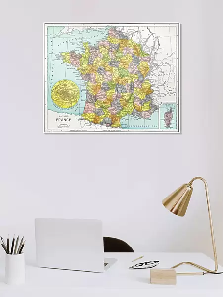
Delivered stretched and ready to hang our premium quality canvas prints are made from a polyester/cotton blend canvas and stretched over a 1.25" (32mm) kiln dried knot free wood stretcher bar. Packaged in a plastic bag and secured to a cardboard insert for safe transit.
Canvas Prints add colour, depth and texture to any space. Professionally Stretched Canvas over a hidden Wooden Box Frame and Ready to Hang
Estimated Product Size is 50.8cm x 40.6cm (20" x 16")
These are individually made so all sizes are approximate
Artwork printed orientated as per the preview above, with landscape (horizontal) orientation to match the source image.
FEATURES IN THESE COLLECTIONS
> Arts
> Landscape paintings
> Waterfall and river artworks
> River artworks
> Europe
> France
> Paris
> Maps
> Europe
> France
> Paris
> Related Images
> Maps and Charts
> Early Maps
> Maps and Charts
> Related Images
> Granger Art on Demand
> Maps
EDITORS COMMENTS
This print from Granger Art on Demand showcases a vintage "Map of France, c1900". With its intricate details and historical significance, this piece takes us back in time to the early 20th century. The map features an inset detail of Paris and its surrounding area, allowing us to explore the enchanting capital city's layout during that era. The craftsmanship evident in this French map is truly remarkable. Every river, town, and border is meticulously illustrated with precision and accuracy. It serves as a testament to the cartographic expertise of the time and provides valuable insights into France's geographical landscape at the turn of the century. As we gaze upon this beautiful artwork, our imagination runs wild with thoughts of exploration and adventure. We can almost envision travelers relying on maps like these to navigate their way through picturesque countryside or bustling city streets. This particular map holds immense historical value as it captures a snapshot of France during an important period in its history. "The Map of France, c1900" by The Granger Collection invites us to appreciate both its aesthetic appeal and educational significance. Whether you are a lover of history or simply intrigued by antique maps, this print will undoubtedly add charm and sophistication to any space it graces.
MADE IN THE USA
Safe Shipping with 30 Day Money Back Guarantee
FREE PERSONALISATION*
We are proud to offer a range of customisation features including Personalised Captions, Color Filters and Picture Zoom Tools
SECURE PAYMENTS
We happily accept a wide range of payment options so you can pay for the things you need in the way that is most convenient for you
* Options may vary by product and licensing agreement. Zoomed Pictures can be adjusted in the Cart.