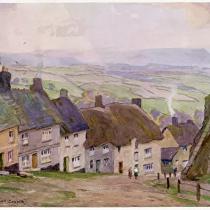
Canvas Print > Europe > United Kingdom > England > Dorset > Bridport
Canvas Print : 1840s Victorian Map of Dorset


![]()
Canvas Prints from Mary Evans Picture Library
1840s Victorian Map of Dorset
Mary Evans Picture Library makes available wonderful images created for people to enjoy over the centuries
Media ID 32350800
© The Keasbury-Gordon Photograph Archive / Mary Evans
1840s Bridport Corfe Dorchester Dorset Dorsetshire Lyme Poole Portland Railways Regis Shaftesbury Weymouth
20"x16" (51x41cm) Canvas Print
"Step back in time with our exquisite Canvas Prints from the Media Storehouse collection, featuring this stunning 1840s Victorian Map of Dorset from The Keasbury-Gordon Photograph Archive Collection, available through Mary Evans Prints Online. This captivating vintage map transports you to an era of elegance and discovery, with intricate details bringing the history of Dorset to life. Each Canvas Print is meticulously crafted using premium materials and vibrant colors, ensuring a museum-quality finish. Elevate your home decor with a touch of history and charm - order yours today!"
Delivered stretched and ready to hang our premium quality canvas prints are made from a polyester/cotton blend canvas and stretched over a 1.25" (32mm) kiln dried knot free wood stretcher bar. Packaged in a plastic bag and secured to a cardboard insert for safe transit.
Canvas Prints add colour, depth and texture to any space. Professionally Stretched Canvas over a hidden Wooden Box Frame and Ready to Hang
Estimated Product Size is 50.8cm x 40.6cm (20" x 16")
These are individually made so all sizes are approximate
Artwork printed orientated as per the preview above, with landscape (horizontal) orientation to match the source image.
FEATURES IN THESE COLLECTIONS
> Europe
> United Kingdom
> England
> Dorset
> Bridport
> Europe
> United Kingdom
> England
> Dorset
> Dorchester
> Europe
> United Kingdom
> England
> Dorset
> Lyme Regis
> Europe
> United Kingdom
> England
> Dorset
> Poole
> Europe
> United Kingdom
> England
> Dorset
> Portland
> Europe
> United Kingdom
> England
> Dorset
> Related Images
> Europe
> United Kingdom
> England
> Dorset
> Shaftesbury
> Europe
> United Kingdom
> England
> Dorset
> Weymouth
> Europe
> United Kingdom
> England
> Maps
> Europe
> United Kingdom
> England
> Posters
> Mary Evans Prints Online
> New Images July 2023
EDITORS COMMENTS
Transport yourself back to the 1840s with this stunning Victorian map of Dorset. This vintage lantern slide captures the intricate details of the county, from Dorchester to Weymouth, Portland to Poole. The map showcases the charming towns and villages that make up this historic region, including Corfe, Lyme Regis, Shaftesbury, and Bridport.
As you study the map closely, you can see how much has changed over the years in Dorset. The early railway lines crisscrossing through the countryside offer a glimpse into a bygone era when steam trains ruled the tracks. The Edwardian architecture of buildings is evident in every corner of this beautifully illustrated map.
This print is not just a piece of history; it's a work of art that tells a story about England's past. Whether you have roots in Dorset or simply appreciate its rich heritage, this map is sure to spark your imagination and curiosity about days gone by.
Add a touch of nostalgia to your home decor with this exquisite Victorian Map of Dorset from The Keasbury-Gordon Photograph Archive Collection at Mary Evans Prints Online. Let its old-world charm transport you back in time as you explore the beauty and history of one of England's most beloved counties.
MADE IN THE USA
Safe Shipping with 30 Day Money Back Guarantee
FREE PERSONALISATION*
We are proud to offer a range of customisation features including Personalised Captions, Color Filters and Picture Zoom Tools
SECURE PAYMENTS
We happily accept a wide range of payment options so you can pay for the things you need in the way that is most convenient for you
* Options may vary by product and licensing agreement. Zoomed Pictures can be adjusted in the Cart.