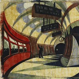
Jigsaw Puzzle > Europe > United Kingdom > England > Dorset > Bridport
Jigsaw Puzzle : 1840s Victorian Map of Dorset


![]()
Jigsaw Puzzles from Mary Evans Picture Library
1840s Victorian Map of Dorset
Mary Evans Picture Library makes available wonderful images created for people to enjoy over the centuries
Media ID 32350800
© The Keasbury-Gordon Photograph Archive / Mary Evans
1840s Bridport Corfe Dorchester Dorset Dorsetshire Lyme Poole Portland Railways Regis Shaftesbury Weymouth
Jigsaw Puzzle (520 Pieces)
Discover the charm of the past with our exquisite 1840s Victorian Map of Dorset jigsaw puzzle from The Keasbury-Gordon Photograph Archive Collection, available at Media Storehouse. This intricately detailed puzzle features an authentic antique map of Dorset, England, transporting you back in time. Immerse yourself in the history and beauty of the region as you piece together this captivating puzzle. Perfect for puzzle enthusiasts, history buffs, or anyone seeking a fun and engaging activity, this 1840s Victorian Map of Dorset puzzle is a must-have addition to your collection.
Made in the USA, 520-piece puzzles measure 16" x 20" (40.6 x 50.8 cm). Every puzzle is meticulously printed on glossy photo paper, which has a strong 1.33 mm thickness. Delivered in a black storage cardboard box, these puzzles are both stylish and practical. (Note: puzzles contain small parts and are not suitable for children under 3 years of age.)
Jigsaw Puzzles are an ideal gift for any occasion
Estimated Product Size is 50.8cm x 40.5cm (20" x 15.9")
These are individually made so all sizes are approximate
Artwork printed orientated as per the preview above, with landscape (horizontal) or portrait (vertical) orientation to match the source image.
FEATURES IN THESE COLLECTIONS
> Europe
> United Kingdom
> England
> Dorset
> Bridport
> Europe
> United Kingdom
> England
> Dorset
> Dorchester
> Europe
> United Kingdom
> England
> Dorset
> Lyme Regis
> Europe
> United Kingdom
> England
> Dorset
> Poole
> Europe
> United Kingdom
> England
> Dorset
> Portland
> Europe
> United Kingdom
> England
> Dorset
> Related Images
> Europe
> United Kingdom
> England
> Dorset
> Shaftesbury
> Europe
> United Kingdom
> England
> Dorset
> Weymouth
> Europe
> United Kingdom
> England
> Maps
> Europe
> United Kingdom
> England
> Posters
> Mary Evans Prints Online
> New Images July 2023
EDITORS COMMENTS
Transport yourself back to the 1840s with this stunning Victorian map of Dorset. This vintage lantern slide captures the intricate details of the county, from Dorchester to Weymouth, Portland to Poole. The map showcases the charming towns and villages that make up this historic region, including Corfe, Lyme Regis, Shaftesbury, and Bridport.
As you study the map closely, you can see how much has changed over the years in Dorset. The early railway lines crisscrossing through the countryside offer a glimpse into a bygone era when steam trains ruled the tracks. The Edwardian architecture of buildings is evident in every corner of this beautifully illustrated map.
This print is not just a piece of history; it's a work of art that tells a story about England's past. Whether you have roots in Dorset or simply appreciate its rich heritage, this map is sure to spark your imagination and curiosity about days gone by.
Add a touch of nostalgia to your home decor with this exquisite Victorian Map of Dorset from The Keasbury-Gordon Photograph Archive Collection at Mary Evans Prints Online. Let its old-world charm transport you back in time as you explore the beauty and history of one of England's most beloved counties.
MADE IN THE USA
Safe Shipping with 30 Day Money Back Guarantee
FREE PERSONALISATION*
We are proud to offer a range of customisation features including Personalised Captions, Color Filters and Picture Zoom Tools
SECURE PAYMENTS
We happily accept a wide range of payment options so you can pay for the things you need in the way that is most convenient for you
* Options may vary by product and licensing agreement. Zoomed Pictures can be adjusted in the Cart.