Canvas Print > Animals > Mammals > Muridae > Western Mediterranean Mouse
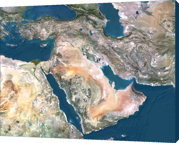
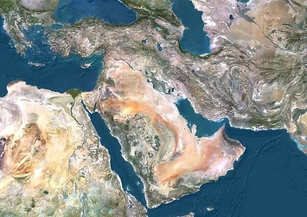
Canvas Print : Middle East, satellite image
![]()

Canvas Prints from Science Photo Library
Middle East, satellite image
Middle East. North is at top. Satellite image of the Middle East, showing the borders (white lines) of the countries. The Middle East is a Eurocentric term used to describe a region that roughly encompasses Western Asia. The Mediterranean Sea (blue, upper left), Black Sea (blue, top left), Caspian Sea (blue, top right), Red Sea (blue, centre left), Indian Ocean (blue, lower left), and Persian Gulf (blue, centre right) can also be seen. Image compiled from data acquired by LANDSAT satellites, in 2012
Science Photo Library features Science and Medical images including photos and illustrations
Media ID 9217947
© PLANETOBSERVER/SCIENCE PHOTO LIBRARY
2012 Aegean Sea Arabian Peninsula Birds Eye View Cartography Continent Continents Countries Country Earth Observation Elevation Elevations Environmental From Above From Space Frontier Frontiers Indian Ocean Land Landsat Mediterranean Sea Middle East Nation Nations Oceans Pacific Ocean Region Satellite Satellite Image Topographic Topography Western Asia Northern Africa
20"x16" (51x41cm) Canvas Print
"Transform your space with a stunning addition from Media Storehouse's Canvas Prints collection. This captivating piece features a mesmerizing satellite image of the Middle East, expertly captured by Science Photo Library. Witness intricate borders of various countries in the region come to life in vibrant detail on your wall. Bring a touch of geography and world culture into your home or office decor with this visually engaging and thought-provoking canvas print. Order yours today and experience the beauty of our planet from a unique perspective."
Delivered stretched and ready to hang our premium quality canvas prints are made from a polyester/cotton blend canvas and stretched over a 1.25" (32mm) kiln dried knot free wood stretcher bar. Packaged in a plastic bag and secured to a cardboard insert for safe transit.
Canvas Prints add colour, depth and texture to any space. Professionally Stretched Canvas over a hidden Wooden Box Frame and Ready to Hang
Estimated Product Size is 50.8cm x 40.6cm (20" x 16")
These are individually made so all sizes are approximate
Artwork printed orientated as per the preview above, with landscape (horizontal) orientation to match the source image.
FEATURES IN THESE COLLECTIONS
> Africa
> Related Images
> Animals
> Mammals
> Muridae
> Western Mediterranean Mouse
> Animals
> Mammals
> Muridae
> Western Mouse
> Arts
> Artists
> O
> Oceanic Oceanic
> Asia
> Related Images
> Europe
> France
> Canton
> Landes
> Maps and Charts
> Related Images
EDITORS COMMENTS
This print showcases a satellite image of the Middle East, with the North positioned at the top. The white lines beautifully outline the borders of various countries in this region. Known as a Eurocentric term, the Middle East encompasses Western Asia and is an area rich in history and culture. As we delve into this image, our eyes are drawn to several stunning bodies of water that surround this landmass. The Mediterranean Sea appears in a vibrant blue shade on the upper left side, while the Black Sea sits adjacent to it. Towards the top right corner lies the Caspian Sea, followed by the Red Sea towards the center-left and Indian Ocean towards lower left. Finally, we spot the Persian Gulf majestically situated at center-right. Compiled from data acquired by LANDSAT satellites in 2012, this photograph offers us a unique perspective on Earth's observation from space. It allows us to appreciate not only geographical features but also highlights how interconnected our world truly is. The intricate details captured here provide valuable insights into elevation levels and environmental characteristics across different regions within Western Asia. This comprehensive view invites exploration of diverse landscapes - from mountain ranges to coastal plains - showcasing both natural beauty and human settlements. With its wealth of information about nations and continents alike, this satellite image print serves as an invaluable tool for cartography enthusiasts or anyone seeking a birds-eye view of our planet's wonders.
MADE IN THE USA
Safe Shipping with 30 Day Money Back Guarantee
FREE PERSONALISATION*
We are proud to offer a range of customisation features including Personalised Captions, Color Filters and Picture Zoom Tools
SECURE PAYMENTS
We happily accept a wide range of payment options so you can pay for the things you need in the way that is most convenient for you
* Options may vary by product and licensing agreement. Zoomed Pictures can be adjusted in the Cart.

