
Maps Collection
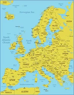
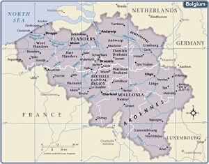
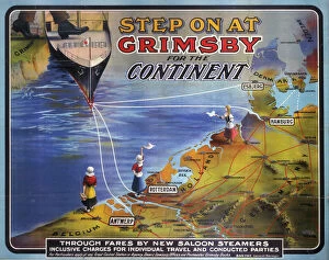
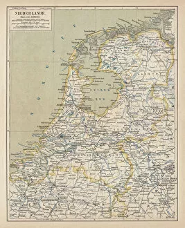
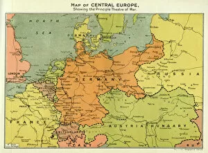
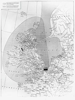
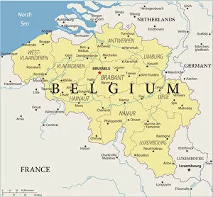
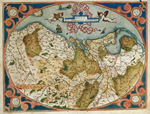
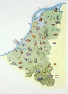
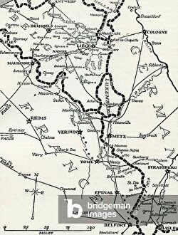
Belgium is a small country located in the heart of Europe and has been an important crossroads for centuries
Choose a picture from our Maps Collection for your Wall Art and Photo Gifts
722 items


All Professionally Made to Order for Quick Shipping
-
Maps Collection
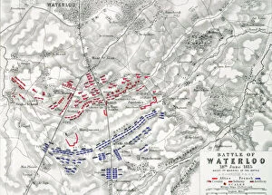
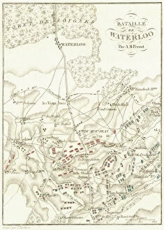
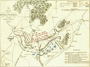
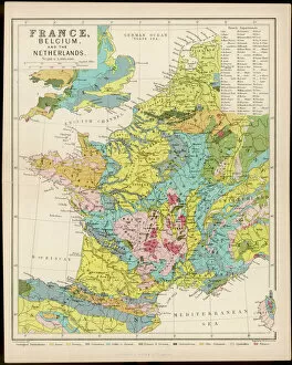
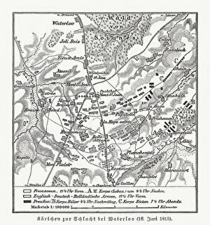
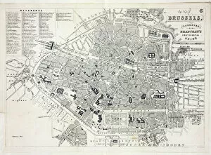
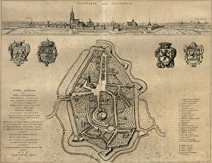
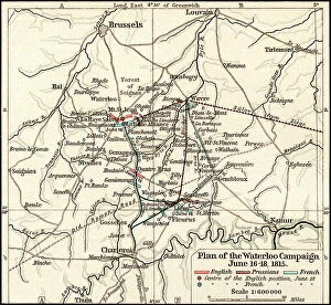
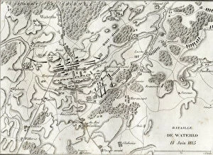
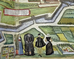
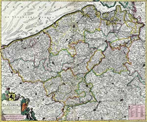
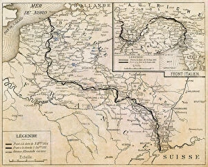
Belgium is a small country located in the heart of Europe and has been an important crossroads for centuries, and its location has made it a popular destination for travelers. Maps of Belgium Europe are essential to navigating this diverse nation. The maps show the country's main cities, rivers, mountains, and other features. They also provide information on transportation networks such as highways and railroads. Additionally, they can help visitors plan their trips by showing them points of interest such as museums, parks, monuments, and other attractions. With its rich history and vibrant culture, Belgium is an exciting place to explore - but make sure you have a good map before you go.
+
Our beautiful pictures are available as Framed Prints, Photos, Wall Art and Photo Gifts
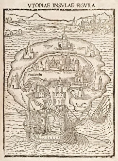
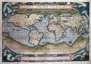
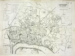
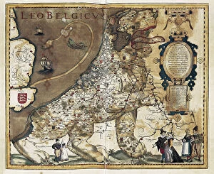
Media Storehouse offers a collection of Maps of Belgium Europe wall art and framed prints. Our collection features vintage maps that showcase the geographical details, cities, towns, rivers, and borders of Belgium in different eras. These maps are printed on high-quality paper using state-of-the-art printing technology to ensure clarity and durability. They come in various sizes and framing options to suit individual preferences. The Maps of Belgium Europe collection is perfect for history enthusiasts, geography lovers or anyone who wants to add a touch of sophistication to their home or office decor. These maps can also serve as educational tools for schools or museums. Media Storehouse guarantees the authenticity and quality of its products by sourcing them from reputable archives worldwide. Customers can browse through the extensive collection online and make secure purchases with ease. Our Maps of Belgium Europe collection offers an excellent opportunity for individuals or institutions to own unique pieces that capture the rich history and beauty of this European country.
+
What are Maps of Belgium Europe art prints?
Maps of Belgium Europe art prints are high-quality reproductions of antique and modern maps depicting the geography, topography, and political boundaries of Belgium. These prints showcase the intricate details and artistic styles used in creating these historical documents. They are perfect for collectors, history enthusiasts, or anyone who appreciates fine art. These maps offer a unique perspective on the evolution of Belgium's landscape over time. From early depictions that show its development as a nation to more recent maps that highlight its cities and landmarks, these prints provide an insight into how this country has changed throughout history. Maps of Belgium Europe art prints come in various sizes and formats to suit different preferences. Whether you want a large canvas print or a smaller framed version to display on your wall, there is something for everyone. These prints make great gifts for friends or family members who have an interest in cartography or Belgian culture.
+
What Maps of Belgium Europe art prints can I buy from Media Storehouse?
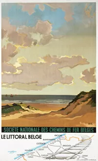
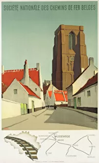
We offer a wide range of Maps of Belgium Europe art prints that you can choose from. These include vintage maps, antique maps, modern maps, and topographical maps. You can also find city plans and street maps of various Belgian cities such as Brussels, Antwerp, Ghent, Bruges and many more. The Maps of Belgium Europe art prints available at Media Storehouse are printed on high-quality paper using the latest printing technology to ensure that they are vibrant and long-lasting. They come in different sizes to suit your needs and preferences. Whether you're looking for a map to decorate your home or office or as a gift for someone who loves geography or history, we have got you covered. With their vast collection of Maps of Belgium Europe art prints, you'll surely find something that will catch your eye. If you want to buy beautiful and accurate Maps of Belgium Europe art prints with excellent quality from an online store with great customer service then Media Storehouse is definitely worth checking out.
+
How do I buy Maps of Belgium Europe art prints?
To buy Maps of Belgium Europe art prints from Media Storehouse, you can browse our extensive collection online. Simply search for "Maps of Belgium Europe" in the search bar on our website and select the print that catches your eye. Once you have found a print that you like, click on it to view more details about the product. From there, add the item to your cart and proceed to checkout. You will be prompted to enter your shipping and payment information before completing your purchase. We offer a variety of sizes for their art prints, so make sure to choose one that fits your needs. We also offer framing options if you want a ready-to-hang piece of artwork. Buying Maps of Belgium Europe art prints from Media Storehouse is easy and convenient. With just a few clicks, you can have beautiful artwork delivered right to your doorstep.
+
How much do Maps of Belgium Europe art prints cost?
We offer a wide range of Maps of Belgium Europe art prints at varying prices. Our collection includes vintage maps, modern maps, and artistic interpretations of the country's geography. The cost of each print depends on several factors such as size, material quality, and printing technique used. We have options for every budget and preference. Our high-quality paper prints are affordable yet durable while our premium canvas prints provide a more luxurious finish. Additionally, we offer framed versions that come ready to hang in your home or office space. Whether you're looking for a detailed map to help plan your travels or an artistic piece to decorate your walls with Belgian charm, we have something for everyone. We take pride in offering exceptional customer service and ensuring that our customers receive their orders promptly without any hassle. Browse through our extensive collection today to find the perfect Maps of Belgium Europe art print that suits your style and budget.
+
How will my Maps of Belgium Europe art prints be delivered to me?
We take great care in ensuring that your Maps of Belgium Europe art prints are delivered to you safely and securely. We use high-quality packaging materials to protect your artwork during transit, including sturdy cardboard tubes for rolled prints and flat-pack boxes for framed prints. Once your order has been processed, our team will carefully package your artwork and arrange for it to be shipped directly to you. We work with trusted courier partners who offer reliable delivery services across the UK and internationally. When your Maps of Belgium Europe art print arrives, simply unpack it from its protective packaging and enjoy. Whether you choose a classic framed print or a contemporary canvas option, our high-quality printing techniques ensure that every detail is captured perfectly. We pride ourselves on delivering exceptional customer service at every stage of the process. If you have any questions about delivery or shipping options, please don't hesitate to get in touch with our friendly team today.