Home > Europe > Italy > Tuscany > Florence
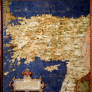
Map of Santo Domingo or Hispaniola, c. 1567. (mural painting)
")
![]()
Wall Art and Photo Gifts from Fine Art Finder
Map of Santo Domingo or Hispaniola, c. 1567. (mural painting)
LRI4595657 Map of Santo Domingo or Hispaniola, c.1567. (mural painting) by Danti, Egnazio (1536-86); Palazzo Vecchio, Florence, Italy; (add.info.: Santo Domingo (Santo Domingo) or Hispaniola Map made by Egnazio Danti (1536-1586) mathematician, cosmographer and Italian architect. Around 1567. Florence, Palazzo Vecchio, Sala del Mappamondo); Luisa Ricciarini; Italian, out of copyright
Media ID 23331470
© Luisa Ricciarini / Bridgeman Images
Caribbean Central America Dominium Geographical Map
FEATURES IN THESE COLLECTIONS
> Europe
> Italy
> Tuscany
> Florence
> Fine Art Finder
> Artists
> Egnazio Danti
> Maps and Charts
> Italy
> Maps and Charts
> Related Images
EDITORS COMMENTS
This print showcases the exquisite "Map of Santo Domingo or Hispaniola" created by the talented Egnazio Danti in 1567. The mural painting, located in Palazzo Vecchio, Florence, Italy, is a testament to Danti's expertise as a mathematician, cosmographer, and architect. The map itself depicts the island of Hispaniola with remarkable detail and precision. It serves as an invaluable geographical resource for understanding the American continent during that era. With its intricate lines and carefully labeled regions, this masterpiece offers a glimpse into the rich history and diverse landscapes of Santo Domingo. Luisa Ricciarini has skillfully captured this iconic artwork through her lens, preserving its beauty for generations to come. Through her photography skills, she allows us to appreciate every stroke and color choice made by Danti centuries ago. As we gaze upon this image, we are transported back in time to an era when cartography was both an art form and a scientific endeavor. This map not only provides valuable information about the geography of Central America but also reflects the cultural significance of exploration during that period. Whether you are an avid lover of historical maps or simply intrigued by Caribbean history, this print is sure to captivate your imagination and spark curiosity about our world's past.
MADE IN THE USA
Safe Shipping with 30 Day Money Back Guarantee
FREE PERSONALISATION*
We are proud to offer a range of customisation features including Personalised Captions, Color Filters and Picture Zoom Tools
SECURE PAYMENTS
We happily accept a wide range of payment options so you can pay for the things you need in the way that is most convenient for you
* Options may vary by product and licensing agreement. Zoomed Pictures can be adjusted in the Cart.