Home > Historic > Ancient civilizations > Ancient Greece > Greek history
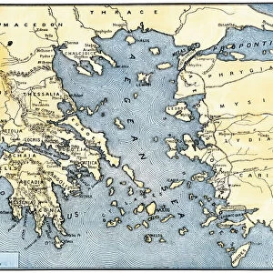
World map of Claudius Ptolemaeus (Claude Ptolemee, 90-168 ap JC), Greek astronomer and astrologer (in red), contrasted with the real positions of cities and countries (in black)
, Greek astronomer and astrologer (in red), contrasted with the real positions of cities and countries (in black)")
![]()
Wall Art and Photo Gifts from Fine Art Finder
World map of Claudius Ptolemaeus (Claude Ptolemee, 90-168 ap JC), Greek astronomer and astrologer (in red), contrasted with the real positions of cities and countries (in black)
NWI4852574 World map of Claudius Ptolemaeus (Claude Ptolemee, 90-168 ap JC), Greek astronomer and astrologer (in red), contrasted with the real positions of cities and countries (in black). Representation of the flat earth without the North and South poles and without the American continent. Colouring engraving of the 19th century.; (add.info.: World map of Claudius Ptolemaeus (Claude Ptolemee, 90-168 ap JC), Greek astronomer and astrologer (in red), contrasted with the real positions of cities and countries (in black). Representation of the flat earth without the North and South poles and without the American continent. Colouring engraving of the 19th century.); Photo © North Wind Pictures
Media ID 38482454
© © North Wind Pictures / Bridgeman Images
Astrologer Astronomer Astronomers Claudius Ptolemaeus Claudius Ptolemy Planisphere Ptolemy Asian Asian Geographical Map
FEATURES IN THESE COLLECTIONS
> Africa
> South Africa
> Maps
> Africa
> South Africa
> Related Images
> Europe
> Greece
> Related Images
> Fine Art Finder
> Artists
> Greek School
> Historic
> Ancient civilizations
> Ancient Greece
> Greek history
> Maps and Charts
> Flat Earth
EDITORS COMMENTS
This print showcases the World map of Claudius Ptolemaeus, also known as Claude Ptolemee, a renowned Greek astronomer and astrologer from 90-168 AD. The map is depicted in striking red, contrasting with the real positions of cities and countries shown in black. This representation offers a fascinating glimpse into the ancient understanding of geography and cartography.
The flat earth depicted on this map lacks the North and South poles, as well as the American continent, reflecting the limited knowledge available during Ptolemaeus' time. Despite these inaccuracies, his work laid the foundation for future explorations and advancements in astronomy.
This 19th-century engraving captures the intricate details of Ptolemaeus' world map, showcasing Europe, Asia, Africa, and Oceania with meticulous precision. The vibrant colors used in this print bring to life an important historical document that continues to inspire curiosity about our planet's past.
As we marvel at this depiction of ancient geographical knowledge juxtaposed with modern understandings of our world's layout, we are reminded of how far humanity has come in unraveling the mysteries of our planet. This print serves as a reminder of both our past accomplishments and ongoing quest for discovery.
MADE IN THE USA
Safe Shipping with 30 Day Money Back Guarantee
FREE PERSONALISATION*
We are proud to offer a range of customisation features including Personalised Captions, Color Filters and Picture Zoom Tools
SECURE PAYMENTS
We happily accept a wide range of payment options so you can pay for the things you need in the way that is most convenient for you
* Options may vary by product and licensing agreement. Zoomed Pictures can be adjusted in the Cart.