Home > Europe > United Kingdom > England > London > Museums > National Maritime Museum
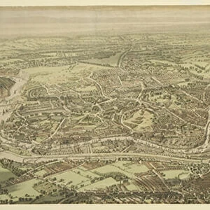
Chart of the Rio de la Plata (river Plate), 1806 (engraving)
, 1806 (engraving)")
![]()
Wall Art and Photo Gifts from Fine Art Finder
Chart of the Rio de la Plata (river Plate), 1806 (engraving)
7342111 Chart of the Rio de la Plata (river Plate), 1806 (engraving) by Arrowsmith (19th century); 14.2x23.1 cm; National Maritime Museum, London, UK; (add.info.: Creator: Arrowsmith); © National Maritime Museum, Greenwich, London
Media ID 38341504
© © National Maritime Museum, Greenwich, London / Bridgeman Images
Argentina Argentina Argentinean Argentinian Argentinians Latin America Uruguay Uruguayan Latine America
FEATURES IN THESE COLLECTIONS
> Europe
> United Kingdom
> England
> London
> Boroughs
> Greenwich
> Europe
> United Kingdom
> England
> London
> Museums
> Greenwich Heritage Centre
> Europe
> United Kingdom
> England
> London
> Museums
> National Maritime Museum
> Europe
> United Kingdom
> England
> London
> Towns
> Greenwich
> Europe
> United Kingdom
> Heritage Sites
> Maritime Greenwich
> Europe
> United Kingdom
> Maps
> Fine Art Finder
> Artists
> Thomas Goldsworth Dutton
> Maps and Charts
> Early Maps
> South America
> Argentina
> La Plata
> South America
> Argentina
> Maps
EDITORS COMMENTS
This stunning engraving from 1806 depicts a detailed Chart of the Rio de la Plata (river Plate), showcasing the intricate cartography skills of Arrowsmith. Measuring 14.2x23.1 cm, this historical piece is housed at the National Maritime Museum in London, UK.
The map provides a glimpse into the geographical features of South America, specifically Argentina and Uruguay, during the early 19th century. The fine lines and intricate details on the engraving highlight Arrowsmith's expertise as a cartographer.
The black and white aesthetic adds a classic touch to this piece, allowing viewers to appreciate its historical significance even more. The precision and accuracy of the map reflect the dedication and skill that went into creating it.
As you study this engraving, you can't help but marvel at how much has changed in these regions over time. It serves as a reminder of our ever-evolving world and how important it is to preserve pieces like this for future generations to admire.
Whether you have an interest in history, geography, or artistry, this Chart of the Rio de la Plata is sure to captivate your imagination and transport you back in time to an era when maps were not just tools for navigation but works of art in their own right.
MADE IN THE USA
Safe Shipping with 30 Day Money Back Guarantee
FREE PERSONALISATION*
We are proud to offer a range of customisation features including Personalised Captions, Color Filters and Picture Zoom Tools
SECURE PAYMENTS
We happily accept a wide range of payment options so you can pay for the things you need in the way that is most convenient for you
* Options may vary by product and licensing agreement. Zoomed Pictures can be adjusted in the Cart.