Fine Art Print > Europe > United Kingdom > England > London > Boroughs > Bexley
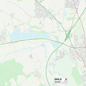
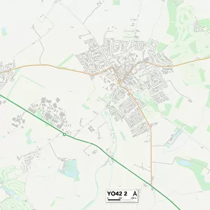
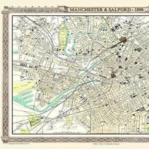
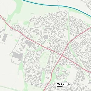
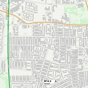
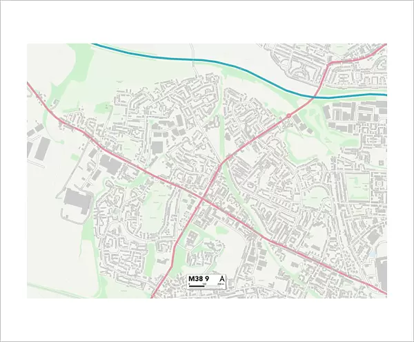
Fine Art Print : Salford M38 9 Map


![]()
Fine Art Prints from Map Marketing
Salford M38 9 Map
Postcode Sector Map of Salford M38 9
Media ID 19974228
Albany Close Bank Lane Beechfield Avenue Blair Avenue Bridgewater Street Broughton Avenue Burns Road Claremont Drive Co Operative Street Coniston Avenue Coniston Grove County Road Crescent Drive Croft Street Crompton Street Devonshire Road Duke Street Ellesmere Street Falcon Drive Green Avenue Greenfield Road Harrison Street Highfield Road Highgate Drive Highgate Lane Hilton Street Hope Avenue Hope Street Kestrel Avenue Kirkham Street Larkfield Avenue Laurel Drive Marsh Road Mill Hill Moorland Drive Oakfield Drive Old Lane Pemberton Street Queen Street Regent Avenue Salford Seddon Street Shelley Road Silverdale Avenue Spring Gardens Thirlmere Drive Upland Drive West Way Windsor Avenue Wingate Road Wordsworth Road
20"x16" (+3" Border) Fine Art Print
20x16 image printed on 26x22 Fine Art Rag Paper with 3" (76mm) white border. Our Fine Art Prints are printed on 300gsm 100% acid free, PH neutral paper with archival properties. This printing method is used by museums and art collections to exhibit photographs and art reproductions.
Our fine art prints are high-quality prints made using a paper called Photo Rag. This 100% cotton rag fibre paper is known for its exceptional image sharpness, rich colors, and high level of detail, making it a popular choice for professional photographers and artists. Photo rag paper is our clear recommendation for a fine art paper print. If you can afford to spend more on a higher quality paper, then Photo Rag is our clear recommendation for a fine art paper print.
Estimated Image Size (if not cropped) is 50.8cm x 35.9cm (20" x 14.1")
Estimated Product Size is 66cm x 55.9cm (26" x 22")
These are individually made so all sizes are approximate
Artwork printed orientated as per the preview above, with landscape (horizontal) orientation to match the source image.
FEATURES IN THESE COLLECTIONS
> Europe
> United Kingdom
> England
> London
> Boroughs
> Bexley
> Europe
> United Kingdom
> England
> Manchester
> Kersal
> Europe
> United Kingdom
> England
> Manchester
> Little Hulton
> Europe
> United Kingdom
> England
> Manchester
> Manchester
> Europe
> United Kingdom
> England
> Manchester
> Ordsall
> Europe
> United Kingdom
> England
> Manchester
> Salford
> Europe
> United Kingdom
> England
> Manchester
> Seedley
> Europe
> United Kingdom
> England
> Manchester
> Weaste
> Europe
> United Kingdom
> Wales
> Flintshire
> Broughton
> Maps and Charts
> Related Images
> Map Marketing
> Postcode Sector Maps
> M - Manchester
> Map Marketing
> UK Maps
MADE IN THE USA
Safe Shipping with 30 Day Money Back Guarantee
FREE PERSONALISATION*
We are proud to offer a range of customisation features including Personalised Captions, Color Filters and Picture Zoom Tools
SECURE PAYMENTS
We happily accept a wide range of payment options so you can pay for the things you need in the way that is most convenient for you
* Options may vary by product and licensing agreement. Zoomed Pictures can be adjusted in the Cart.