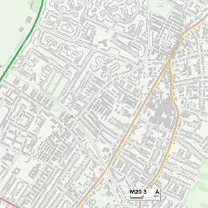
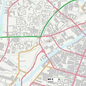
Photographic Print > Europe > United Kingdom > England > London > Boroughs > Bexley
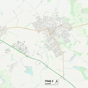
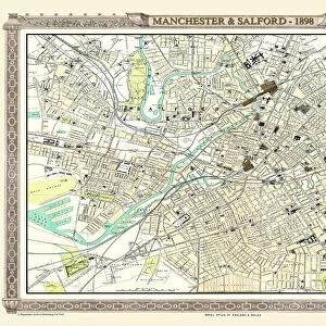
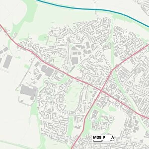
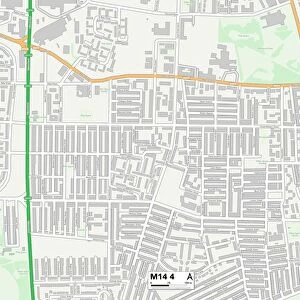
Photographic Print : Salford M38 9 Map


![]()
Photo Prints from Map Marketing
Salford M38 9 Map
Postcode Sector Map of Salford M38 9
Media ID 19974228
Albany Close Bank Lane Beechfield Avenue Blair Avenue Bridgewater Street Broughton Avenue Burns Road Claremont Drive Co Operative Street Coniston Avenue Coniston Grove County Road Crescent Drive Croft Street Crompton Street Devonshire Road Duke Street Ellesmere Street Falcon Drive Green Avenue Greenfield Road Harrison Street Highfield Road Highgate Drive Highgate Lane Hilton Street Hope Avenue Hope Street Kestrel Avenue Kirkham Street Larkfield Avenue Laurel Drive Marsh Road Mill Hill Moorland Drive Oakfield Drive Old Lane Pemberton Street Queen Street Regent Avenue Salford Seddon Street Shelley Road Silverdale Avenue Spring Gardens Thirlmere Drive Upland Drive West Way Windsor Avenue Wingate Road Wordsworth Road
10"x8" Photo Print
Photo prints are produced on Kodak professional photo paper resulting in timeless and breath-taking prints which are also ideal for framing. The colors produced are rich and vivid, with accurate blacks and pristine whites, resulting in prints that are truly timeless and magnificent. Whether you're looking to display your prints in your home, office, or gallery, our range of photographic prints are sure to impress. Dimensions refers to the size of the paper in inches.
Our Photo Prints are in a large range of sizes and are printed on Archival Quality Paper for excellent colour reproduction and longevity. They are ideal for framing (our Framed Prints use these) at a reasonable cost. Alternatives include cheaper Poster Prints and higher quality Fine Art Paper, the choice of which is largely dependant on your budget.
Estimated Image Size (if not cropped) is 25.4cm x 18cm (10" x 7.1")
Estimated Product Size is 25.4cm x 20.3cm (10" x 8")
These are individually made so all sizes are approximate
Artwork printed orientated as per the preview above, with landscape (horizontal) orientation to match the source image.
FEATURES IN THESE COLLECTIONS
> Map Marketing
> Postcode Sector Maps
> M - Manchester
> Map Marketing
> UK Maps
> Europe
> United Kingdom
> England
> London
> Boroughs
> Bexley
> Europe
> United Kingdom
> England
> Manchester
> Kersal
> Europe
> United Kingdom
> England
> Manchester
> Little Hulton
> Europe
> United Kingdom
> England
> Manchester
> Manchester
> Europe
> United Kingdom
> England
> Manchester
> Ordsall
> Europe
> United Kingdom
> England
> Manchester
> Salford
> Europe
> United Kingdom
> England
> Manchester
> Seedley
> Europe
> United Kingdom
> England
> Manchester
> Weaste
> Europe
> United Kingdom
> Wales
> Flintshire
> Broughton
> Maps and Charts
> Related Images
MADE IN THE USA
Safe Shipping with 30 Day Money Back Guarantee
FREE PERSONALISATION*
We are proud to offer a range of customisation features including Personalised Captions, Color Filters and Picture Zoom Tools
SECURE PAYMENTS
We happily accept a wide range of payment options so you can pay for the things you need in the way that is most convenient for you
* Options may vary by product and licensing agreement. Zoomed Pictures can be adjusted in the Cart.