Fine Art Print > Maps and Charts > World
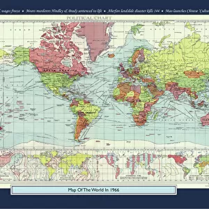
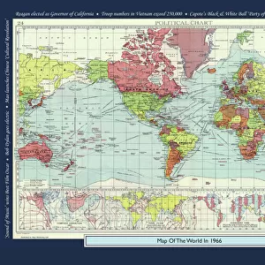
Fine Art Print : Old Map of the World 1966


![]()
Fine Art Prints from MapSeeker
Old Map of the World 1966
WMY1966
Welcome to the Mapseeker Image library and enter an historic gateway to one of the largest on-line collections of Historic Maps, Nostalgic Views, Vista's and Panorama's from a World gone by.
Media ID 20347267
Map Of The World Old Map Of The World The World World Map
21"x14" (+3" Border) Fine Art Print
21x14 image printed on 27x20 Fine Art Rag Paper with 3" (76mm) white border. Our Fine Art Prints are printed on 300gsm 100% acid free, PH neutral paper with archival properties. This printing method is used by museums and art collections to exhibit photographs and art reproductions.
Our fine art prints are high-quality prints made using a paper called Photo Rag. This 100% cotton rag fibre paper is known for its exceptional image sharpness, rich colors, and high level of detail, making it a popular choice for professional photographers and artists. Photo rag paper is our clear recommendation for a fine art paper print. If you can afford to spend more on a higher quality paper, then Photo Rag is our clear recommendation for a fine art paper print.
Estimated Image Size (if not cropped) is 53.3cm x 35.5cm (21" x 14")
Estimated Product Size is 68.6cm x 50.8cm (27" x 20")
These are individually made so all sizes are approximate
Artwork printed orientated as per the preview above, with landscape (horizontal) orientation to match the source image.
FEATURES IN THESE COLLECTIONS
> Maps and Charts
> World
> MapSeeker
> Maps Showing the World
> Maps of The World by Year PORTFOLIO
EDITORS COMMENTS
This print showcases the "Old Map of the World 1966 (WMY1966)" from MapSeeker, taking us on a nostalgic journey through time. The image depicts a beautifully preserved vintage map that offers a glimpse into how our world was perceived over half a century ago. With its warm sepia tones and intricate details, this old map of the world evokes a sense of wonder and curiosity. It transports us to an era when cartography was still an art form, meticulously hand-drawn with delicate strokes. Every continent, ocean, and island is carefully outlined, inviting exploration and sparking imagination. As we gaze upon this remarkable piece of history, we are reminded of the vastness and diversity of our planet. From the majestic mountain ranges to sprawling deserts and lush rainforests, this map captures Earth's breathtaking landscapes in all their glory. Beyond its aesthetic appeal lies another layer of significance - it serves as a reminder of how much our understanding of geography has evolved since 1966. Boundaries have shifted; countries have emerged or transformed; new discoveries have reshaped our knowledge about remote regions once shrouded in mystery. Whether displayed in homes or offices, this print invites viewers to embark on their own personal voyage across time and space. It sparks conversations about history's influence on present-day geopolitics while igniting wanderlust for far-flung destinations yet to be explored
MADE IN THE USA
Safe Shipping with 30 Day Money Back Guarantee
FREE PERSONALISATION*
We are proud to offer a range of customisation features including Personalised Captions, Color Filters and Picture Zoom Tools
SECURE PAYMENTS
We happily accept a wide range of payment options so you can pay for the things you need in the way that is most convenient for you
* Options may vary by product and licensing agreement. Zoomed Pictures can be adjusted in the Cart.