
Maps Collection
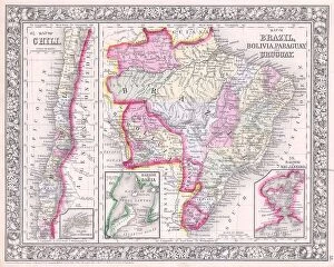
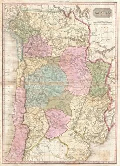
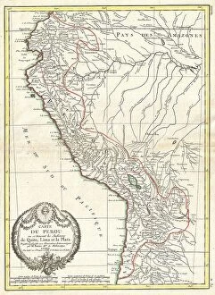
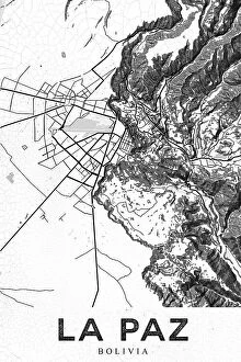
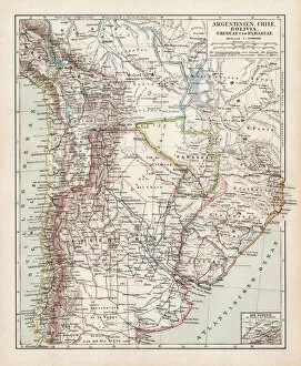
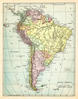
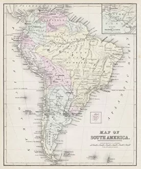
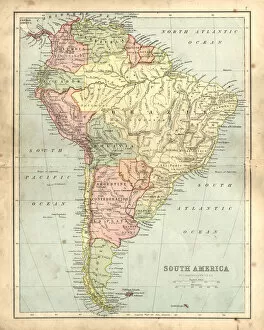
Bolivia is a landlocked country located in the heart of South America, and is bordered by Brazil, Paraguay, Argentina, Chile and Peru
Choose a picture from our Maps Collection for your Wall Art and Photo Gifts
30 items

All Professionally Made to Order for Quick Shipping
-
Maps Collection
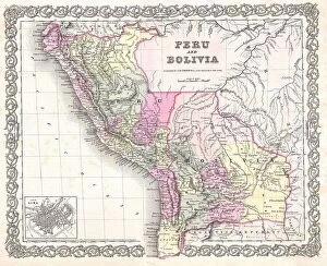
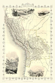
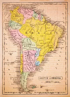
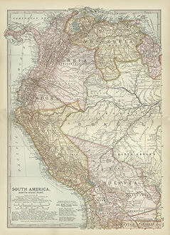
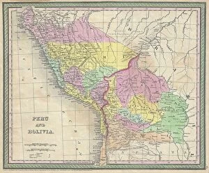
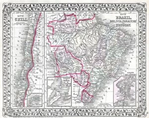
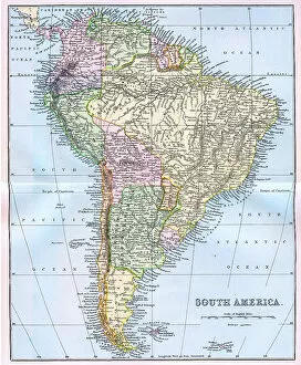
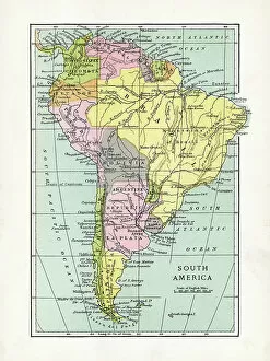
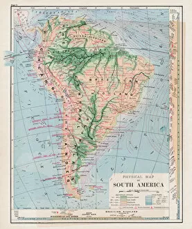
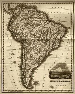
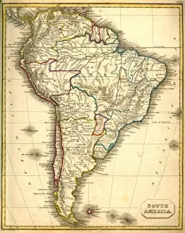
Bolivia is a landlocked country located in the heart of South America, and is bordered by Brazil, Paraguay, Argentina, Chile and Peru. The country has a varied landscape with mountains, deserts and jungles. Its capital city is La Paz and its official language is Spanish. Bolivia has an area of 1,098,581 square kilometres and its population was estimated at 11 million in 2019. Maps of Bolivia South America show the country's diverse geography including its mountain ranges such as the Andes Mountains; rivers such as the Amazon River; lakes such as Lake Titicaca; deserts like Uyuni Salt Flats; national parks like Madidi National Park; cities like Sucre and Santa Cruz de la Sierra; and other features like roads, railways and airports. They also provide information on climate zones which range from tropical to alpine climates depending on altitude.
+
Our beautiful pictures are available as Framed Prints, Photos, Wall Art and Photo Gifts
Media Storehouse offers a stunning collection of Maps of Bolivia South America wall art and framed prints. This unique collection showcases the diverse geography, topography, and political boundaries of Bolivia in exquisite detail. The maps are sourced from various archives and collections around the world, ensuring that each piece is authentic and historically significant. The Maps of Bolivia South America collection features a range of styles, including antique maps dating back to the 16th century as well as modern-day satellite imagery. Each map is carefully reproduced using high-quality printing techniques to ensure that every detail is captured with precision. Whether you're looking for a beautiful addition to your home decor or an educational resource for your classroom or office space, our collection has something for everyone. With its rich history and breathtaking landscapes, Bolivia is truly one-of-a-kind - and these maps offer a fascinating glimpse into its past and present.
+
What are Maps of Bolivia South America art prints?
Maps of Bolivia South America art prints are high-quality reproductions of maps that showcase the geography and topography of Bolivia, a landlocked country in South America. These prints are created using state-of-the-art printing technology to ensure that every detail is captured accurately and vividly. These art prints serve as both decorative pieces and educational tools, allowing viewers to explore the different regions, cities, rivers, mountains, and other geographical features of Bolivia. They can be used to decorate homes or offices with an interest in geography or travel. Maps of Bolivia South America art prints come in various sizes and styles to suit different preferences. Some feature antique maps from centuries ago while others display modern-day cartography. Regardless of their style or age, these art prints offer a unique way for people to appreciate the beauty and complexity of this fascinating country's landscape.
+
What Maps of Bolivia South America art prints can I buy from Media Storehouse?
We offer a wide range of Maps of Bolivia South America art prints that are perfect for those who love geography and history. These maps showcase the various regions, cities, and landmarks in Bolivia, providing an excellent visual representation of this beautiful country. You can choose from different styles and designs to suit your taste, including antique maps with intricate details or modern ones with bold colors. Some popular options include the Map of Bolivia by John Tallis & Company from 1851, which features hand-colored engravings of the country's topography and major cities. Another great choice is the Political Map of Bolivia by National Geographic Maps that shows detailed boundaries between provinces and departments. Whether you're looking to decorate your home or office space or searching for a unique gift idea for someone special, we have plenty of options to choose from when it comes to Maps of Bolivia South America art prints.
+
How do I buy Maps of Bolivia South America art prints?
To buy Maps of Bolivia South America art prints from Media Storehouse, you can browse through their online collection of maps and select the one that catches your eye. Once you have found the map print you want to purchase, simply add it to your cart and proceed to checkout. You will be prompted to enter your shipping and payment details before completing the order. We offer a wide range of high-quality art prints, including maps, which are printed on premium paper using state-of-the-art printing technology. Their selection includes vintage maps as well as contemporary designs featuring modern cartography techniques. Whether you're looking for a unique piece of wall art for your home or office or a gift for someone who loves travel and geography, we have something for everyone. With our easy-to-use website and secure checkout process, buying Maps of Bolivia South America art prints has never been easier.
+
How much do Maps of Bolivia South America art prints cost?
We offer a wide range of Maps of Bolivia South America art prints at varying prices. The cost depends on the size and type of print you choose. We have options for both framed and unframed prints, as well as canvas and poster styles. Our selection includes vintage maps, modern designs, and everything in between. Our Maps of Bolivia South America art prints are printed using high-quality materials to ensure that they look great for years to come. Whether you're looking to decorate your home or office space, our collection has something for everyone. We take pride in offering affordable prices without sacrificing quality. You can trust that when you purchase from us, you're getting a great deal on a beautiful piece of artwork that will enhance any room it's displayed in. The cost of our Maps of Bolivia South America art prints varies depending on your preferences but rest assured we offer competitive pricing without compromising quality.
+
How will my Maps of Bolivia South America art prints be delivered to me?
We take great care in ensuring that your Maps of Bolivia South America art prints are delivered to you safely and securely. We use high-quality packaging materials to protect your artwork during transit, including sturdy cardboard tubes or flat mailers depending on the size and type of print. Our team works closely with trusted shipping partners to ensure timely delivery of your order. Once your order is processed and shipped, you will receive a tracking number so that you can monitor its progress until it arrives at your doorstep. We understand how important it is for our customers to receive their orders in perfect condition, which is why we go above and beyond when it comes to packaging and shipping. Whether you're ordering one print or several, rest assured that each piece will be carefully packaged and delivered right to your door.