Framed Print > Granger Art on Demand > Maps
Framed Print : MAP: JAMAICA, 1763. British map of the island of Jamaica, published 1763


![]()
Framed Photos from Granger
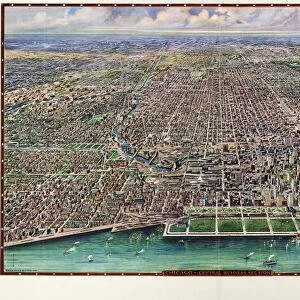
MAP: JAMAICA, 1763. British map of the island of Jamaica, published 1763
MAP: JAMAICA, 1763.
British map of the island of Jamaica, published 1763
Granger holds millions of images spanning more than 25,000 years of world history, from before the Stone Age to the dawn of the Space Age
Media ID 12321400
12"x10" Modern Frame
Step back in time with our vintage Framed Print from the Media Storehouse collection. This exquisite piece features a detailed 1763 British map of Jamaica, published by Granger, NYC / The Granger Collection. The map, titled "Jamaica, 1763," showcases the island's intricate topography and historical landmarks during the British colonial era. Add an air of sophistication and intrigue to any room with this captivating and authentic work of art. Order your Framed Print today from Granger Art on Demand and let history come alive in your home.
10x8 Print in an MDF Wooden Frame with 180 gsm Satin Finish Paper. Glazed using shatter proof thin plexi glass. Frame thickness is 1 inch and depth 0.75 inch. Fluted cardboard backing held with clips. Supplied ready to hang with sawtooth hanger and rubber bumpers. Spot clean with a damp cloth. Packaged foam wrapped in a card.
Contemporary Framed and Mounted Prints - Professionally Made and Ready to Hang
Estimated Image Size (if not cropped) is 25.4cm x 25.4cm (10" x 10")
Estimated Product Size is 30.5cm x 25.4cm (12" x 10")
These are individually made so all sizes are approximate
Artwork printed orientated as per the preview above, with landscape (horizontal) or portrait (vertical) orientation to match the source image.
EDITORS COMMENTS
This print showcases a historical artifact that takes us back to the year 1763, when the British map of Jamaica was published. The intricate details and sepia tones evoke a sense of nostalgia, transporting us to an era long gone. As we gaze upon this piece, we are reminded of the significance and influence that maps hold in shaping our understanding of the world. The map itself is a testament to the meticulous craftsmanship and dedication put forth by its creators. Every contour line, river bend, and coastline has been carefully etched onto parchment paper, capturing the essence of Jamaica's geography with remarkable precision. The text accompanying this masterpiece provides valuable insights into the island's history during that time period. Through this image, we are invited to explore not only Jamaica's physical landscape but also its cultural heritage as seen through colonial British eyes. It serves as a reminder of how cartography can be both informative and subjective - reflecting not only geographical features but also political boundaries and power dynamics. Granger Art on Demand presents us with yet another gem from their extensive collection: an extraordinary visual representation that sparks curiosity about our past while celebrating human ingenuity in mapping out our world.
MADE IN THE USA
Safe Shipping with 30 Day Money Back Guarantee
FREE PERSONALISATION*
We are proud to offer a range of customisation features including Personalised Captions, Color Filters and Picture Zoom Tools
SECURE PAYMENTS
We happily accept a wide range of payment options so you can pay for the things you need in the way that is most convenient for you
* Options may vary by product and licensing agreement. Zoomed Pictures can be adjusted in the Cart.