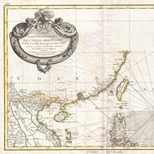
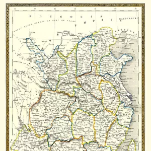
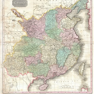
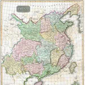
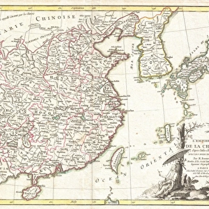
Framed Print : 1799, Clement Cruttwell Map of China, Korea, and Taiwan, topography, cartography


![]()
Framed Photos from Liszt Collection
1799, Clement Cruttwell Map of China, Korea, and Taiwan, topography, cartography
1799, Clement Cruttwell Map of China, Korea, and Taiwan
Liszt Collection of nineteenth-century engravings and images to browse and enjoy
Media ID 14004858
© Artokoloro Quint Lox Limited
1799 Korea Antique Map Latitude Longitude Mappa Mundi Old Antique Plan Old Antique View Ols Antique Map Rare Old Maps Topo
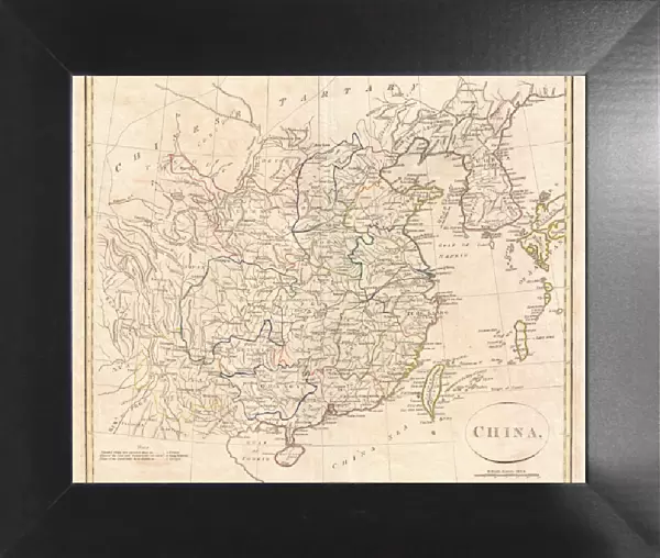
12"x10" Modern Frame
Discover the rich history and intricate detail of the past with our stunning Framed Print from the Media Storehouse's Liszt Collection. Featuring the 1799 Clement Cruttwell Map of China, Korea, and Taiwan, this topographical and cartographical masterpiece offers a captivating glimpse into the geography of the East Asian region as it was known over 200 years ago. The intricate lines, vivid colors, and meticulous annotations of this rare map are sure to captivate history enthusiasts, geographers, and art lovers alike. frame this beautiful piece in your home or office as a conversation starter and a testament to the wonders of the past. Each Framed Print is carefully crafted with museum-quality materials to ensure longevity and protection, making it a valuable addition to any collection.
10x8 Print in an MDF Wooden Frame with 180 gsm Satin Finish Paper. Glazed using shatter proof thin plexi glass. Frame thickness is 1 inch and depth 0.75 inch. Fluted cardboard backing held with clips. Supplied ready to hang with sawtooth hanger and rubber bumpers. Spot clean with a damp cloth. Packaged foam wrapped in a card.
Contemporary Framed and Mounted Prints - Professionally Made and Ready to Hang
Estimated Image Size (if not cropped) is 25.4cm x 25.4cm (10" x 10")
Estimated Product Size is 30.5cm x 25.4cm (12" x 10")
These are individually made so all sizes are approximate
Artwork printed orientated as per the preview above, with landscape (horizontal) or portrait (vertical) orientation to match the source image.
EDITORS COMMENTS
This print showcases the intricate beauty of the 1799 Clement Cruttwell Map of China, Korea, and Taiwan. A true masterpiece in cartography, this vintage map takes us back in time to an era when exploration and discovery were at their peak. With its topographical details meticulously illustrated, it offers a glimpse into the geographical features of these ancient lands. The artistry displayed on this old paper map is simply awe-inspiring. The carefully crafted grid lines, latitude and longitude markings, and geometric precision demonstrate the immense skill and dedication that went into creating such a historical artifact. As we delve deeper into its rich history, we are transported to a world where navigation relied on maps like these for journeys across vast regions. This rare antique map not only serves as a valuable tool for understanding past civilizations but also doubles as a decorative piece that adds character to any space. Its aged appearance evokes nostalgia while reminding us of our planet's ever-changing landscape throughout time. Whether you are an avid collector or simply appreciate the beauty of historical artifacts, this Clement Cruttwell Map is sure to captivate your imagination with its intricate details and fascinating depiction of China, Korea, and Taiwan from centuries ago.
MADE IN THE USA
Safe Shipping with 30 Day Money Back Guarantee
FREE PERSONALISATION*
We are proud to offer a range of customisation features including Personalised Captions, Color Filters and Picture Zoom Tools
SECURE PAYMENTS
We happily accept a wide range of payment options so you can pay for the things you need in the way that is most convenient for you
* Options may vary by product and licensing agreement. Zoomed Pictures can be adjusted in the Cart.