Atlas Collection (page 6)

"Exploring the World through Atlas: Unveiling the Past and Present" Delving into history, the vintage Map of Ireland from 1897 takes us on a journey back in time

Background imageAtlas Collection: Mexico, 1844

Mexico, 1844
2902775 Mexico, 1844; (add.info.: Mexico, 1844.); Buyenlarge Archive/UIG

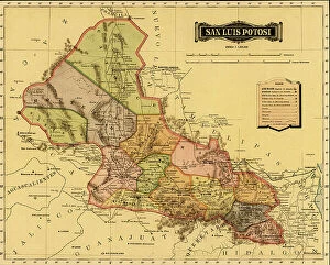
Background imageAtlas Collection: San Luis Potosi

San Luis Potosi
2902771 San Luis Potosi; (add.info.: San Luis Potosi, 1844.); Buyenlarge Archive/UIG

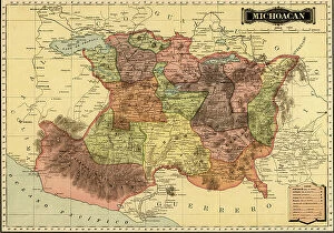
Background imageAtlas Collection: Michoacan, 1844

Michoacan, 1844
2902764 Michoacan, 1844; (add.info.: Michoacan, 1844.); Buyenlarge Archive/UIG

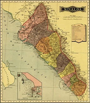
Background imageAtlas Collection: Sinaloa

Sinaloa
2902761 Sinaloa; (add.info.: Sinaloa, 1844.); Buyenlarge Archive/UIG

Background imageAtlas Collection: map of Haiti, Santo Domingo - Hispaniola, 18th century (engraving)

map of Haiti, Santo Domingo - Hispaniola, 18th century (engraving)
2902890 map of Haiti, Santo Domingo - Hispaniola, 18th century (engraving); Buyenlarge Archive/UIG

Background imageAtlas Collection: Portuguese Navigational Map of Caribbean Ports, 1630

Portuguese Navigational Map of Caribbean Ports, 1630
2902886 Portuguese Navigational Map of Caribbean Ports, 1630; (add.info.: Portuguese Navigational Map of Caribbean Ports, 1630.); Buyenlarge Archive/UIG

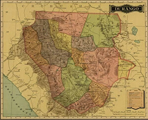
Background imageAtlas Collection: Durango, 1844

Durango, 1844
2902768 Durango, 1844; (add.info.: Durango, 1844.); Buyenlarge Archive/UIG

Background imageAtlas Collection: Chipas, 1844

Chipas, 1844
2902767 Chipas, 1844; (add.info.: Chipas, 1844.); Buyenlarge Archive/UIG

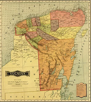
Background imageAtlas Collection: Yucatan

Yucatan
2902760 Yucatan; (add.info.: Yucatan, 1844.); Buyenlarge Archive/UIG

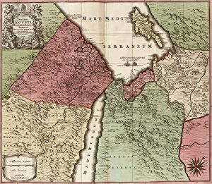
Background imageAtlas Collection: Egypt, Syria - Arabia, 1700s

Egypt, Syria - Arabia, 1700s
2902289 Egypt, Syria - Arabia, 1700s; (add.info.: Egypt, Syria - Arabia, 1700s.); Buyenlarge Archive/UIG

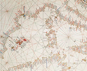
Background imageAtlas Collection: Map of Western Mediterran Sea

Map of Western Mediterran Sea
3499621 Map of Western Mediterran Sea; (add.info.: Map of Western Mediterran Sea. European coast from Cartagena (Spain) until the southof Naples. Corsica and Sardinia islands. North African coast

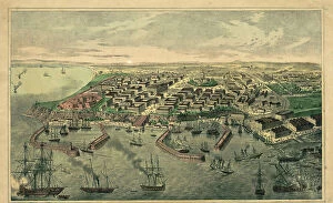
Background imageAtlas Collection: Ukraine

Ukraine
2901937 Ukraine; (add.info.: The predecessor of Odessa, - small Tatar settlement, was founded by Hac - Giray, the Khan of Crimea, in 1440 and originally named after him as Hac?bey)

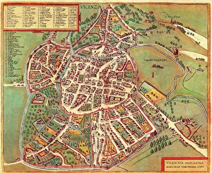
Background imageAtlas Collection: Vincenza, Italy

Vincenza, Italy
2901900 Vincenza, Italy; (add.info.: Founded by Ligurians in 1st cen. BCE; gained independence in 1164 and joined Lombard League; was destroyed by Emperor Frederick II in 1236; ruled by Della Scala)

Background imageAtlas Collection: Workers and residents of the Znamensky glass factory village, 1909. Creator: S. Ia. Mamontov

Workers and residents of the Znamensky glass factory village, 1909. Creator: S. Ia. Mamontov
Workers and residents of the Znamensky glass factory village, 1909. This collection includes more than four hundred photographs of daily life in Yenisei Province in the late tsarist period

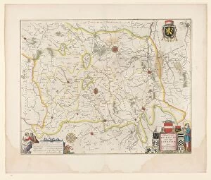
Background imageAtlas Collection: Map of Brabant, 1635. Creator: Michael van Langren

Map of Brabant, 1635. Creator: Michael van Langren
Map of Brabant, 1635. Prima pars Brabantiae cuius caput Lovanivm'. Top right: a coat of arms; bottom right: title in a cartouche with King David playing the harp

Background imageAtlas Collection: Atlases on the Wallpavillon of the Dresden Zwinger, 1880. Creator: Adolph Menzel

Atlases on the Wallpavillon of the Dresden Zwinger, 1880. Creator: Adolph Menzel
Atlases on the Wallpavillon of the Dresden Zwinger, 1880

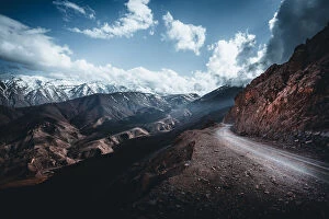
Background imageAtlas Collection: Canyon Curve

Canyon Curve
Heinz Klein

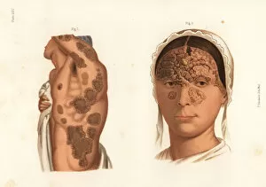
Background imageAtlas Collection: Tubercular syphilis symptoms on the body

Tubercular syphilis symptoms on the body
Syphilitic tubercules on the torso and arms 1, and suppurating tubercular syphilide on the face.Chromolithograph by T. Sinclaire from Freeman J. Bumsteads Atlas of Venereal Diseases, Henry C

Background imageAtlas Collection: Syphilis symptoms on the body

Syphilis symptoms on the body
Diffused papular syphillde before treatment 1, same after treatment with mercury 2, papular syphilide with scales on back 3, and syphilitic lichen on sides and arms 4. Chromolithograph by T

Background imageAtlas Collection: Panther cap mushroom, Amanita pantherina

Panther cap mushroom, Amanita pantherina, and Amanita franchetii (Amanita aspera). Poisonous mushrooms. Chromolithograph by Lassus after an illustration by A

Background imageAtlas Collection: Fly agaric mushroom, Amanita muscaria

Fly agaric mushroom, Amanita muscaria. Poisonous psychoactive mushroom. Chromolithograph by Lassus after an illustration by A

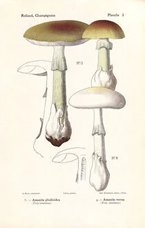
Background imageAtlas Collection: Death cap mushroom, Amanita phalloides

Death cap mushroom, Amanita phalloides, and fools mushroom, Amanita verna. Highly poisonous mushrooms. Chromolithograph by Lassus after an illustration by A
Background imageAtlas Collection: Young women of the Kabyle Tribe, Algeria

Young women of the Kabyle Tribe, Algeria
Young Kabyle Women from Taourirt Des Beni Menguellet in the Djurdjura or Jurjura Range, a mountain range of the Tell Atlas, part of the Atlas Mountain System, located in Kabylie, Algeria

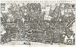
Background imageAtlas Collection: Map of the City of London by John Ogilby 1676. Ogilby (also Ogelby

Map of the City of London by John Ogilby 1676. Ogilby (also Ogelby, Oglivie - 16001676) was a Scottish translator, impresario and cartographer

Background imageAtlas Collection: world map 1882

world map 1882
french map of the world showing the trajectories of travels and discovery around 1780 and 1822 - map is from 1882

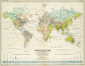
Background imageAtlas Collection: Rivers - Map of the world 1861

Rivers - Map of the world 1861
Map of the world - The river systems

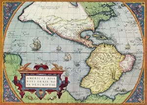
Background imageAtlas Collection: America, or the New World: From the Theatrum Orbis Terrarum by Abraham Ortelius, 1570, 1570

America, or the New World: From the Theatrum Orbis Terrarum by Abraham Ortelius, 1570, 1570
America, or the New World: From the Theatrum Orbis Terrarum by Abraham Ortelius, 1570, (1936). From The Connoisseur, Vol. 98, edited by H. Granville Fell. [International Studio, London, 1936]

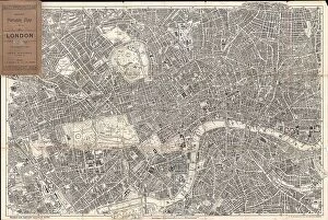
Background imageAtlas Collection: 1899 Bacon Pocket Plan Or Map Of London Topography

1899 Bacon Pocket Plan Or Map Of London Topography
1899, Bacon Pocket Plan or Map of London

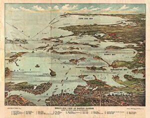
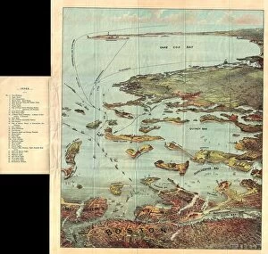
Background imageAtlas Collection: 1899 View Map Of Boston Harbor From Boston To Cape Cod And Provincetown

1899 View Map Of Boston Harbor From Boston To Cape Cod And Provincetown
1899, View Map of Boston Harbor from Boston to Cape Cod and Provincetown

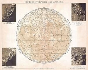
Background imageAtlas Collection: 1898 Brockhaus Map Of The Moon Topography Cartography

1898 Brockhaus Map Of The Moon Topography Cartography
1898, Brockhaus Map of the Moon

Background imageAtlas Collection: 1895 U.S. Coast Survey Map Of The Chesapeake Bay Around Annapolis

1895 U.S. Coast Survey Map Of The Chesapeake Bay Around Annapolis
1895, U.S. Coast Survey Map of the Chesapeake Bay around Annapolis

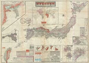
Background imageAtlas Collection: 1895 Meiji 28 Japanese Map Of Imperial Japan With Taiwan

1895 Meiji 28 Japanese Map Of Imperial Japan With Taiwan
1895, Meiji 28 Japanese Map of Imperial Japan with Taiwan

Background imageAtlas Collection: 1898 Walker Trolley Map And View Of New England Centered On Boston

1898 Walker Trolley Map And View Of New England Centered On Boston
1898, Walker Trolley Map and View of New England centered on Boston

Background imageAtlas Collection: 1893 U.S. Coast Survey Nautical Chart Or Map Of The Chesapeake Bay And Delaware Bay

1893 U.S. Coast Survey Nautical Chart Or Map Of The Chesapeake Bay And Delaware Bay
1893, U.S. Coast Survey Nautical Chart or Map of the Chesapeake Bay and Delaware Bay

Background imageAtlas Collection: 1897 Walker View Of Boston Harbor Topography

1897 Walker View Of Boston Harbor Topography
1897, Walker View of Boston Harbor

Background imageAtlas Collection: 1892 Scientific American Map And View Of New York City

1892 Scientific American Map And View Of New York City
1892, Scientific American Map and View of New York City

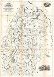
Background imageAtlas Collection: 1894 Colton Map Of Maine Topography Cartography

1894 Colton Map Of Maine Topography Cartography
1894, Colton Map of Maine

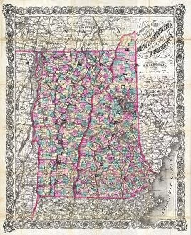
Background imageAtlas Collection: 1892 Colton Pocket Map Of Vermont And New Hampshire

1892 Colton Pocket Map Of Vermont And New Hampshire
1892, Colton Pocket Map of Vermont and New Hampshire

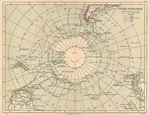
Background imageAtlas Collection: 1890 Hachette Map Of Antarctica Topography Cartography

1890 Hachette Map Of Antarctica Topography Cartography
1890, Hachette Map of Antarctica

Background imageAtlas Collection: 1890 View Map Of Boston Habor From Boston To Cape Cod And Provincetown

1890 View Map Of Boston Habor From Boston To Cape Cod And Provincetown
1890, View Map of Boston Habor from Boston to Cape Cod and Provincetown

Background imageAtlas Collection: 1886 Telescopic View And Map Of The Moon Topography

1886 Telescopic View And Map Of The Moon Topography
1886, Telescopic View and Map of the Moon

Background imageAtlas Collection: 1888 Topographic Survey Map Of The United States

1888 Topographic Survey Map Of The United States
1888, Topographic Survey Map of the United States

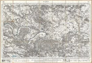
Background imageAtlas Collection: 1886 Depot De La Guerre Pocket Map Of Paris And Environs

1886 Depot De La Guerre Pocket Map Of Paris And Environs
1886, Depot de la Guerre Pocket Map of Paris and Environs

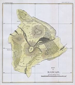
Background imageAtlas Collection: 1883 U.S.G.S. Map Of The Island Of Hawaii Topography

1883 U.S.G.S. Map Of The Island Of Hawaii Topography
1883, U.S.G.S. Map of the Island of Hawaii

Background imageAtlas Collection: 1884 Drew Pocket Map Of Florida Topography Cartography

1884 Drew Pocket Map Of Florida Topography Cartography
1884, Drew Pocket Map of Florida

Background imageAtlas Collection: 1881 Thomas Sedgwick Steele Map Of Maine Topography

1881 Thomas Sedgwick Steele Map Of Maine Topography
1881, Thomas Sedgwick Steele Map of Maine

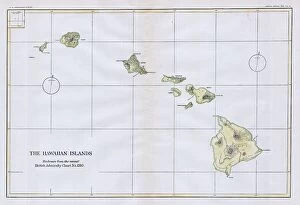
Background imageAtlas Collection: 1883 U.S.G.S. Map Of The Hawaiian Islands Topography

1883 U.S.G.S. Map Of The Hawaiian Islands Topography
1883, U.S.G.S. Map of the Hawaiian Islands

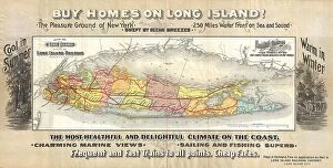
Background imageAtlas Collection: 1891 Long Island Railroad Real Estate Map Of Long Island

1891 Long Island Railroad Real Estate Map Of Long Island
1891, Long Island Railroad Real Estate Map of Long Island


For sale as Licensed Images

Choose your image, Select your licence and Download the media

"Exploring the World through Atlas: Unveiling the Past and Present" Delving into history, the vintage Map of Ireland from 1897 takes us on a journey back in time, unraveling the secrets of this enchanting land. Witnessing scientific breakthroughs, the Higgs boson event captured by ATLAS detector C013 / 6892 at CERN unveils a whole new realm of particle physics. The Map of the World from 1882 serves as a window to an era long gone, offering glimpses into how our planet was perceived centuries ago. James Craig's intricate map showcases Edinburgh's New Town in 1768, providing insight into its early development and topography. Embarking on an adventure to Croatia with its captivating map that unravels hidden gems and scenic landscapes waiting to be explored. Dürer's world map from 1515 offers a glimpse into Renaissance cartography, showcasing both geographical knowledge and artistic finesse. The ATLAS detector at CERN continues to push boundaries in scientific exploration, enabling us to delve deeper into understanding fundamental particles and their interactions. Transported back in time with a mesmerizing 16th Century Plan of Florence; it reveals architectural wonders that have stood the test of time. A haunting reminder of war-torn Sheffield during WWII emerges through an Ordnance Survey map copied by Germans marked with bombing targets - bearing witness to resilience amidst adversity. With Delisle's ancient Greek maps dating back to 1794, we can trace footsteps across Southern Greece, Greek Isles, and Crete while exploring their rich topography steeped in mythological tales. Discovering Buenos Aires through its vibrant cityscape depicted on an alluring map invites you to immerse yourself in Argentine culture and charm.