Caribbean Island Collection (page 4)

Discover the captivating charm of a Caribbean island, where history and beauty intertwine

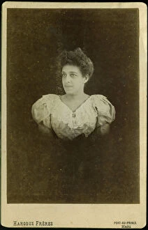
Background imageCaribbean Island Collection: Haiti, Port au Prince: Portrait of a young creole with a lace bodice, 1900

Haiti, Port au Prince: Portrait of a young creole with a lace bodice, 1900
LUX4712729 Haiti, Port au Prince: Portrait of a young creole with a lace bodice, 1900; (add.info.: Haiti, Port au Prince: Portrait of a young creole with a lace bodice, 1900); Photo © Lux-in-Fine

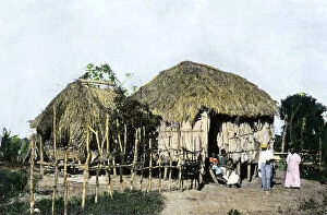
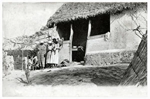
Background imageCaribbean Island Collection: Native hut in a village in Puerto Rico in the Caribbean Sea, circa 1890

Native hut in a village in Puerto Rico in the Caribbean Sea, circa 1890. Reproduction of after photography
NWI4865992 Native hut in a village in Puerto Rico in the Caribbean Sea, circa 1890. Reproduction of after photography; (add.info.: Native hut in a village in Puerto Rico in the Caribbean Sea)

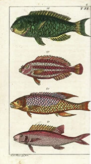
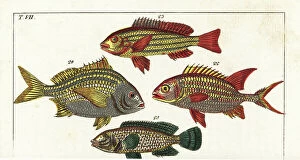
Background imageCaribbean Island Collection: Mediterranee parrot fish - Atlantic parrot fish - Spanish labre (or Spanish pig)

Mediterranee parrot fish - Atlantic parrot fish - Spanish labre (or Spanish pig) - Caribbean Sea squirrel -Parrotfish
FLO4725591 Mediterranee parrot fish - Atlantic parrot fish - Spanish labre (or Spanish pig) - Caribbean Sea squirrel -Parrotfish, Sparisoma cretense 18, striped parrotfish, Scarus iseri 19

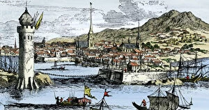
Background imageCaribbean Island Collection: Ports in the West Indies, 1630

Ports in the West Indies, 1630
2902885 Ports in the West Indies, 1630; (add.info.: Ports in the West Indies, 1630.); Buyenlarge Archive/UIG

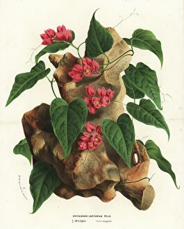
Background imageCaribbean Island Collection: Mexican creeper, Antigonon leptopus. Handcoloured lithograph from Louis van Houtte

Mexican creeper, Antigonon leptopus. Handcoloured lithograph from Louis van Houtte
FLO4628715 Mexican creeper, Antigonon leptopus. Handcoloured lithograph from Louis van Houtte and Charles Lemaire's Flowers of the Gardens and Hothouses of Europe

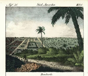
Background imageCaribbean Island Collection: The city of Bombarde (Haiti). Lithography for the book: ' Galerie complete en tableaux fideles des

The city of Bombarde (Haiti). Lithography for the book: " Galerie complete en tableaux fideles des peuples
FLO4635962 The city of Bombarde (Haiti). Lithography for the book: " Galerie complete en tableaux fideles des peuples d'Amerique et d'Australie" by Friedrich Wilhelm Goedsche

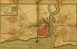
Background imageCaribbean Island Collection: Siege of Santo Domingo

Siege of Santo Domingo
2902889 Siege of Santo Domingo; (add.info.: Siege of Santo Domingo, 1895.); Buyenlarge Archive/UIG

Background imageCaribbean Island Collection: Purple cymbidium orchid, Cymbidium purpureum, native to the Caribbean and the Caribbean

Purple cymbidium orchid, Cymbidium purpureum, native to the Caribbean and the Caribbean
FLO4569844 Purple cymbidium orchid, Cymbidium purpureum, native to the Caribbean and the Caribbean. Handcoloured stipple engraving on copper by Barrois from a botanical illustration by Pancrace Bessa

Background imageCaribbean Island Collection: Cactus Hylocereus, native to the Caribbean - Strawberry pear Hylocereus trigonus

Cactus Hylocereus, native to the Caribbean - Strawberry pear Hylocereus trigonus (Triangular creeping cereus)
FLO4579207 Cactus Hylocereus, native to the Caribbean - Strawberry pear Hylocereus trigonus (Triangular creeping cereus, Cactus triangularis)

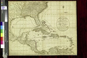
Background imageCaribbean Island Collection: Map of the West Indies, c.1900 (engraving)

Map of the West Indies, c.1900 (engraving)
533240 Map of the West Indies, c.1900 (engraving); (add.info.: Map of the West Indies, circa 1902, from the 10th edition of Encyclopaedia Britannica.); Encyclopaedia Britannica/UIG

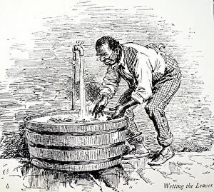
Background imageCaribbean Island Collection: Machado's cigar factory, Jamaica 1889 (engraving)

Machado's cigar factory, Jamaica 1889 (engraving)
1574633 Machado's cigar factory, Jamaica 1889 (engraving); (add.info.: Machado's cigar factory, Jamaica: Wetting the leaves)

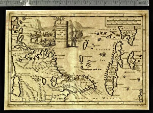
Background imageCaribbean Island Collection: Geographic map of Central America (one distinguishes Puerto Rico, Haiti, Jamaica and Cuba)

Geographic map of Central America (one distinguishes Puerto Rico, Haiti, Jamaica and Cuba)
XEE5027156 Geographic map of Central America (one distinguishes Puerto Rico, Haiti, Jamaica and Cuba) - 17th or 18th century - Museum of America

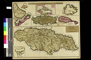
Background imageCaribbean Island Collection: Geography map: representation of the main British islands of the Caribbean Sea (Antigua, Barbados)

Geography map: representation of the main British islands of the Caribbean Sea (Antigua, Barbados, Jamaica, Tobago, St)
VEN5030281 Geography map: representation of the main British islands of the Caribbean Sea (Antigua, Barbados, Jamaica, Tobago, St. Christopher Island or St)

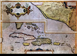
Background imageCaribbean Island Collection: Geography map: representation of the Caribbean Sea with part of the archipelago of the Great

Geography map: representation of the Caribbean Sea with part of the archipelago of the Great Antilles (Hispaniola)
VEN5030217 Geography map: representation of the Caribbean Sea with part of the archipelago of the Great Antilles (Hispaniola)

Background imageCaribbean Island Collection: Geography map: representation of the coasts of the island of Hispaniola (Santo Domingo and Haiti)

Geography map: representation of the coasts of the island of Hispaniola (Santo Domingo and Haiti) in the West Indies
VEN5030191 Geography map: representation of the coasts of the island of Hispaniola (Santo Domingo and Haiti) in the West Indies, made by Dutch cartographer Gerard van Keulen (1678-1726) 1709-1713

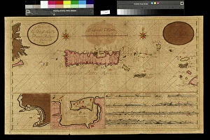
Background imageCaribbean Island Collection: Geography map: representation of the island of Puerto Rico in the Caribbean

Geography map: representation of the island of Puerto Rico in the Caribbean
VEN5030187 Geography map: representation of the island of Puerto Rico in the Caribbean, made by Dutch cartographer Gerard van Keulen (1678-1726) 1709-1713

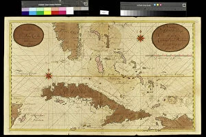
Background imageCaribbean Island Collection: Geography map: representation of the coasts of Florida, the Bahamas Islands

Geography map: representation of the coasts of Florida, the Bahamas Islands
VEN5030120 Geography map: representation of the coasts of Florida, the Bahamas Islands, the island of Cuba and part of the island of Hispaniola (Santo Domingo and Haiti)

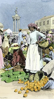
Background imageCaribbean Island Collection: Population and Culture of the Caribbean: Jamaican shopping for farm products in Jamaica, circa 1890

Population and Culture of the Caribbean: Jamaican shopping for farm products in Jamaica, circa 1890
NWI4866563 Population and Culture of the Caribbean: Jamaican shopping for farm products in Jamaica, circa 1890. Colourful engraving of the 19th century.; (add.info)

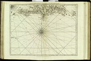
Background imageCaribbean Island Collection: Geography Atlas: representation of the island of Hispaniola (Haiti and Santo Domingo)

Geography Atlas: representation of the island of Hispaniola (Haiti and Santo Domingo)
VEN5030000 Geography Atlas: representation of the island of Hispaniola (Haiti and Santo Domingo) and the passage of the Winds (or Under-wind) in the Caribbean archipelago. Below is a Wind Rose

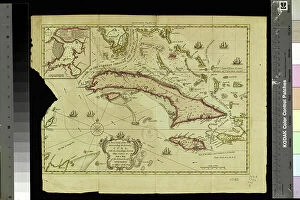
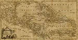
Background imageCaribbean Island Collection: Geography Atlas: representation of the Caribbean Sea, Caribbean Sea (Cuba, Jamaica, Hispaniola)

Geography Atlas: representation of the Caribbean Sea, Caribbean Sea (Cuba, Jamaica, Hispaniola), Bahamas Islands
VEN5029612 Geography Atlas: representation of the Caribbean Sea, Caribbean Sea (Cuba, Jamaica, Hispaniola), Bahamas Islands, South United States (Florida, Virginia, Carolina)

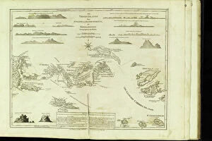
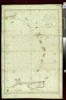
Background imageCaribbean Island Collection: Geography Atlas: representation of the Virgin Islands (Antilles)

Geography Atlas: representation of the Virgin Islands (Antilles). Map taken from "The west indian atlas or general
VEN5029596 Geography Atlas: representation of the Virgin Islands (Antilles). Map taken from "The west indian atlas or general description of west indies" by Thomas Jefferys

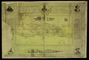
Background imageCaribbean Island Collection: Geography Atlas: representation of the island of Santo Domingo in the West Indies

Geography Atlas: representation of the island of Santo Domingo in the West Indies
VEN5031364 Geography Atlas: representation of the island of Santo Domingo in the West Indies. Map taken from an atlas by Antonio del Monte y Tejada (1783-1861) with portraits of Christopher Columbus

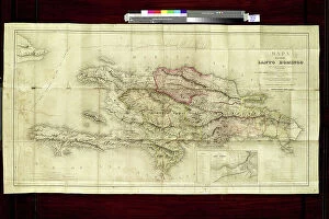
Background imageCaribbean Island Collection: Geography: map of the island of Santo Domingo (Dominican Republic) in the West Indies

Geography: map of the island of Santo Domingo (Dominican Republic) in the West Indies
VEN5031333 Geography: map of the island of Santo Domingo (Dominican Republic) in the West Indies. Map from an Atlas of Geography of Mendes, 1858

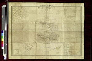
Background imageCaribbean Island Collection: Geography: Map of Puerto Rico Island in the Caribbean with descriptive text

Geography: Map of Puerto Rico Island in the Caribbean with descriptive text
VEN5031321 Geography: Map of Puerto Rico Island in the Caribbean with descriptive text. Map from an Atlas of Geopolitics from 1851

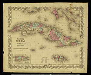
Background imageCaribbean Island Collection: Geography: map of the Greater Antilles (Cuba, Jamaica, Puerto Rico and the Bahamas) from an Atlas

Geography: map of the Greater Antilles (Cuba, Jamaica, Puerto Rico and the Bahamas) from an Atlas, 1855
VEN5031228 Geography: map of the Greater Antilles (Cuba, Jamaica, Puerto Rico and the Bahamas) from an Atlas, 1855, Bibliotheque Jose Marti, Havana

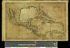
Background imageCaribbean Island Collection: Geography: map showing the Gulf of Mexico, the Caribbean Islands, Central America (Mexico)

Geography: map showing the Gulf of Mexico, the Caribbean Islands, Central America (Mexico, Yucatan, Honduras)
VEN5031226 Geography: map showing the Gulf of Mexico, the Caribbean Islands, Central America (Mexico, Yucatan, Honduras, Nicaragua and Costa Rica) part of the United States

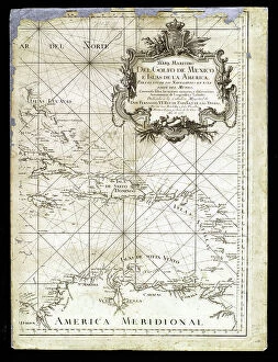
Background imageCaribbean Island Collection: Geography: map for navigators representing the Gulf of Mexico

Geography: map for navigators representing the Gulf of Mexico and the Caribbean Islands from an Atlas of 1755
VEN5031213 Geography: map for navigators representing the Gulf of Mexico and the Caribbean Islands from an Atlas of 1755, Bibliotheque Jose Marti, Havana

Background imageCaribbean Island Collection: Geography Atlas: representation of the island of Antigua and Barbuda (Antilles)

Geography Atlas: representation of the island of Antigua and Barbuda (Antilles)
VEN5031159 Geography Atlas: representation of the island of Antigua and Barbuda (Antilles). Map taken from "The west indian atlas or general description of west indies" by Thomas Jefferys

Background imageCaribbean Island Collection: Caribbean Sea squirrel - Snapper - Croupia lippu - Crenilabre - Squirrelfish

Caribbean Sea squirrel - Snapper - Croupia lippu - Crenilabre - Squirrelfish, Holocentrus adscensionis 22
FLO4725548 Caribbean Sea squirrel - Snapper - Croupia lippu - Crenilabre - Squirrelfish, Holocentrus adscensionis 22, five-lined snapper, Lutjanus quinquelineatus 23, Torroto grunt

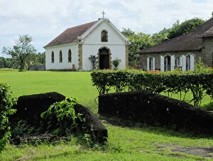
Background imageCaribbean Island Collection: French West Indies - French Antilles - Fonds Saint Jacques, Sugar Housing du Pere Labat (1663-1736)

French West Indies - French Antilles - Fonds Saint Jacques, Sugar Housing du Pere Labat (1663-1736)
JEB4950127 French West Indies - French Antilles - Fonds Saint Jacques, Sugar Housing du Pere Labat (1663-1736). La Chapelle - Martinique

Background imageCaribbean Island Collection: French West Indies - French Antilles - La Trinite, Le chateau Dubuc was built in 1721

French West Indies - French Antilles - La Trinite, Le chateau Dubuc was built in 1721, by Louis du Buc du Galion
JEB4949137 French West Indies - French Antilles - La Trinite, Le chateau Dubuc was built in 1721, by Louis du Buc du Galion, grandson of Pierre du Buc, Sieur de La Caravelle et du Marigot

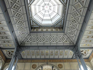
Background imageCaribbean Island Collection: English West Indies - French Antilles - Fort de France. Ceiling of the Schoelcher Library

English West Indies - French Antilles - Fort de France. Ceiling of the Schoelcher Library, architect Pierre Henri Picq
JEB4948834 English West Indies - French Antilles - Fort de France. Ceiling of the Schoelcher Library, architect Pierre Henri Picq

Background imageCaribbean Island Collection: Caribbean moonfish, Brown's Vomer, Selene brownii, and doctorfish, Acanthurus surgical

Caribbean moonfish, Brown's Vomer, Selene brownii, and doctorfish, Acanthurus surgical, Acanthur surgeon
FLO4644953 Caribbean moonfish, Brown's Vomer, Selene brownii, and doctorfish, Acanthurus surgical, Acanthur surgeon. Handcoloured copperplate stipple engraving from Jussieu's "

Background imageCaribbean Island Collection: Portuguese Navigational Map of Caribbean Ports, 1630

Portuguese Navigational Map of Caribbean Ports, 1630
2902886 Portuguese Navigational Map of Caribbean Ports, 1630; (add.info.: Portuguese Navigational Map of Caribbean Ports, 1630.); Buyenlarge Archive/UIG

Background imageCaribbean Island Collection: The West Indies, 1782

The West Indies, 1782
2902873 The West Indies, 1782; (add.info.: Map of the West Indies.); Buyenlarge Archive/UIG

Background imageCaribbean Island Collection: Pointed stone, 15th (engraving)

Pointed stone, 15th (engraving)
2909992 Pointed stone, 15th (engraving); (add.info.: Pointed stone from the Taino culture. Created by the Arawak people, the indigenous peoples of the Caribbean)

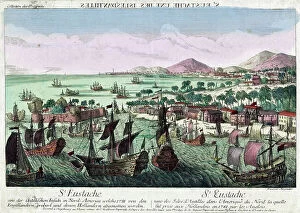
Background imageCaribbean Island Collection: The Capture of Sint Eustatius took place in February 1781

The Capture of Sint Eustatius took place in February 1781
3586518 The Capture of Sint Eustatius took place in February 1781; (add.info.: The Capture of Sint Eustatius took place in February 1781 during the 4th Anglo-Dutch War when British army)

Background imageCaribbean Island Collection: Variety of small Caribbean candle cactus - Hairy cereus, Pilosocereus lanuginosus

Variety of small Caribbean candle cactus - Hairy cereus, Pilosocereus lanuginosus (Van Royan's cereus)
FLO4583118 Variety of small Caribbean candle cactus - Hairy cereus, Pilosocereus lanuginosus (Van Royan's cereus, Cereus royenii)

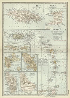
Background imageCaribbean Island Collection: Map of Jamaica and the Lesser Antilles, c.1900 (engraving)

Map of Jamaica and the Lesser Antilles, c.1900 (engraving)
533243 Map of Jamaica and the Lesser Antilles, c.1900 (engraving); (add.info.: Map of Jamaica and the Lesser Antilles, circa 1902)

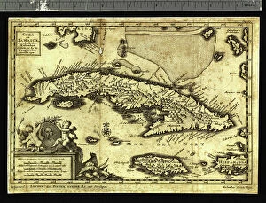
Background imageCaribbean Island Collection: Geography: representation of the Caribbean Sea with the island of Cuba, Jamaica and Hispaniola

Geography: representation of the Caribbean Sea with the island of Cuba, Jamaica and Hispaniola
VEN5031173 Geography: representation of the Caribbean Sea with the island of Cuba, Jamaica and Hispaniola. Map taken from an Atlas of American Cotes by Pieter Vander AA based on the description of

Background imageCaribbean Island Collection: Geography Atlas: representation of the Caribbean Sea region, the Greater Antilles (Cuba, Jamaica)

Geography Atlas: representation of the Caribbean Sea region, the Greater Antilles (Cuba, Jamaica)
VEN5030080 Geography Atlas: representation of the Caribbean Sea region, the Greater Antilles (Cuba, Jamaica, Hispaniola) and the Lesser Antilles. Map from an Atlas of 1818

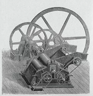
Background imageCaribbean Island Collection: Agriculture. Sugar making. Sugar cane mill. Engraving in: Grands hommes et grands faits de

Agriculture. Sugar making. Sugar cane mill. Engraving in: Grands hommes et grands faits de l'industrie, France
3434737 Agriculture. Sugar making. Sugar cane mill. Engraving in: Grands hommes et grands faits de l'industrie, France, c.1880 (engraving); (add.info.: Agriculture. Production du sucre. Coll)

Background imageCaribbean Island Collection: Port of Havana, Cuba in the Caribbean Sea during the Spanish colonies (16th-17th century)

Port of Havana, Cuba in the Caribbean Sea during the Spanish colonies (16th-17th century). Colour engraving
NWI4866127 Port of Havana, Cuba in the Caribbean Sea during the Spanish colonies (16th-17th century). Colour engraving; (add.info.: Port of Havana)

Background imageCaribbean Island Collection: Geography: map of the islands of the Lesser Antilles in the Caribbean Sea

Geography: map of the islands of the Lesser Antilles in the Caribbean Sea
VEN5031325 Geography: map of the islands of the Lesser Antilles in the Caribbean Sea. Map made by naval officers Cosme Churruca and Francisco Fidalgo, 1802

Background imageCaribbean Island Collection: Family in Haiti, c.1910 (b/w photo)

Family in Haiti, c.1910 (b/w photo)
7292892 Family in Haiti, c.1910 (b/w photo); (add.info.: Geography. Haiti. Poor family in the countryside of Haiti. Photo, Haiti, ca 1910.); Photo: © Archives Charmet

Background imageCaribbean Island Collection: Christopher Columbus giving hawks bells to the Taino people, the first Native Americans he

Christopher Columbus giving hawks bells to the Taino people, the first Native Americans he encountered in 1492, 1837
FLO4620926 Christopher Columbus giving hawks bells to the Taino people, the first Native Americans he encountered in 1492

Background imageCaribbean Island Collection: House of the Island Carib or Kalinago people, West Indies. A man relaxes in a hammock under a

House of the Island Carib or Kalinago people, West Indies. A man relaxes in a hammock under a thatched roof
FLO4621559 House of the Island Carib or Kalinago people, West Indies. A man relaxes in a hammock under a thatched roof, with rattan basket, rattan table and water jug

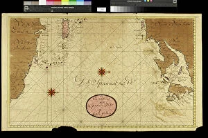
Background imageCaribbean Island Collection: Geography Atlas: representation of the Caribbean Sea, Caribbean Sea (Cuba, Jamaica, Hispaniola)

Geography Atlas: representation of the Caribbean Sea, Caribbean Sea (Cuba, Jamaica, Hispaniola), Bahamas Islands
VEN5029608 Geography Atlas: representation of the Caribbean Sea, Caribbean Sea (Cuba, Jamaica, Hispaniola), Bahamas Islands, South United States (Florida, Virginia, Carolina)


For sale as Licensed Images

Choose your image, Select your licence and Download the media

Discover the captivating charm of a Caribbean island, where history and beauty intertwine. 🌴✨ From the vibrant streets of Cuba's historical center in Havana, adorned with the iconic Havana Club painted on bar walls, to the legacy left by Cuban President Tomas Estrada Palma, every corner tells a fascinating story. In Vedado, Havana's neighborhood, stands the magnificent Iglesia de San Juan de Letran, an architectural gem that showcases the rich heritage of this enchanting island. Travel back in time to Ponce, Puerto Rico in the 1890s and witness its timeless allure captured through GATL2A-00033. Nature lovers will be mesmerized by Holguin's breathtaking scenery near Playa Esmeralda (GATL2A-00027), offering a serene escape amidst lush landscapes. Explore Villa Nova plantation house once owned by. . [missing information]. Marvel at Jardines del Rey archipelago in Villa Clara Province as you venture into Cayo Santa Maria – a true paradise on earth. Immerse yourself in history through stunning watercolor depictions of Guiana Indians from c. 1843-50 and Mestee and mulatto girls of Dominica from the same era. These artworks offer glimpses into cultural diversity that has shaped these islands over time. Lastly, pay your respects at Hotel Valentino's Book of Condolence in Cayo Santa Maria as it honors Cuban memories lost but never forgotten. Embark on an unforgettable journey to this Caribbean island where vibrant culture meets natural wonders – an experience that will leave you enchanted forever.