Caribbean Island Collection (#3)

Discover the captivating charm of a Caribbean island, where history and beauty intertwine

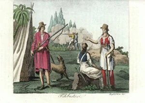
Background imageCaribbean Island Collection: Male and female pirates of the West Indies, armed with musket and cutlass.early 1800s

Male and female pirates of the West Indies, armed with musket and cutlass.early 1800s
FLO4621671 Male and female pirates of the West Indies, armed with musket and cutlass.early 1800s. The buccaneer at left wears a linen shirt dyed with animal blood
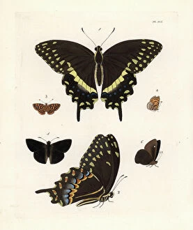
Background imageCaribbean Island Collection: Palamedes swallowtail butterfly, Papilio palamedes 1, 2, Antillea pelops 3, 4

Palamedes swallowtail butterfly, Papilio palamedes 1, 2, Antillea pelops 3, 4, and Caribbean duskywing
FLO4615459 Palamedes swallowtail butterfly, Papilio palamedes 1, 2, Antillea pelops 3, 4, and Caribbean duskywing, Ephyriades arcas 5, 6. Handcoloured lithograph from John O

Background imageCaribbean Island Collection: Trois Ilets, Domaine de la Pagerie, portrait of Josephine de Beauharnais - Martinique

Trois Ilets, Domaine de la Pagerie, portrait of Josephine de Beauharnais - Martinique, island of the French Antilles
JEB4949247 Trois Ilets, Domaine de la Pagerie, portrait of Josephine de Beauharnais - Martinique, island of the French Antilles; (add.info.: Trois Ilets, Domaine de la Pagerie)

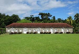
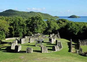
Background imageCaribbean Island Collection: French West Indies - French Antilles - La Trinite, Le chateau Dubuc was built in 1721

French West Indies - French Antilles - La Trinite, Le chateau Dubuc was built in 1721, by Louis du Buc du Galion
JEB4949178 French West Indies - French Antilles - La Trinite, Le chateau Dubuc was built in 1721, by Louis du Buc du Galion, grandson of Pierre du Buc, Sieur de La Caravelle et du Marigot

Background imageCaribbean Island Collection: French West Indies - French Antilles - La Trinite, Le chateau Dubuc was built in 1721

French West Indies - French Antilles - La Trinite, Le chateau Dubuc was built in 1721, by Louis du Buc du Galion
JEB4949120 French West Indies - French Antilles - La Trinite, Le chateau Dubuc was built in 1721, by Louis du Buc du Galion, grandson of Pierre du Buc, Sieur de La Caravelle et du Marigot

Background imageCaribbean Island Collection: French West Indies - French Antilles - Fonds Saint Jacques, Sugar Housing du Pere Labat (1663-1736)

French West Indies - French Antilles - Fonds Saint Jacques, Sugar Housing du Pere Labat (1663-1736)
JEB4950077 French West Indies - French Antilles - Fonds Saint Jacques, Sugar Housing du Pere Labat (1663-1736). Purgerie or sugar was set to decanter to obtain sugar loaves - Martinique

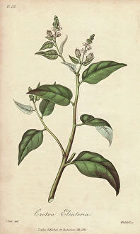
Background imageCaribbean Island Collection: Cascarilla tree, Croton eleuteria

Cascarilla tree, Croton eleuteria
5855121 Cascarilla tree, Croton eleuteria; (add.info.: Cascarilla tree, Croton eleuteria. Handcoloured botanical illustration drawn by G)

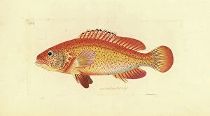
Background imageCaribbean Island Collection: Merou variete of the Caribbean, Cephalopholis fulva - Lithography by Richard Polydore Nodder

Merou variete of the Caribbean, Cephalopholis fulva - Lithography by Richard Polydore Nodder (1774-1823)
FLO4684077 Merou variete of the Caribbean, Cephalopholis fulva - Lithography by Richard Polydore Nodder (1774-1823) published in The Naturalist Miscellany

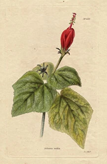
Background imageCaribbean Island Collection: Hibiscus chilli or dormant hibiscus (Achania mollis or Malvaviscus arboreus)

Hibiscus chilli or dormant hibiscus (Achania mollis or Malvaviscus arboreus), species with crimson red flowers
FLO4666671 Hibiscus chilli or dormant hibiscus (Achania mollis or Malvaviscus arboreus), species with crimson red flowers, which never open. Originally from South America and the Caribbean

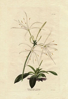
Background imageCaribbean Island Collection: Variete of white Amaryllis (Pancratium ovatum), native to the Caribbean

Variete of white Amaryllis (Pancratium ovatum), native to the Caribbean. Engraving by George Cooke (1781-1834)
FLO4666503 Variete of white Amaryllis (Pancratium ovatum), native to the Caribbean. Engraving by George Cooke (1781-1834)

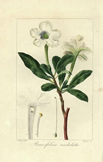
Background imageCaribbean Island Collection: Lady of the night, Brunfelsia americana, native to Jamaica and the Caribbean

Lady of the night, Brunfelsia americana, native to Jamaica and the Caribbean
FLO4569693 Lady of the night, Brunfelsia americana, native to Jamaica and the Caribbean. Handcoloured stipple engraving on copper by Barrois from a botanical illustration by Pancrace Bessa

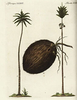
Background imageCaribbean Island Collection: Coconut palm tree, Cocos nucifera 1, coconut fruit a, and Caribbean royal palm, Roystonea oleracea 2

Coconut palm tree, Cocos nucifera 1, coconut fruit a, and Caribbean royal palm, Roystonea oleracea 2
FLO4573683 Coconut palm tree, Cocos nucifera 1, coconut fruit a, and Caribbean royal palm, Roystonea oleracea 2. Handcoloured copperplate engraving from Friedrich Johann Bertuch's Bilderbuch fur

Background imageCaribbean Island Collection: Rebellion of a brown negre in the Netherlands Antilles - Strong water extracted from

Rebellion of a brown negre in the Netherlands Antilles - Strong water extracted from the Encyclopedie of Natural
FLO4727689 Rebellion of a brown negre in the Netherlands Antilles - Strong water extracted from the Encyclopedie of Natural History: Humanite, by Gottlieb Tobias Wilhelm (1758-1811)

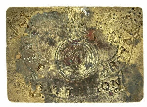
Background imageCaribbean Island Collection: Waist beltplate of Grenadier company of the 1st Battalion Royal Regiment

Waist beltplate of Grenadier company of the 1st Battalion Royal Regiment
3031601 Waist beltplate of Grenadier company of the 1st Battalion Royal Regiment; Private Collection; (add.info.: Waist beltplate of Grenadier company of the 1st Battalion Royal Regiment (1st of Foot)

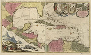
Background imageCaribbean Island Collection: Theatre or War, Mexican Archipelago - the Caribbean, 1757

Theatre or War, Mexican Archipelago - the Caribbean, 1757
2902869 Theatre or War, Mexican Archipelago - the Caribbean, 1757; (add.info.: Theatre or War, Mexican Archipelago - the Caribbean, 1757.); Buyenlarge Archive/UIG

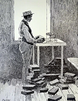
Background imageCaribbean Island Collection: Machado's cigar factory, Jamaica 1889 (engraving)

Machado's cigar factory, Jamaica 1889 (engraving)
1574635 Machado's cigar factory, Jamaica 1889 (engraving); (add.info.: Machado's cigar factory, Jamaica: Packing the cigars)

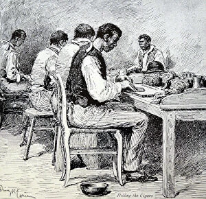
Background imageCaribbean Island Collection: Machado's cigar factory, Jamaica, 1889 (engraving)

Machado's cigar factory, Jamaica, 1889 (engraving)
1574634 Machado's cigar factory, Jamaica, 1889 (engraving); (add.info.: Machado's cigar factory, Jamaica: Rolling the cigars)

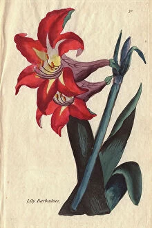
Background imageCaribbean Island Collection: Barbadoes lily, Amaryllis equestris

Barbadoes lily, Amaryllis equestris
5856376 Barbadoes lily, Amaryllis equestris; (add.info.: Barbados lily, Amaryllis equestris, with deep crimson flower and dark foliage)

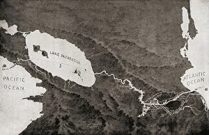
Background imageCaribbean Island Collection: An 1870 map showing the proposed route of the The Nicaraguan Canal

An 1870 map showing the proposed route of the The Nicaraguan Canal, a planned shipping route through Nicaragua to
UIG5419658 An 1870 map showing the proposed route of the The Nicaraguan Canal, a planned shipping route through Nicaragua to connect the Caribbean Sea, and therefore the Atlantic Ocean

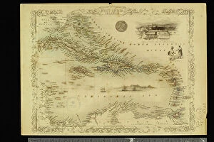
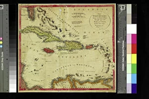
Background imageCaribbean Island Collection: Geography Atlas: representation of the Caribbean Sea region, the Greater Antilles (Cuba, Jamaica)

Geography Atlas: representation of the Caribbean Sea region, the Greater Antilles (Cuba, Jamaica)
VEN5030072 Geography Atlas: representation of the Caribbean Sea region, the Greater Antilles (Cuba, Jamaica, Hispaniola) and the Lesser Antilles. Map from an Atlas of 1857

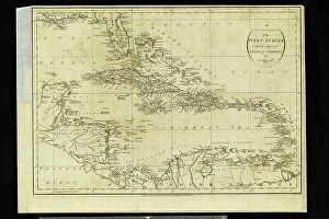
Background imageCaribbean Island Collection: Geographic Atlas: representation of the Caribbean Sea and the Greater Antilles (Cuba, Hispaniola)

Geographic Atlas: representation of the Caribbean Sea and the Greater Antilles (Cuba, Hispaniola)
VEN5029600 Geographic Atlas: representation of the Caribbean Sea and the Greater Antilles (Cuba, Hispaniola, Puerto Rico and Jamaica), the Bahamas Islands, the South of the United States

Background imageCaribbean Island Collection: Geography Atlas: representation of the archipelago of Guadeloupe

Geography Atlas: representation of the archipelago of Guadeloupe. Map taken from "The west indian atlas or general
VEN5029635 Geography Atlas: representation of the archipelago of Guadeloupe. Map taken from "The west indian atlas or general description of west indies" by Thomas Jefferys

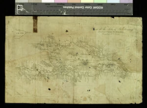
Background imageCaribbean Island Collection: Geography Atlas: representation of the island of Santo Domingo in the West Indies

Geography Atlas: representation of the island of Santo Domingo in the West Indies
VEN5031371 Geography Atlas: representation of the island of Santo Domingo in the West Indies. Map from an atlas by Antonio del Monte y Tejada (1783-1861), 1860

Background imageCaribbean Island Collection: Geography Atlas: representation of the island of Santo Domingo in the West Indies

Geography Atlas: representation of the island of Santo Domingo in the West Indies. Map from an atlas by J. B
VEN5031350 Geography Atlas: representation of the island of Santo Domingo in the West Indies. Map from an atlas by J. B. Poirson (1761-1831), French geographer, 1803

Background imageCaribbean Island Collection: Geography Atlas: representation of Cape Francais (Cap de la Republique)

Geography Atlas: representation of Cape Francais (Cap de la Republique) in Santo Domingo in the West Indies
VEN5031342 Geography Atlas: representation of Cape Francais (Cap de la Republique) in Santo Domingo in the West Indies. Map from an atlas by Thomas Jefferys, geographer of the Prince of Wales, 1760

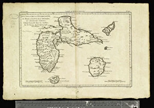
Background imageCaribbean Island Collection: Geography: map of the island of Guadeloupe in the West Indies

Geography: map of the island of Guadeloupe in the West Indies. Map from an Atlas de Villers from 1843
VEN5031313 Geography: map of the island of Guadeloupe in the West Indies. Map from an Atlas de Villers from 1843. Biblioteca Jose Marti, Havana

Background imageCaribbean Island Collection: Geography: map of the island of Guadeloupe, Marie Galante, Desirade in the West Indies

Geography: map of the island of Guadeloupe, Marie Galante, Desirade in the West Indies
VEN5031309 Geography: map of the island of Guadeloupe, Marie Galante, Desirade in the West Indies. Map from an Atlas by Rigobert Bonne (1756-1823) from 1780

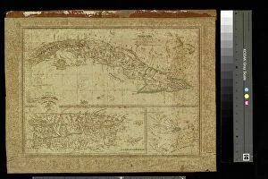
Background imageCaribbean Island Collection: Geography: map of Cuba, Puerto Rico and general view of the Caribbean Sea

Geography: map of Cuba, Puerto Rico and general view of the Caribbean Sea. Map from an Atlas of Camilo Alabern, 1853
VEN5031293 Geography: map of Cuba, Puerto Rico and general view of the Caribbean Sea. Map from an Atlas of Camilo Alabern, 1853

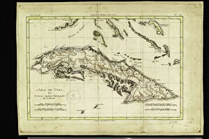
Background imageCaribbean Island Collection: Geography: map of the island of Cuba with map in the Caribbean Sea

Geography: map of the island of Cuba with map in the Caribbean Sea. Map from an Atlas by Rigobert Bonne (1756-1823)
VEN5031278 Geography: map of the island of Cuba with map in the Caribbean Sea. Map from an Atlas by Rigobert Bonne (1756-1823) from 1780

Background imageCaribbean Island Collection: Geography: map showing Central America (Mexico, Yucatan, Honduras, Nicaragua, Costa Rica)

Geography: map showing Central America (Mexico, Yucatan, Honduras, Nicaragua, Costa Rica)
VEN5031262 Geography: map showing Central America (Mexico, Yucatan, Honduras, Nicaragua, Costa Rica), the Gulf of Mexico and the Caribbean Sea islands (Antilles)

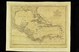
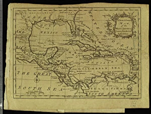
Background imageCaribbean Island Collection: Geography: map showing the Gulf of Mexico and the Caribbean Sea islands (Caribbean)

Geography: map showing the Gulf of Mexico and the Caribbean Sea islands (Caribbean)
VEN5031256 Geography: map showing the Gulf of Mexico and the Caribbean Sea islands (Caribbean). Plate from an Atlas by Thomas Kitchin (1718-1784) 1780-1790 Biblioteca Jose Marti, Havana

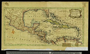
Background imageCaribbean Island Collection: Geography: map showing the Gulf of Mexico, the Caribbean Islands, Central America (Mexico)

Geography: map showing the Gulf of Mexico, the Caribbean Islands, Central America (Mexico, Yucatan, Salvador, Honduras)
VEN5031245 Geography: map showing the Gulf of Mexico, the Caribbean Islands, Central America (Mexico, Yucatan, Salvador, Honduras, Nicaragua, Costarica)

Background imageCaribbean Island Collection: Geography: map representing the Greater and Lesser Antilles in the Caribbean Sea

Geography: map representing the Greater and Lesser Antilles in the Caribbean Sea
VEN5031208 Geography: map representing the Greater and Lesser Antilles in the Caribbean Sea. Plate taken from an Atlas of the geographer Robert, 1750

Background imageCaribbean Island Collection: Geography: map showing Central America (Mexico, Honduras, Yucatan)

Geography: map showing Central America (Mexico, Honduras, Yucatan) and the Caribbean Sea Islands (Antilles)
VEN5031197 Geography: map showing Central America (Mexico, Honduras, Yucatan) and the Caribbean Sea Islands (Antilles). Plate taken from an Atlas by Thomas Kitchin (1718-1784)

Background imageCaribbean Island Collection: Geography map: representation of the islands of the Greater Antilles (Cuba, Hispaniola)

Geography map: representation of the islands of the Greater Antilles (Cuba, Hispaniola, Jamaica) in the Caribbean Sea
VEN5030433 Geography map: representation of the islands of the Greater Antilles (Cuba, Hispaniola, Jamaica) in the Caribbean Sea. Engraved board from an Atlas of the 18th century

Background imageCaribbean Island Collection: Geography map: general view of the Caribbean Sea and the Caribbean Islands

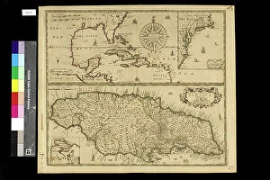
Geography map: general view of the Caribbean Sea and the Caribbean Islands
VEN5030283 Geography map: general view of the Caribbean Sea and the Caribbean Islands and a detailed view of Jamaica from an Atlas by Charles Price, beginning of the 18th century

Background imageCaribbean Island Collection: Geography map: representation of Panama's coasts on the Caribbean Sea

Geography map: representation of Panama's coasts on the Caribbean Sea
VEN5030232 Geography map: representation of Panama's coasts on the Caribbean Sea, made by Dutch cartographer Gerard van Keulen (1678-1726) 1709-1713

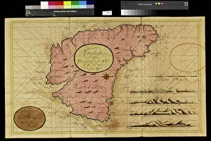
Background imageCaribbean Island Collection: Geography map: representation of Barbados Island in the Caribbean Sea by Dutch cartographer Gerard

Geography map: representation of Barbados Island in the Caribbean Sea by Dutch cartographer Gerard van Keulen
VEN5030212 Geography map: representation of Barbados Island in the Caribbean Sea by Dutch cartographer Gerard van Keulen (1678-1726) 1709-1713

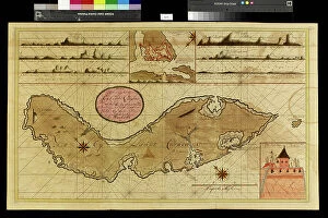
Background imageCaribbean Island Collection: Geography map: depiction of the island of Curacao in the small West Indies

Geography map: depiction of the island of Curacao in the small West Indies
VEN5030201 Geography map: depiction of the island of Curacao in the small West Indies, made by Dutch cartographer Gerard van Keulen (1678-1726) 1709-1713

Background imageCaribbean Island Collection: Geography map: representation of the island of Hispaniola grouping the present-day Haiti

Geography map: representation of the island of Hispaniola grouping the present-day Haiti
VEN5030177 Geography map: representation of the island of Hispaniola grouping the present-day Haiti and Santo Domingo in the West Indies

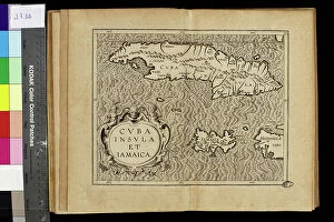
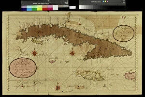
Background imageCaribbean Island Collection: Geography map: representation of the island of Cuba in the Caribbean

Geography map: representation of the island of Cuba in the Caribbean, made by Dutch cartographer Gerard van Keulen
VEN5030107 Geography map: representation of the island of Cuba in the Caribbean, made by Dutch cartographer Gerard van Keulen (1678-1726) 1709-1713

Background imageCaribbean Island Collection: Macouba, Rheuerie JM, since 1845 in Macouba - Martinique, island of the French Antilles

Macouba, Rheuerie JM, since 1845 in Macouba - Martinique, island of the French Antilles
JEB4949945 Macouba, Rheuerie JM, since 1845 in Macouba - Martinique, island of the French Antilles; (add.info.: Macouba, Rheuerie JM, since 1845 in Macouba - Martinique)

Background imageCaribbean Island Collection: Trois Ilets, Domaine de la Pagerie, Bust of Napoleon Bonaparte - Martinique

Trois Ilets, Domaine de la Pagerie, Bust of Napoleon Bonaparte - Martinique, island of the French Antilles
JEB4949232 Trois Ilets, Domaine de la Pagerie, Bust of Napoleon Bonaparte - Martinique, island of the French Antilles; (add.info.: Trois Ilets, Domaine de la Pagerie)

Background imageCaribbean Island Collection: French West Indies - French Antilles - La Trinite, Le chateau Dubuc was built in 1721

French West Indies - French Antilles - La Trinite, Le chateau Dubuc was built in 1721, by Louis du Buc du Galion
JEB4949177 French West Indies - French Antilles - La Trinite, Le chateau Dubuc was built in 1721, by Louis du Buc du Galion, grandson of Pierre du Buc, Sieur de La Caravelle et du Marigot

Background imageCaribbean Island Collection: French West Indies - French Antilles - La Trinite, Le chateau Dubuc was built in 1721

French West Indies - French Antilles - La Trinite, Le chateau Dubuc was built in 1721, by Louis du Buc du Galion
JEB4949144 French West Indies - French Antilles - La Trinite, Le chateau Dubuc was built in 1721, by Louis du Buc du Galion, grandson of Pierre du Buc, Sieur de La Caravelle et du Marigot

Background imageCaribbean Island Collection: English West Indies - French Antilles - Fort de France. Library Schoelcher

English West Indies - French Antilles - Fort de France. Library Schoelcher, architect Pierre Henri Picq. opened in 1893
JEB4948818 English West Indies - French Antilles - Fort de France. Library Schoelcher, architect Pierre Henri Picq. opened in 1893.; (add.info)

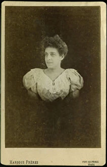
Background imageCaribbean Island Collection: Haiti, Port au Prince: Portrait of a young creole with a lace bodice, 1900

Haiti, Port au Prince: Portrait of a young creole with a lace bodice, 1900
LUX4712729 Haiti, Port au Prince: Portrait of a young creole with a lace bodice, 1900; (add.info.: Haiti, Port au Prince: Portrait of a young creole with a lace bodice, 1900); Photo © Lux-in-Fine

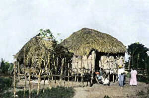
Background imageCaribbean Island Collection: Native hut in a village in Puerto Rico in the Caribbean Sea, circa 1890

Native hut in a village in Puerto Rico in the Caribbean Sea, circa 1890. Reproduction of after photography
NWI4865992 Native hut in a village in Puerto Rico in the Caribbean Sea, circa 1890. Reproduction of after photography; (add.info.: Native hut in a village in Puerto Rico in the Caribbean Sea)


For sale as Licensed Images

Choose your image, Select your licence and Download the media

Discover the captivating charm of a Caribbean island, where history and beauty intertwine. 🌴✨ From the vibrant streets of Cuba's historical center in Havana, adorned with the iconic Havana Club painted on bar walls, to the legacy left by Cuban President Tomas Estrada Palma, every corner tells a fascinating story. In Vedado, Havana's neighborhood, stands the magnificent Iglesia de San Juan de Letran, an architectural gem that showcases the rich heritage of this enchanting island. Travel back in time to Ponce, Puerto Rico in the 1890s and witness its timeless allure captured through GATL2A-00033. Nature lovers will be mesmerized by Holguin's breathtaking scenery near Playa Esmeralda (GATL2A-00027), offering a serene escape amidst lush landscapes. Explore Villa Nova plantation house once owned by. . [missing information]. Marvel at Jardines del Rey archipelago in Villa Clara Province as you venture into Cayo Santa Maria – a true paradise on earth. Immerse yourself in history through stunning watercolor depictions of Guiana Indians from c. 1843-50 and Mestee and mulatto girls of Dominica from the same era. These artworks offer glimpses into cultural diversity that has shaped these islands over time. Lastly, pay your respects at Hotel Valentino's Book of Condolence in Cayo Santa Maria as it honors Cuban memories lost but never forgotten. Embark on an unforgettable journey to this Caribbean island where vibrant culture meets natural wonders – an experience that will leave you enchanted forever.