Coordinates Collection (#8)

"Unlocking the Secrets of Coordinates: Navigating Through Time and Space" Embark on a captivating journey as we delve into the fascinating world of coordinates

Background imageCoordinates Collection: Antique map of Russia and Asiatica

Antique map of Russia and Asiatica

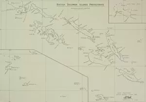
Background imageCoordinates Collection: Antique map of British Solomon Islands Protectorate

Antique map of British Solomon Islands Protectorate

Background imageCoordinates Collection: Antique map of coast of southeast Australia

Antique map of coast of southeast Australia

Background imageCoordinates Collection: Antique map of New South Wales in Australia

Antique map of New South Wales in Australia

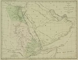
Background imageCoordinates Collection: Antique map of Arabia and adjacent Africa and Persia

Antique map of Arabia and adjacent Africa and Persia

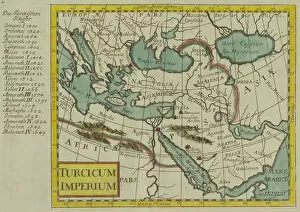
Background imageCoordinates Collection: Antique map of the Turkish Empire

Antique map of the Turkish Empire

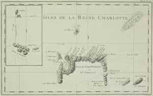
Background imageCoordinates Collection: Antique map of the Queen Charlotte Islands off Australia

Antique map of the Queen Charlotte Islands off Australia

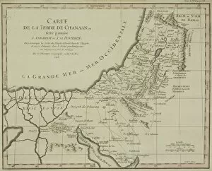
Background imageCoordinates Collection: Antique map of holy land with Nile River Delta

Antique map of holy land with Nile River Delta

Background imageCoordinates Collection: Map of the world, based on descriptions and co-ordinates given in Geographia

Map of the world, based on descriptions and co-ordinates given in Geographia
XCF306025 Map of the world, based on descriptions and co-ordinates given in Geographia, first published in Ulm, Germany (hand coloured engraving) by Ptolemy (Claudius Ptolemaeus of Alexandria)

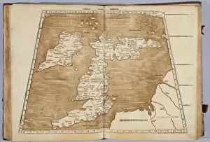
Background imageCoordinates Collection: Tabula Prima Europa, from Geographie opus novissima traductione e Grecorum archetypis

Tabula Prima Europa, from Geographie opus novissima traductione e Grecorum archetypis
XYC269016 Tabula Prima Europa, from Geographie opus novissima traductione e Grecorum archetypis castigatissime pressum, printed by Johann Scott in 1513 (colour litho)

Background imageCoordinates Collection: John Franklins (1786-1847) Message to the Secretary of the Admiralty, 28th May 1847

John Franklins (1786-1847) Message to the Secretary of the Admiralty, 28th May 1847
XJF128020 John Franklins (1786-1847) Message to the Secretary of the Admiralty, 28th May 1847 (b/w photo) by English School

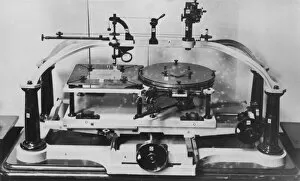
Background imageCoordinates Collection: Roberts stellar pantograver

Roberts stellar pantograver. This device was invented by British amateur astronomer and engineer Isaac Roberts (1829-1904)

Background imageCoordinates Collection: Southern constellations, 1829 C016 / 4415

Southern constellations, 1829 C016 / 4415
Southern constellations. 19th-century map of stars and constellations from the celestial atlas Sozviezdiia Predstavlennyia na XXX Tablitsakh (1829) by Kornelius Reissig

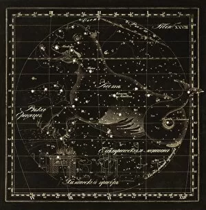
Background imageCoordinates Collection: Cetus constellations, 1829 C016 / 4414

Cetus constellations, 1829 C016 / 4414
Cetus constellations. 19th-century map of stars and constellations from the celestial atlas Sozviezdiia Predstavlennyia na XXX Tablitsakh (1829) by Kornelius Reissig

Background imageCoordinates Collection: Monoceros constellations, 1829 C016 / 4413

Monoceros constellations, 1829 C016 / 4413
Monoceros constellations. 19th-century map of stars and constellations from the celestial atlas Sozviezdiia Predstavlennyia na XXX Tablitsakh (1829) by Kornelius Reissig

Background imageCoordinates Collection: Orion constellations, 1829 C016 / 4410

Orion constellations, 1829 C016 / 4410
Orion constellations. 19th-century map of stars and constellations from the celestial atlas Sozviezdiia Predstavlennyia na XXX Tablitsakh (1829) by Kornelius Reissig

Background imageCoordinates Collection: Corvus constellations, 1829 C016 / 4411

Corvus constellations, 1829 C016 / 4411
Corvus constellations. 19th-century map of stars and constellations from the celestial atlas Sozviezdiia Predstavlennyia na XXX Tablitsakh (1829) by Kornelius Reissig

Background imageCoordinates Collection: Pisces constellation, 1829 C016 / 4409

Pisces constellation, 1829 C016 / 4409
Pisces constellation. 19th-century map of stars and constellations from the celestial atlas Sozviezdiia Predstavlennyia na XXX Tablitsakh (1829) by Kornelius Reissig

Background imageCoordinates Collection: Aquarius constellations, 1829 C016 / 4408

Aquarius constellations, 1829 C016 / 4408
Aquarius constellations. 19th-century map of stars and constellations from the celestial atlas Sozviezdiia Predstavlennyia na XXX Tablitsakh (1829) by Kornelius Reissig

Background imageCoordinates Collection: Sagittarius constellations, 1829 C016 / 4407

Sagittarius constellations, 1829 C016 / 4407
Sagittarius constellations. 19th-century map of stars and constellations from the celestial atlas Sozviezdiia Predstavlennyia na XXX Tablitsakh (1829) by Kornelius Reissig

Background imageCoordinates Collection: Libra constellations, 1829 C016 / 4406

Libra constellations, 1829 C016 / 4406
Libra constellations. 19th-century map of stars and constellations from the celestial atlas Sozviezdiia Predstavlennyia na XXX Tablitsakh (1829) by Kornelius Reissig

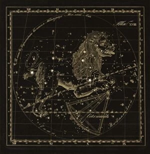
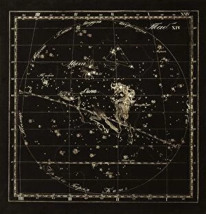
Background imageCoordinates Collection: Leo constellations, 1829 C016 / 4404

Leo constellations, 1829 C016 / 4404
Leo constellations. 19th-century map of stars and constellations from the celestial atlas Sozviezdiia Predstavlennyia na XXX Tablitsakh (1829) by Kornelius Reissig

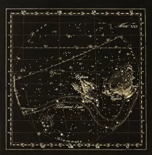
Background imageCoordinates Collection: Cancer constellations, 1829 C016 / 4403

Cancer constellations, 1829 C016 / 4403
Cancer constellations. 19th-century map of stars and constellations from the celestial atlas Sozviezdiia Predstavlennyia na XXX Tablitsakh (1829) by Kornelius Reissig

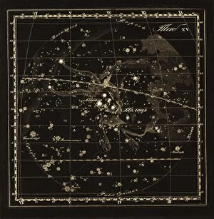
Background imageCoordinates Collection: Taurus constellation, 1829 C016 / 4401

Taurus constellation, 1829 C016 / 4401
Taurus constellation. 19th-century map of stars and constellations from the celestial atlas Sozviezdiia Predstavlennyia na XXX Tablitsakh (1829) by Kornelius Reissig

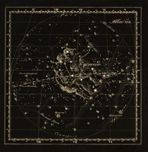
Background imageCoordinates Collection: Gemini constellation, 1829 C016 / 4402

Gemini constellation, 1829 C016 / 4402
Gemini constellation. 19th-century map of stars and constellations from the celestial atlas Sozviezdiia Predstavlennyia na XXX Tablitsakh (1829) by Kornelius Reissig

Background imageCoordinates Collection: Aries constellations, 1829 C016 / 4400

Aries constellations, 1829 C016 / 4400
Aries constellations. 19th-century map of stars and constellations from the celestial atlas Sozviezdiia Predstavlennyia na XXX Tablitsakh (1829) by Kornelius Reissig

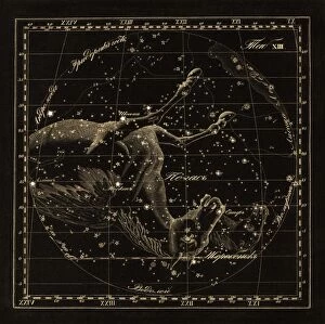
Background imageCoordinates Collection: Pegasus constellations, 1829 C016 / 4399

Pegasus constellations, 1829 C016 / 4399
Pegasus constellations. 19th-century map of stars and constellations from the celestial atlas Sozviezdiia Predstavlennyia na XXX Tablitsakh (1829) by Kornelius Reissig

Background imageCoordinates Collection: Aqulia constellations, 1829 C016 / 4398

Aqulia constellations, 1829 C016 / 4398
Aqulia constellations. 19th-century map of stars and constellations from the celestial atlas Sozviezdiia Predstavlennyia na XXX Tablitsakh (1829) by Kornelius Reissig

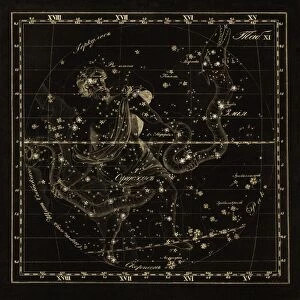
Background imageCoordinates Collection: Ophiuchus constellations, 1829 C016 / 4397

Ophiuchus constellations, 1829 C016 / 4397
Ophiuchus constellations. 19th-century map of stars and constellations from the celestial atlas Sozviezdiia Predstavlennyia na XXX Tablitsakh (1829) by Kornelius Reissig

Background imageCoordinates Collection: Cygnus constellations, 1829 C016 / 4396

Cygnus constellations, 1829 C016 / 4396
Cygnus constellations. 19th-century map of stars and constellations from the celestial atlas Sozviezdiia Predstavlennyia na XXX Tablitsakh (1829) by Kornelius Reissig

Background imageCoordinates Collection: Bootes constellations, 1829 C016 / 4394

Bootes constellations, 1829 C016 / 4394
Bootes constellations. 19th-century map of stars and constellations from the celestial atlas Sozviezdiia Predstavlennyia na XXX Tablitsakh (1829) by Kornelius Reissig

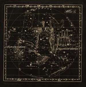
Background imageCoordinates Collection: Hercules constellations, 1829 C016 / 4395

Hercules constellations, 1829 C016 / 4395
Hercules constellations. 19th-century map of stars and constellations from the celestial atlas Sozviezdiia Predstavlennyia na XXX Tablitsakh (1829) by Kornelius Reissig

Background imageCoordinates Collection: Leo Minor constellation, 1829 C016 / 4393

Leo Minor constellation, 1829 C016 / 4393
Leo Minor constellation. 19th-century map of stars and constellations from the celestial atlas Sozviezdiia Predstavlennyia na XXX Tablitsakh (1829) by Kornelius Reissig

Background imageCoordinates Collection: Lynx constellation, 1829 C016 / 4392

Lynx constellation, 1829 C016 / 4392
Lynx constellation. 19th-century map of stars and constellations from the celestial atlas Sozviezdiia Predstavlennyia na XXX Tablitsakh (1829) by Kornelius Reissig

Background imageCoordinates Collection: Auriga constellations, 1829 C016 / 4391

Auriga constellations, 1829 C016 / 4391
Auriga constellations. 19th-century map of stars and constellations from the celestial atlas Sozviezdiia Predstavlennyia na XXX Tablitsakh (1829) by Kornelius Reissig

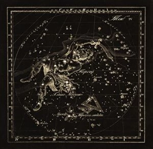
Background imageCoordinates Collection: Perseus constellations, 1829 C016 / 4390

Perseus constellations, 1829 C016 / 4390
Perseus constellations. 19th-century map of stars and constellations from the celestial atlas Sozviezdiia Predstavlennyia na XXX Tablitsakh (1829) by Kornelius Reissig

Background imageCoordinates Collection: Andromeda constellations, 1829 C016 / 4389

Andromeda constellations, 1829 C016 / 4389
Andromeda constellations. 19th-century map of stars and constellations from the celestial atlas Sozviezdiia Predstavlennyia na XXX Tablitsakh (1829) by Kornelius Reissig

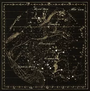
Background imageCoordinates Collection: Cepheus constellations, 1829 C016 / 4388

Cepheus constellations, 1829 C016 / 4388
Cepheus constellations. 19th-century map of stars and constellations from the celestial atlas Sozviezdiia Predstavlennyia na XXX Tablitsakh (1829) by Kornelius Reissig


For sale as Licensed Images

Choose your image, Select your licence and Download the media

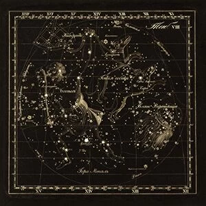
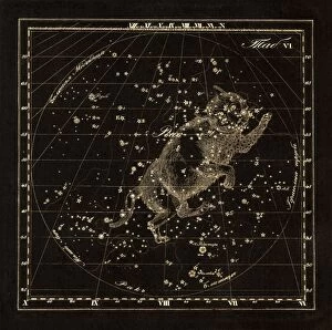
"Unlocking the Secrets of Coordinates: Navigating Through Time and Space" Embark on a captivating journey as we delve into the fascinating world of coordinates. Like a treasure map, an antique depiction of Israel reveals the ancient art of charting locations. Marvel at the Hydra constellations meticulously etched in 1829 C016 / 4412, guiding sailors through uncharted waters. Gaze upon Ursa Major constellation's celestial beauty captured in 1829 C016 / 4387, reminding us that even amidst darkness, there are always stars to guide our way. Discover New York City's bustling energy with its precise coordinates marking its place on Earth's grid. Travel back in time to Rome as you explore its rich history through carefully plotted coordinates alongside a sketch of the majestic Colosseum. Istanbul beckons with its enchanting allure, inviting adventurers to uncover hidden treasures using precise geographical markers. Venture eastward towards Bangkok where vibrant culture meets modernity; let coordinates lead you to this mesmerizing cityscape. Paris awaits your arrival with open arms - follow its coordinates and immerse yourself in romance and timeless elegance. Uncover Barcelona's architectural wonders by tracing its city coordinates; every corner tells a story waiting to be discovered. London calls out from across the Atlantic Ocean - navigate through time zones using these vital markers and embrace British charm. Intriguingly intertwined with history, World War II witnessed R. A. F Messenger Pigeons carrying life-saving messages across treacherous terrains guided by secret codes embedded within their flight paths. Zoom into England's Somerset County as an antique map unveils intricate details about this picturesque region nestled within nature’s embrace – each coordinate leading explorers deeper into English heritage and countryside bliss. Coordinates serve as our universal language connecting people across borders and generations. They unlock mysteries, guide adventures, and remind us that no matter where we stand or what era we find ourselves in, we are all connected by the invisible threads of latitude and longitude.