Geographical Or Topographical Map Collection

"Exploring the World Through Antique Maps: A Glimpse into History" Step back in time and embark on a journey through centuries-old geographical and topographical maps

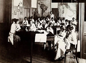
Background imageGeographical Or Topographical Map Collection: House of the Italians in Bahia, Brazil. Sewing class

House of the Italians in Bahia, Brazil. Sewing class
3569758 House of the Italians in Bahia, Brazil. Sewing class by Unknown photographer, (20th century); (add.info.: Bahia, Brazil 1930 ca. Photographer: Unidentified Author); Alinari Archives, Florence

Background imageGeographical Or Topographical Map Collection: 'Outdoor lesson', Professional Women's School and Home Education, Pisa

"Outdoor lesson", Professional Women's School and Home Education, Pisa Pisa. Date of Photograph:1910-1920

Background imageGeographical Or Topographical Map Collection: 'Italian Explorers and Navigators: the discovery of America'

"Italian Explorers and Navigators: the discovery of America", section of the Italian scientific exhibit, prepared by Prof

Background imageGeographical Or Topographical Map Collection: Exhibit of the Libro Coloniale of the Istituto Italiano del Libro

Exhibit of the Libro Coloniale of the Istituto Italiano del Libro, First Congress of Colonial Studies, Florence, April 8-12, 1931 Florence. Date of Photograph:1931/04/08-1931/04/12

Background imageGeographical Or Topographical Map Collection: Libro Coloniale Exhibit of the Istituto Italiano del Libro, First Congress of Colonial Studies

Libro Coloniale Exhibit of the Istituto Italiano del Libro, First Congress of Colonial Studies, Florence, 8-12 April, 1931 Florence. Date of Photograph:1931/04/08-1931/04/12

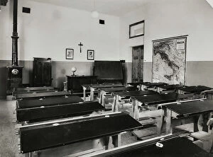
Background imageGeographical Or Topographical Map Collection: Classroom in a school in Mutigliano, Lucca

Classroom in a school in Mutigliano, Lucca Lucca Mutigliano. Date of Photograph:1930-1940

Background imageGeographical Or Topographical Map Collection: Elementary schools Giovanni Berta, Lecco: a classroom with some teaching aids; on the blackboard

Elementary schools Giovanni Berta, Lecco: a classroom with some teaching aids; on the blackboard the words "Duce we will bring the Fascist School on the Plan of the Empire" Lecco

Background imageGeographical Or Topographical Map Collection: Geography Classroom, Royal School of Professional Magistracy for the Woman 'Pietro Scalcerle', Padua

Geography Classroom, Royal School of Professional Magistracy for the Woman "Pietro Scalcerle", Padua Padua. Date of Photograph:1930-1940

Background imageGeographical Or Topographical Map Collection: Classroom of an Italian school

Classroom of an Italian school Italy. Date of Photograph:1930-1940

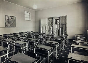
Background imageGeographical Or Topographical Map Collection: Classroom in Sezano, Verona

Classroom in Sezano, Verona Verona Sezano. Date of Photograph:1930-1940

Background imageGeographical Or Topographical Map Collection: Postcard depicting the Italian railway line

Postcard depicting the Italian railway line International Art of 20th Century. Date of Photograph:1900 ca.. Date of Artwork:1900 ca

Background imageGeographical Or Topographical Map Collection: Postcard depicting the railway line in northern Italy

Postcard depicting the railway line in northern Italy International Art of 20th Century. Date of Photograph:1900 ca.. Date of Artwork:1900 ca

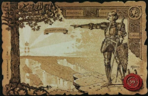
Background imageGeographical Or Topographical Map Collection: Postcard commemorating the 3 Corps, illustration of Faccioli

Postcard commemorating the 3 Corps, illustration of Faccioli Italy Print International Art of 20th Century. Date of Photograph:1900-1910. Date of Artwork:1900-1910. Artist:Faccioli

Background imageGeographical Or Topographical Map Collection: Postcard commemorating the 3 Regiment Artillery Coast, illustration of A. Dalbesio

Postcard commemorating the 3 Regiment Artillery Coast, illustration of A. Dalbesio Italy Print International Art of 20th Century. Date of Photograph:1900-1910. Date of Artwork:1900-1910

Background imageGeographical Or Topographical Map Collection: Postcard commemorating the 59 Infantry Regiment

Postcard commemorating the 59 Infantry Regiment Italy Print International Art of 20th Century. Date of Photograph:1900-1910. Date of Artwork:1900-1910

Background imageGeographical Or Topographical Map Collection: Female pupils with teacher in the classroom

Female pupils with teacher in the classroom Europe. Date of Photograph:1920-1940

Background imageGeographical Or Topographical Map Collection: Postcard commemorating the Italian Bersaglieri

Postcard commemorating the Italian Bersaglieri Italy Print International Art of 20th Century. Date of Photograph:1903-1910. Date of Artwork:1903-1910

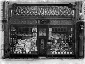
Background imageGeographical Or Topographical Map Collection: Bemporad bookstore, Trieste

Bemporad bookstore, Trieste Trieste. Date of Photograph:1921 ca

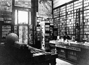
Background imageGeographical Or Topographical Map Collection: Interior of the Bemporad bookstore, Trieste

Interior of the Bemporad bookstore, Trieste Trieste. Date of Photograph:1910-1020

Background imageGeographical Or Topographical Map Collection: Portrait of a group of samurai and japanese officers in traditional clothes

Portrait of a group of samurai and japanese officers in traditional clothes. They are intently consulting a map. Date of Photograph:1865-1870

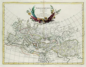
Background imageGeographical Or Topographical Map Collection: Western and Eastern Roman Empire, engraving by G. Zuliani taken from Tome IV of the 'Newest Atlas'

Western and Eastern Roman Empire, engraving by G. Zuliani taken from Tome IV of the "Newest Atlas" published in Venice in 1785 by Antonio Zatta

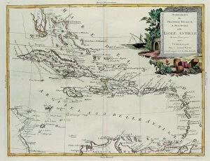
Background imageGeographical Or Topographical Map Collection: Establishments of the French, English and Spanish on the Antilles Islands, engraving by G

Establishments of the French, English and Spanish on the Antilles Islands, engraving by G. Zuliani taken from Tome IV of the "Newest Atlas" published in Venice in 1785 by Antonio Zatta

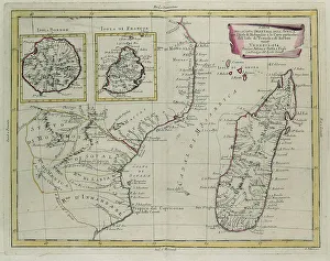
Background imageGeographical Or Topographical Map Collection: Part of the eastern coast of Africa with the Island of Madagascar

Part of the eastern coast of Africa with the Island of Madagascar and the detailed maps of the islands belonging to France and Bourbon, engraving by G

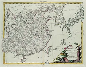
Background imageGeographical Or Topographical Map Collection: Chinese Empire with the islands of Japan, engraving by G. Zuliani taken from Tome IV of

Chinese Empire with the islands of Japan, engraving by G. Zuliani taken from Tome IV of the "Newest Atlas" published in Venice in 1784 by Antonio Zatta

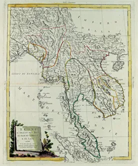
Background imageGeographical Or Topographical Map Collection: Kingdoms of Arakan, Pegu, Siam, Cambodia and Laos, engraving by G

Kingdoms of Arakan, Pegu, Siam, Cambodia and Laos, engraving by G. Zuliani taken from Tome IV of the "Newest Atlas" published in Venice in 1785 by Antonio Zatta

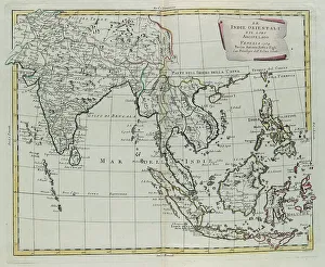
Background imageGeographical Or Topographical Map Collection: East Indies and their Archipelago, engraving by G. Zuliani taken from Tome IV of the 'Newest

East Indies and their Archipelago, engraving by G. Zuliani taken from Tome IV of the "Newest Atlas" published in Venice in 1784 by Antonio Zatta

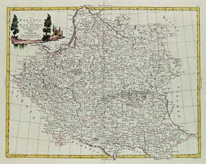
Background imageGeographical Or Topographical Map Collection: Poland divided into its Palatinates, engraving by G. Zuliani taken from Tome III of the 'Newest

Poland divided into its Palatinates, engraving by G. Zuliani taken from Tome III of the "Newest Atlas" published in Venice in 1782 by Antonio Zatta

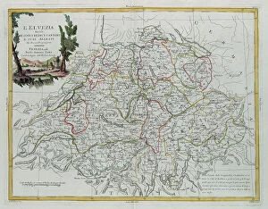
Background imageGeographical Or Topographical Map Collection: Helvetia divided into its 13 Cantons and its allies, engraving by G

Helvetia divided into its 13 Cantons and its allies, engraving by G. Zuliani taken from Tome III of the "Newest Atlas" published in Venice in 1781 by Antonio Zatta

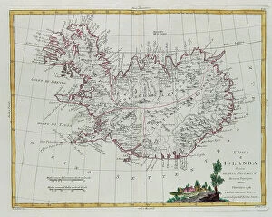
Background imageGeographical Or Topographical Map Collection: Iceland divided into its districts, engraving by G. Zuliani taken from Tome III of the 'Newest

Iceland divided into its districts, engraving by G. Zuliani taken from Tome III of the "Newest Atlas" published in Venice in 1781 by Antonio Zatta

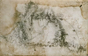
Background imageGeographical Or Topographical Map Collection: The Arno River from the Mugnone outlet to the area around Peretola, drawing (12677)

The Arno River from the Mugnone outlet to the area around Peretola, drawing (12677), by Leonardo da Vinci, housed in the Royal Library of Windsor Drawing High Renaissance, Renaissance

Background imageGeographical Or Topographical Map Collection: The Arno River and the Valley of Florence with the Lake of Bientina and the Fucecchio marshlands

The Arno River and the Valley of Florence with the Lake of Bientina and the Fucecchio marshlands, drawing (12685r), by Leonardo da Vinci

Background imageGeographical Or Topographical Map Collection: Itinerary sketch of the Iseo Lake region, of the lower Valseriana and the outskirts of Bergamo

Itinerary sketch of the Iseo Lake region, of the lower Valseriana and the outskirts of Bergamo and Brescia, drawing (12674r), by Leonardo da Vinci

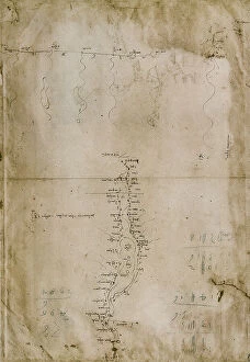
Background imageGeographical Or Topographical Map Collection: Itinerary sketch along the Seriana Valley and other lateral valleys, drawing (12674v)

Itinerary sketch along the Seriana Valley and other lateral valleys, drawing (12674v), by Leonardo da Vinci, housed in the Royal Library of Windsor Drawing High Renaissance, Renaissance

Background imageGeographical Or Topographical Map Collection: Bergamo-Brescia: three itinerary sketches of the Val Brembana and the Val Trompia, drawing (12673r)

Bergamo-Brescia: three itinerary sketches of the Val Brembana and the Val Trompia, drawing (12673r), by Leonardo da Vinci, housed in the Royal Library of Windsor Drawing High Renaissance

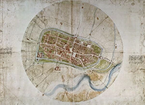
Background imageGeographical Or Topographical Map Collection: Map of the city of Imola, drawing (12684), by Leonardo da Vinci

Map of the city of Imola, drawing (12684), by Leonardo da Vinci, housed in the Royal Library of Windsor Drawing High Renaissance, Renaissance, Renaissance-Baroque styles and periods, Europe

Background imageGeographical Or Topographical Map Collection: Map of the city of Florence, drawing (12681), by Leonardo da Vinci

Map of the city of Florence, drawing (12681), by Leonardo da Vinci, housed in the Royal Library of Windsor Drawing High Renaissance, Renaissance, Renaissance-Baroque styles and periods, Europe

Background imageGeographical Or Topographical Map Collection: Chorographical map of Pontine Marshes, drawing (12684), by Leonardo da Vinci

Chorographical map of Pontine Marshes, drawing (12684), by Leonardo da Vinci, housed in the Royal Library of Windsor Drawing High Renaissance, Renaissance, Renaissance-Baroque styles and periods

Background imageGeographical Or Topographical Map Collection: Chorographical map of Tuscany from Lucca to Campiglia and the immediate hinterlands, drawing (12683)

Chorographical map of Tuscany from Lucca to Campiglia and the immediate hinterlands, drawing (12683), by Leonardo da Vinci, housed in the Royal Library of Windsor Drawing High Renaissance

Background imageGeographical Or Topographical Map Collection: Chorographical map of Tuscany and the neighboring regions, drawing (12277), by Leonardo da Vinci

Chorographical map of Tuscany and the neighboring regions, drawing (12277), by Leonardo da Vinci, housed in the Royal Library of Windsor Drawing High Renaissance, Renaissance

Background imageGeographical Or Topographical Map Collection: Chorographical map of the Val di Chiana from the area around Arezzo, drawing (12682)

Chorographical map of the Val di Chiana from the area around Arezzo, drawing (12682), by Leonardo da Vinci, housed in the Royal Library of Windsor Drawing High Renaissance, Renaissance

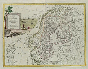
Background imageGeographical Or Topographical Map Collection: The Kingdoms of Sweden, Denmark and Norway, engraving by G. Zuliani taken from Tome III of

The Kingdoms of Sweden, Denmark and Norway, engraving by G. Zuliani taken from Tome III of the "Newest Atlas" published in Venice in 1781 by Antonio Zatta

Background imageGeographical Or Topographical Map Collection: Chorographical map of the Val di Chiana, Lake Trasimeno and the neighboring regions

Chorographical map of the Val di Chiana, Lake Trasimeno and the neighboring regions, including a large part of the region of Siena, drawing (12278r), by Leonardo da Vinci

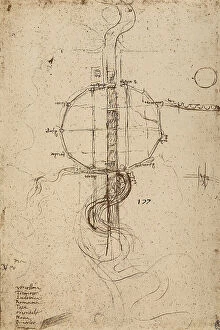
Background imageGeographical Or Topographical Map Collection: Sketch of a short waterway and its tributaries, drawing (12675), by Leonardo da Vinci

Sketch of a short waterway and its tributaries, drawing (12675), by Leonardo da Vinci, housed in the Royal Library of Windsor Drawing High Renaissance, Renaissance

Background imageGeographical Or Topographical Map Collection: Germany divided into its Circles, engraving by G. Zuliani taken from Tome III of the 'Newest

Germany divided into its Circles, engraving by G. Zuliani taken from Tome III of the "Newest Atlas" published in Venice in 1776 by Antonio Zatta

Background imageGeographical Or Topographical Map Collection: Sketch of a small waterway and its tributaries, drawing (12676), by Leonardo da Vinci

Sketch of a small waterway and its tributaries, drawing (12676), by Leonardo da Vinci, housed in the Royal Library of Windsor Drawing High Renaissance, Renaissance

Background imageGeographical Or Topographical Map Collection: The section of the Arno River east of Florence between the outlets of the Mensola

The section of the Arno River east of Florence between the outlets of the Mensola and Africo torrents, drawing (12679), by Leonardo da Vinci

Background imageGeographical Or Topographical Map Collection: The section of the Arno River from the Mugnone outlet to the area around Peretola, drawing (12678)

The section of the Arno River from the Mugnone outlet to the area around Peretola, drawing (12678), by Leonardo da Vinci, housed in the Royal Library of Windsor Drawing High Renaissance, Renaissance

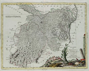
Background imageGeographical Or Topographical Map Collection: The Legations of Bologna and Ferrara, engraving by G. Zuliani taken from Tome II of the 'Newest

The Legations of Bologna and Ferrara, engraving by G. Zuliani taken from Tome II of the "Newest Atlas" published in Venice in 1783 by Antonio Zatta


For sale as Licensed Images

Choose your image, Select your licence and Download the media

"Exploring the World Through Antique Maps: A Glimpse into History" Step back in time and embark on a journey through centuries-old geographical and topographical maps. This captivating collection, featuring engravings by G. Zuliani from Antonio Zatta's "Newest Atlas, " offers a glimpse into the world as it was known in the late 18th century. Discover Iceland divided into its districts, beautifully depicted with intricate details that showcase the island's unique topography. Marvel at Hudson Bay, Land of Labrador, and Greenland along with their adjacent islands, each stroke of Zuliani's engraving capturing the vastness and grandeur of these remote regions. Delve into Southern Scotland divided meticulously into counties, providing insights into this historic land steeped in rich heritage. Immerse yourself in part of the Kingdom of Ireland—Ulster and Leinster provinces—where boundaries tell tales of ancient kingdoms. Witness Lorraine, Barr, and Alsace governances come to life through Zuliani's artistry; his engravings breathe vitality into these regions' cultural tapestry. Explore Spain and Portugal divided intricately into provinces—a testament to their diverse landscapes and vibrant histories. Travel across America as it once was—an amalgamation of main states captured vividly by Zuliani's skilled hand. Traverse Europe through its main states—the birthplace of countless civilizations—and marvel at its ever-changing borders throughout history. Gaze upon a world map that provides not only geographic accuracy but also a general description that transports you to an era when cartographers were explorers themselves. Lose yourself in every detail etched onto paper by G. Zuliani under Antonio Zatta's guidance—a true masterpiece showcasing our planet’s wonders. As you peruse these antique maps preserved within private collections or study charts from Mediceo Atlas (Gaddi 9), let your imagination soar across Sweden’s kingdoms or delve into the enchanting landscapes of Hither Calabria.