
Geographical Or Topographical Map Collection (#3)
"Exploring the World Through Antique Maps: A Glimpse into History" Step back in time and embark on a journey through centuries-old geographical and topographical maps


For sale as Licensed Images
Choose your image, Select your licence and Download the media
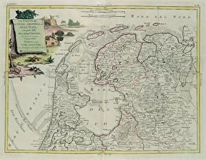
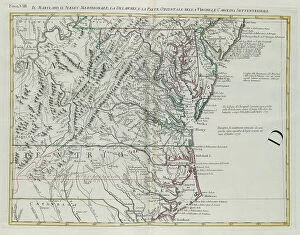
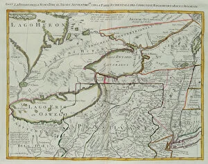
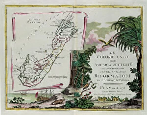
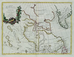
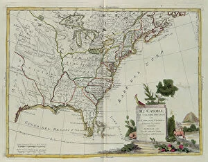
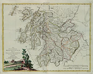
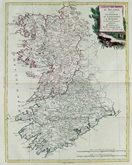
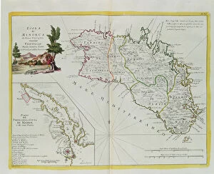
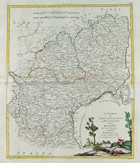
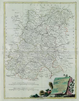
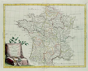
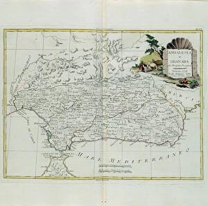
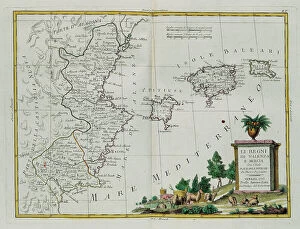
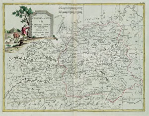
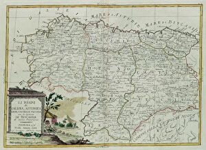
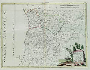
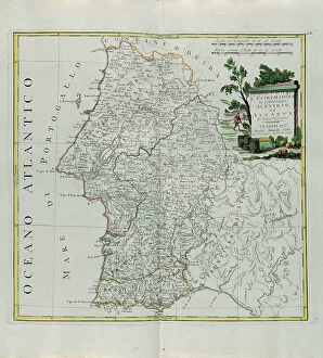
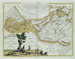
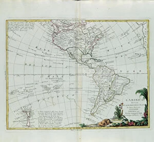
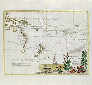
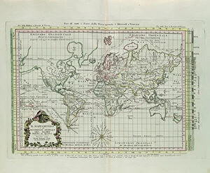
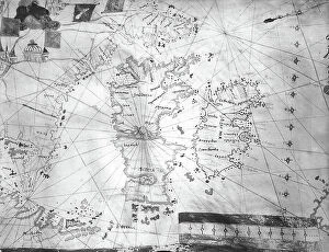
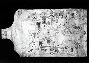
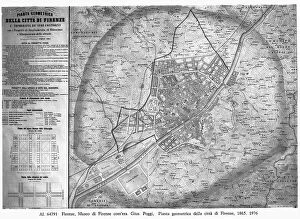
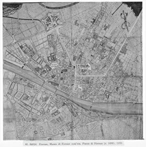
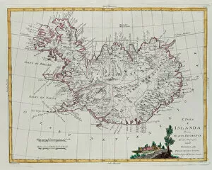
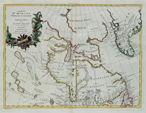
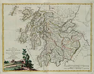
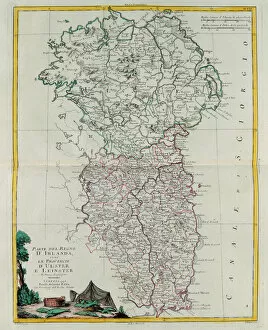
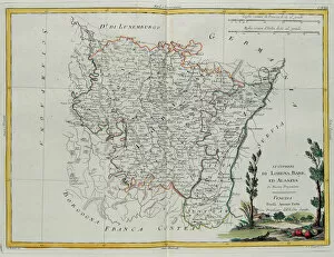
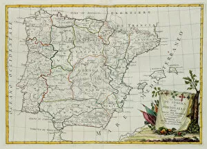
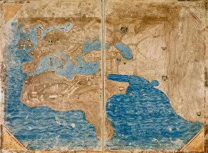
"Exploring the World Through Antique Maps: A Glimpse into History" Step back in time and embark on a journey through centuries-old geographical and topographical maps. This captivating collection, featuring engravings by G. Zuliani from Antonio Zatta's "Newest Atlas, " offers a glimpse into the world as it was known in the late 18th century. Discover Iceland divided into its districts, beautifully depicted with intricate details that showcase the island's unique topography. Marvel at Hudson Bay, Land of Labrador, and Greenland along with their adjacent islands, each stroke of Zuliani's engraving capturing the vastness and grandeur of these remote regions. Delve into Southern Scotland divided meticulously into counties, providing insights into this historic land steeped in rich heritage. Immerse yourself in part of the Kingdom of Ireland—Ulster and Leinster provinces—where boundaries tell tales of ancient kingdoms. Witness Lorraine, Barr, and Alsace governances come to life through Zuliani's artistry; his engravings breathe vitality into these regions' cultural tapestry. Explore Spain and Portugal divided intricately into provinces—a testament to their diverse landscapes and vibrant histories. Travel across America as it once was—an amalgamation of main states captured vividly by Zuliani's skilled hand. Traverse Europe through its main states—the birthplace of countless civilizations—and marvel at its ever-changing borders throughout history. Gaze upon a world map that provides not only geographic accuracy but also a general description that transports you to an era when cartographers were explorers themselves. Lose yourself in every detail etched onto paper by G. Zuliani under Antonio Zatta's guidance—a true masterpiece showcasing our planet’s wonders. As you peruse these antique maps preserved within private collections or study charts from Mediceo Atlas (Gaddi 9), let your imagination soar across Sweden’s kingdoms or delve into the enchanting landscapes of Hither Calabria.