Haiti Collection (#6)

"Haiti: A Tapestry of History, Culture, and Resilience" Step back in time to 1883 with the Haiti and Dominican Republic map

Background imageHaiti Collection: ©EyeUbiquitous_20064480

©EyeUbiquitous_20064480
HAITI, Music Ra Ra musicians

Background imageHaiti Collection: EyeUbiquitous_20099812

EyeUbiquitous_20099812
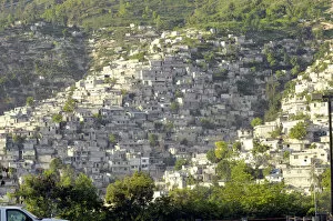
HAITI, Isla de la Laganave, Slum Housing on hillside

Background imageHaiti Collection: EyeUbiquitous_20099810

EyeUbiquitous_20099810
HAITI, Isla de Laganave, Slum housing on hillside

Background imageHaiti Collection: EyeUbiquitous_20099884

EyeUbiquitous_20099884
Haiti, Isla de Laganave, Building damaged by earthquake, man salvaging iron reinforcing rods from building collapsed during earthquake

Background imageHaiti Collection: EyeUbiquitous_20099882

EyeUbiquitous_20099882
Haitia, Isla de Laganave, Government Building damaged by earthquake

Background imageHaiti Collection: EyeUbiquitous_20099883

EyeUbiquitous_20099883
Haiti, Isla de Laganave, Government Building damaged by earthquake

Background imageHaiti Collection: EyeUbiquitous_20099881

EyeUbiquitous_20099881
Haiti, Isla de Laganave, local people sat outside hime with tin roof

Background imageHaiti Collection: EyeUbiquitous_20099877

EyeUbiquitous_20099877
Haiti, Isla de Laganave, Aerial view of slum buildings made from corrugated steel

Background imageHaiti Collection: West Indies, West Indies, Port au Prince, Statue of Unknown Maroon

West Indies, West Indies, Port au Prince, Statue of Unknown Maroon
West Indies, Haiti, Port au Prince, Statue of Unknown Maroon, Maroons were native Haitians

Background imageHaiti Collection: Religious Ceremony of the Inhabitants of the Isle of Hispaniola, c1721. Creator: Bernard Picart

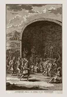
Religious Ceremony of the Inhabitants of the Isle of Hispaniola, c1721. Creator: Bernard Picart
Religious Ceremony of the Inhabitants of the Isle of Hispaniola, c1721. Indigenous people drumming and dancing during a celebration for the gods, on the Caribbean island of Hispaniola

Background imageHaiti Collection: Map of the West Indies and Central America, 1902. Creator: Unknown

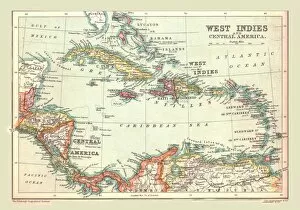
Map of the West Indies and Central America, 1902. Creator: Unknown
Map of the West Indies and Central America, 1902. Showing the various Caribbean islands, and the north coast of South America. From The Century Atlas of the World. [John Walker & Co, Ltd

Background imageHaiti Collection: Geographical map of the West Indies

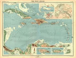
Geographical map of the West Indies. Map of the Caribbean, showing the Isthmus of Panama, the north coast of South America, the Greater Antilles, and various other islands

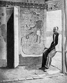
Background imageHaiti Collection: Baptism of a native and agricultural scenes, mural preserved in the Cathedral of Port Prince

Baptism of a native and agricultural scenes, mural preserved in the Cathedral of Port Prince, building completely destroyed by the earthquake of 12th January 2010

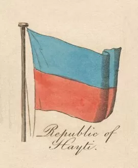
Background imageHaiti Collection: Republic of Hayti, 1838

Republic of Hayti, 1838. From A Display of the Naval Flags of All Nations. Collected from the Best Authorities. [Fisher, Son, & Co. London, 1838]

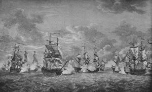
Background imageHaiti Collection: The Battle of Cap-Francais, c1760. Artist: Richard Paton

The Battle of Cap-Francais, c1760. Artist: Richard Paton
The Battle of Cap-Francais, c1760. The Battle of Cap-Francais was a naval battle fought between French and British forces outside the harbour of Cap-Francais, Haiti

Background imageHaiti Collection: Sack of Puerto Principe, Hispaniola, by Captain Morgan, 1667 (c1880)

Sack of Puerto Principe, Hispaniola, by Captain Morgan, 1667 (c1880). Born in Wales, Henry Morgan (1635-1688) was a notorious pirate and buccaneer who

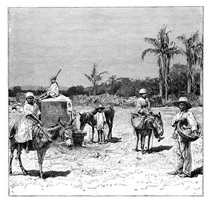
Background imageHaiti Collection: Group of Haitians, c1890

Group of Haitians, c1890. From Universal Geography, Maps & Illustrations, Vol XXXIV, Virtue & Co Limited, (London, c1890)

Background imageHaiti Collection: The Mole St Nicolas Peninsula, Haiti, c1890

The Mole St Nicolas Peninsula, Haiti, c1890. From Universal Geography, Maps & Illustrations, Vol XXXIV, Virtue & Co Limited, (London, c1890)

Background imageHaiti Collection: Port-Au-Prince, Haiti, c1890. Artist: A Kohl

Port-Au-Prince, Haiti, c1890. Artist: A Kohl
Port-Au-Prince, Haiti, c1890. From Universal Geography, Maps & Illustrations, Vol XXXIV, Virtue & Co Limited, (London, c1890)

Background imageHaiti Collection: Turtle Island, view taken at the mouth of the Three Rivers, c1890

Turtle Island, view taken at the mouth of the Three Rivers, c1890. Possibly Tortuga off the coast of Haiti, infamous haunt of pirates

Background imageHaiti Collection: Francois C. Antoine Simon, president of Haiti, dressed as an admiral, 1922

Francois C. Antoine Simon, president of Haiti, dressed as an admiral, 1922. Simon was president of Haiti from 1908 to 1911, before being overthrown

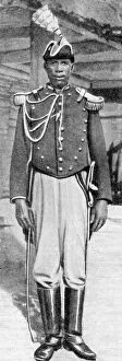
Background imageHaiti Collection: General Zephirin, Haiti, 1922

General Zephirin, Haiti, 1922. From Peoples of All Nations, Their Life Today and the Story of Their Past, volume IV: Georgia to Italy

Background imageHaiti Collection: On the threshold of a voodoo temple, Haiti, 1922

On the threshold of a voodoo temple, Haiti, 1922. From Peoples of All Nations, Their Life Today and the Story of Their Past, volume IV: Georgia to Italy

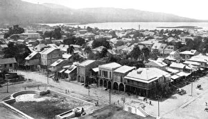
Background imageHaiti Collection: Port-au-Prince, Haiti, 1926

Port-au-Prince, Haiti, 1926. As seen from the Cathedral Tower. From An Outline of Christianity, The Story of Our Civilisation, volume 5: Christianity Today and Tomorrow

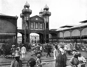
Background imageHaiti Collection: The market place, Port-au-Prince, Haiti, 1926

The market place, Port-au-Prince, Haiti, 1926. From An Outline of Christianity, The Story of Our Civilisation, volume 5: Christianity Today and Tomorrow, edited by RG Parsons and AS Peake

Background imageHaiti Collection: Cap Haitien, Haiti, 19th century. Artist: Charles Barbant

Cap Haitien, Haiti, 19th century. Artist: Charles Barbant
Cap Haitien, Haiti, 19th century

Background imageHaiti Collection: River in Haiti, 19th century. Artist: T Weber

River in Haiti, 19th century. Artist: T Weber
River in Haiti, 19th century

Background imageHaiti Collection: Haitian women, 19th century. Artist: T Wust

Haitian women, 19th century. Artist: T Wust
Haitian women, 19th century

Background imageHaiti Collection: Cap Tiburon, Haiti, 19th century. Artist: T Weber

Cap Tiburon, Haiti, 19th century. Artist: T Weber
Cap Tiburon, Haiti, 19th century

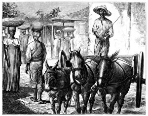
Background imageHaiti Collection: Street scene, Haiti, 19th century. Artist: T Wust

Street scene, Haiti, 19th century. Artist: T Wust
Street scene, Haiti, 19th century

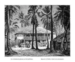
Background imageHaiti Collection: Tropical building, Port-au-Prince, Haiti, 19th century. Artist: Vuillier

Tropical building, Port-au-Prince, Haiti, 19th century. Artist: Vuillier
Tropical building, Port-au-Prince, Haiti, 19th century

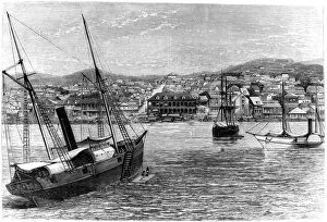
Background imageHaiti Collection: Port-au-Prince, Haiti, 1873

Port-au-Prince, Haiti, 1873. From Santo Domingo: past and present, with a glance at Hayti, by Samuel Hazard, 1873

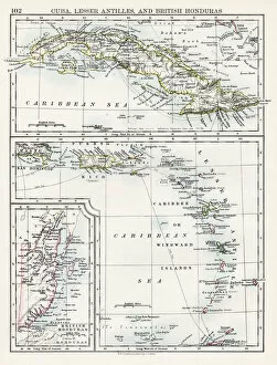
Background imageHaiti Collection: Cuba lesser antilles map 1897

Cuba lesser antilles map 1897
The World-Wide Atlas of Modern Geography, Political and Physical W. & A.K. Johnston - London 1897

Background imageHaiti Collection: Faustin Edmond Wirkus, King of La Gonave, Haiti

Faustin Edmond Wirkus, King of La Gonave, Haiti
Faustin Edmond Wirkus (1896-1945), King of La Gonave, Haiti as Faustin II, ruling from 1926 to 1929. He had been a Polish-American US Marine stationed in Haiti during the US occupation

Background imageHaiti Collection: Port au Prince, Haiti - Commercial HQ of A. de Matteis & Co

Port au Prince, Haiti - Commercial HQ of A. de Matteis & Co
Port au Prince, Haiti - The Commercial Headquarters of A. de Matteis & Co. Date: circa 1910s

Background imageHaiti Collection: Pension Andre, Cap Haitien, Haiti, West Indies

Pension Andre, Cap Haitien, Haiti, West Indies. Date: circa 1930

Background imageHaiti Collection: Jamaica - Duke Street, Kingston

Jamaica - Duke Street, Kingston
Slide showing a photograph of Duke Street in Kingston. Kingston is the capital and largest city of Jamaica, located on the south-eastern coast of the island facing a natural harbour

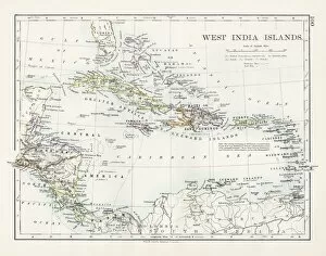
Background imageHaiti Collection: West indies map 1897

West indies map 1897
The World-Wide Atlas of Modern Geography, Political and Physical W. & A.K. Johnston - London 1897

Background imageHaiti Collection: Street scene, Port au Prince, Haiti, West Indies

Street scene, Port au Prince, Haiti, West Indies
Street scene, approach to the Iron Market with its famous Moorish-style gate, Port au Prince, Haiti, West Indies. Date: circa 1930

Background imageHaiti Collection: Thomas Goodall

Thomas Goodall
THOMAS GOODALL Naval commander, Admiral in service in Haiti. Date: 1767 - 1832

Background imageHaiti Collection: Nicholas-Fabre Geffrard

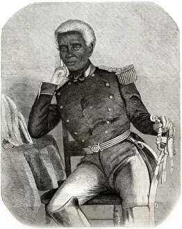
Nicholas-Fabre Geffrard
NICHOLAS-FABRE GEFFRARD Haitian general and politician; President of Haiti 1859-67 Date: 1806 - 1879

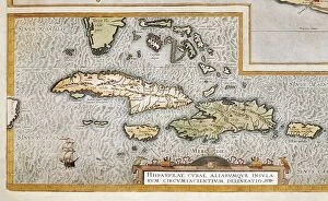
Background imageHaiti Collection: ORTELIUS, Abraham (1527-1598). Theatrum Orbis Terrarum

ORTELIUS, Abraham (1527-1598). Theatrum Orbis Terrarum. 1570. It is considered to be the first modern atlas. Map of the Caribbean Sea with the islands of Cuba, Cayman Islands

Background imageHaiti Collection: Jamaica - Spanish Town, The Cathedral Interior

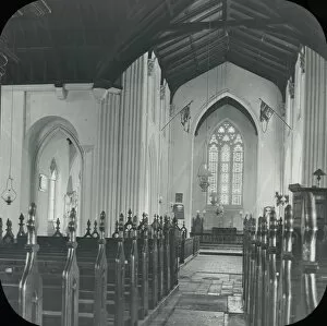
Jamaica - Spanish Town, The Cathedral Interior
Slide showing a photograph of the inside of the cathedral, in Spanish Town. Spanish Town is the capital and the largest town in the parish of St. Catherine in the county of Middlesex, Jamaica

Background imageHaiti Collection: Jamaica - Brooks Hotel, Mandeville

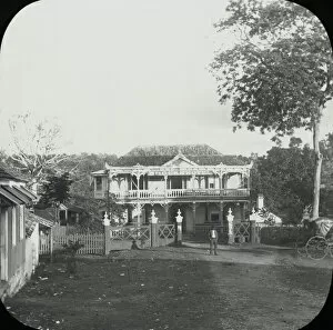
Jamaica - Brooks Hotel, Mandeville
Slide showing a photograph of Brooks Hotel in Mandeville. Mandeville is the capital and largest town in the parish of Manchester in the county of Middlesex, Jamaica.. Part of Box 108
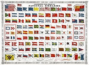
Background imageHaiti Collection: FLAGS, 1868. Johnsons New Chart of National Emblems. Engraving showing national

FLAGS, 1868. Johnsons New Chart of National Emblems. Engraving showing national, maritime and signal flags, 1868

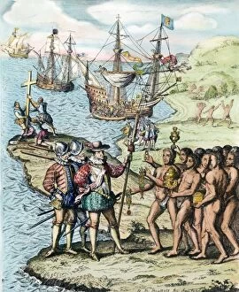
Background imageHaiti Collection: CHRISTOPHER COLUMBUS (1451-1506). Italian navigator. Landing on the island of Hispaniola, 1492

CHRISTOPHER COLUMBUS (1451-1506). Italian navigator. Landing on the island of Hispaniola, 1492. Etching, 1728

Background imageHaiti Collection: HENRI CHRISTOPHE (1767-1820). Haitian revolutionist and ruler. Portrait as King of Haiti

HENRI CHRISTOPHE (1767-1820). Haitian revolutionist and ruler. Portrait as King of Haiti. Oil on canvas, 1816, by Richard Evans

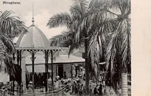
Background imageHaiti Collection: Haiti - Miragoane

Haiti - Miragoane, a coastal town in western Haiti and the capital of the Nippes Department. Date: circa 1904


For sale as Licensed Images

Choose your image, Select your licence and Download the media

"Haiti: A Tapestry of History, Culture, and Resilience" Step back in time to 1883 with the Haiti and Dominican Republic map, witnessing the intertwined destinies of these Caribbean nations. Explore the legacy of Henri Christophe, a visionary leader who shaped Haiti's history. Marvel at the breathtaking view over Cap Haitien, where the vibrant spirit comes alive. Immerse yourself in Port-au-Prince's bustling market scene, where colors and aromas blend harmoniously. Travel through time to the 1870s Caribbean islands, discovering their enchanting beauty and rich heritage. Visit the iconic Old Barbancourt rum factory established in 1765; its walls whisper tales of craftsmanship passed down through generations. Unveil Toussaint L'Ouverture's portrait from Universal History—a symbol of courage and resistance that forever changed Haiti's destiny. Stand before the majestic Haiti Royal Palace as it stands tall amidst historical turbulence. Experience Wilson Bigaud's captivating vision of heaven painted on a tryptych panel in 1957—an artistic masterpiece that reflects both faith and hope within Port au Prince. Trace your fingers along an ancient map depicting Hispaniola—the island that holds secrets dating back centuries. Finally, let a 17th-century map guide you through the New World—uncovering stories untold and connecting dots across continents. Haiti beckons you with open arms to discover its tapestry woven by history, culture, resilience—a land where past meets present for an unforgettable journey into Central America's heart.