Haiti Collection (#8)

"Haiti: A Tapestry of History, Culture, and Resilience" Step back in time to 1883 with the Haiti and Dominican Republic map

Background imageHaiti Collection: Jamaica - The Waterfall, Newcastle

Jamaica - The Waterfall, Newcastle
Slide showing a photograph of a waterfall at Newcastle, Jamaica. Newcastle is a settlement in the Blue Mountains of Jamaica and became a military centre in the 1840s.. Part of Box 108

Background imageHaiti Collection: Jamaica - Parish Church, The Altar, Kingston

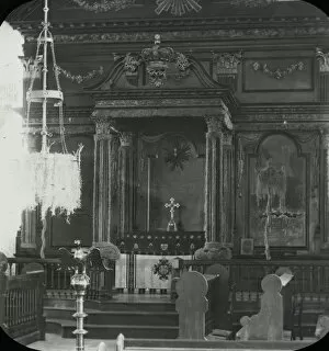
Jamaica - Parish Church, The Altar, Kingston
Slide showing a photograph of the inside of a parish church in Kingston showing the altar. Kingston is the capital and largest city of Jamaica

Background imageHaiti Collection: Jamaica - The Cemetery, Newcastle

Jamaica - The Cemetery, Newcastle
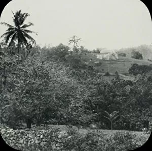
Slide showing a photograph of a cemetery at the foot of a hill with a settlement in the background up the hill at Newcastle, Jamaica

Background imageHaiti Collection: Jamaica - Distant View of Camp, Newcastle

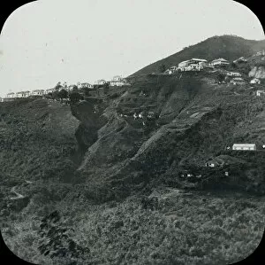
Jamaica - Distant View of Camp, Newcastle
Slide showing a photograph of buildings on the side of a hill taken from an opposite hill at Newcastle, Jamaica. Newcastle is a settlement in the Blue Mountains of Jamaica

Background imageHaiti Collection: Jamaica - Spanish Town, The Bishops House

Jamaica - Spanish Town, The Bishops House
Slide showing a photograph of The Bishops House, in Spanish Town. Spanish Town is the capital and the largest town in the parish of St. Catherine in the county of Middlesex, Jamaica

Background imageHaiti Collection: Jamaica - Victoria Market, Kingston

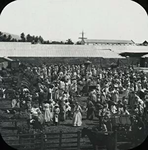
Jamaica - Victoria Market, Kingston
Slide showing a photograph of Victoria Market Kingston. Kingston is the capital and largest city of Jamaica, located on the south-eastern coast of the island facing a natural harbour

Background imageHaiti Collection: Jamaica - Gordons Town

Jamaica - Gordons Town
Slide showing a photograph of the small settlement of Gordon Town amongst the trees.. Part of Box 108. Boswell Collection. Slide number 28

Background imageHaiti Collection: Jamaica - The Conversorium, Kingston

Jamaica - The Conversorium, Kingston
Slide showing a photograph of the Conversorium, where shows and talks would be held. Kingston is the capital and largest city of Jamaica

Background imageHaiti Collection: Jamaica - Old Navy Yard, Rock Ford

Jamaica - Old Navy Yard, Rock Ford
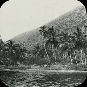
Slide showing a photograph of a settlement at the foot of a hill, near to water. Possibly Rockfort near Kingston on the coast.. Part of Box 108. Boswell Collection. Slide number 45

Background imageHaiti Collection: Jamaica - On the Road to Mandeville, Williamsfield

Jamaica - On the Road to Mandeville, Williamsfield
Slide showing a photograph of the road heading to Mandeville. Pictured is the settlement of Williamsfield in the distance

Background imageHaiti Collection: Jamaica - On the Road to Mandeville Porous

Jamaica - On the Road to Mandeville Porous
Slide showing a photograph of the road heading to Mandeville. Pictured is a shack on the side of the road serving as a pub

Background imageHaiti Collection: Jamaica - Public Buildings, Kingston

Jamaica - Public Buildings, Kingston
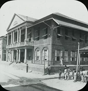
Slide showing a photograph of a public building in Kingston. Kingston is the capital and largest city of Jamaica, located on the south-eastern coast of the island facing a natural harbour

Background imageHaiti Collection: Jamaica - Panorama of Kingston

Jamaica - Panorama of Kingston
Slide showing a photograph looking out over the rooftops of Kingston. Kingston is the capital and largest city of Jamaica, located on the south-eastern coast of the island facing a natural harbour

Background imageHaiti Collection: Jamaica - Jacmel

Jamaica - Jacmel
Slide showing a photograph of Jacmel from the sea. Jacmel is a town on the coast in southern Haiti founded in 1698.. Part of Box 108. Boswell Collection. Slide number 3

Background imageHaiti Collection: Haiti Flags Nations Series 1 N9 Allen & Ginter Cigarettes Brands

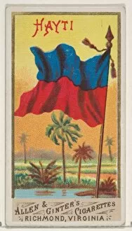
Haiti Flags Nations Series 1 N9 Allen & Ginter Cigarettes Brands
Artokoloro

Background imageHaiti Collection: Triclinium Excavated House Actaeon Pompeii ca

Triclinium Excavated House Actaeon Pompeii ca
Artokoloro

Background imageHaiti Collection: Haiti Natives Costume series N16 Allen & Ginter Cigarettes Brands

Haiti Natives Costume series N16 Allen & Ginter Cigarettes Brands
Artokoloro

Background imageHaiti Collection: 1859, Dufour Map of Hispaniola or Santo Domingo, West Indies, Haiti, Dominican Republic

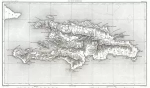
1859, Dufour Map of Hispaniola or Santo Domingo, West Indies, Haiti, Dominican Republic

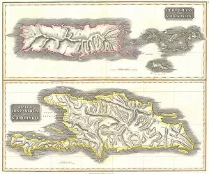
Background imageHaiti Collection: 1815, Thomson Map of Porto Rico, Virgin Islands, Haiti, Dominican Republic, John Thomson

1815, Thomson Map of Porto Rico, Virgin Islands, Haiti, Dominican Republic, John Thomson, 1777 - 1840, was a Scottish cartographer from Edinburgh, UK

Background imageHaiti Collection: 1800, Stockdale Map of Hispaniola or Santo Domingo, West Indies, Haiti, Dominican Republic

1800, Stockdale Map of Hispaniola or Santo Domingo, West Indies, Haiti, Dominican Republic

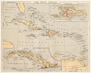
Background imageHaiti Collection: West Indies map 1869

West Indies map 1869
Cornells Grammars-School Geography - S.S. Cornell - New York D. Appleton and Company 1869

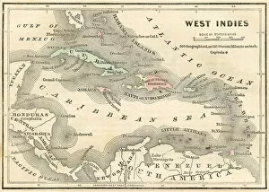
Background imageHaiti Collection: West Indies map 1855

West Indies map 1855
System of Geography for the use of schools by Sidney E. Morse - Published by Harper & Brothers - New York 1855

Background imageHaiti Collection: West Indies map 1856

West Indies map 1856
Colton and Fitchs Modern School Geography by George W. Fitch - New York 1856

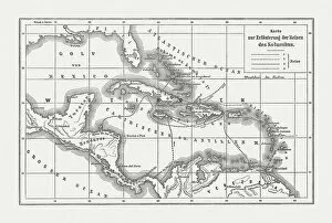
Background imageHaiti Collection: Voyages of Christopher Columbus, wood engraving, published c. 1882

Voyages of Christopher Columbus, wood engraving, published c. 1882
Map with the routes of the four voyages of Christopher Columbus in the Caribbean Sea. Wood engraving, published c. 1882

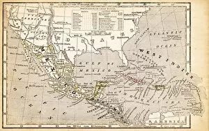
Background imageHaiti Collection: Mexico, Texas, Guatimala and West Indies 1852 Map

Mexico, Texas, Guatimala and West Indies 1852 Map

Background imageHaiti Collection: West Indies map 1867

West Indies map 1867
Mitchellas Modern Atlas - Published by E.H. Butler and Co - Philadelphia 1867

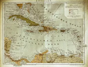
Background imageHaiti Collection: West indies, Antilles map

West indies, Antilles map
Illustration of a West indies, Antilles map

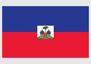
Background imageHaiti Collection: Illustration of official and state flag of Haiti, with blue and red field

Illustration of official and state flag of Haiti, with blue and red field and coat of arms of Haiti in centre on white panel

Background imageHaiti Collection: View over the beautiful coastline of Labadie, Cap Haitien, Haiti, Caribbean, Central

View over the beautiful coastline of Labadie, Cap Haitien, Haiti, Caribbean, Central America

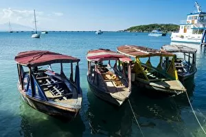
Background imageHaiti Collection: Local tourist boats Labadie, Haiti, Caribbean, Central America

Local tourist boats Labadie, Haiti, Caribbean, Central America

Background imageHaiti Collection: Totally polluted River Mapou flowing through Cap Haitien, Haiti, Caribbean, Central

Totally polluted River Mapou flowing through Cap Haitien, Haiti, Caribbean, Central America

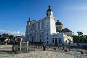
Background imageHaiti Collection: Cathedral Notre Dame on Place d Armes, Cap Haitien, Haiti, Caribbean, Central America

Cathedral Notre Dame on Place d Armes, Cap Haitien, Haiti, Caribbean, Central America

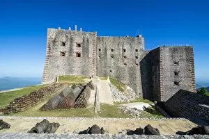
Background imageHaiti Collection: Citadelle Laferriere, UNESCO World Heritage Site, Cap Haitien, Haiti, Caribbean

Citadelle Laferriere, UNESCO World Heritage Site, Cap Haitien, Haiti, Caribbean, Central America

Background imageHaiti Collection: Old cannons in front of the Citadelle Laferriere, UNESCO World Heritage Site, Cap Haitien

Old cannons in front of the Citadelle Laferriere, UNESCO World Heritage Site, Cap Haitien, Haiti, Caribbean, Central America

Background imageHaiti Collection: View over the beautiful mountains around the Citadelle Laferriere, UNESCO World Heritage Site

View over the beautiful mountains around the Citadelle Laferriere, UNESCO World Heritage Site, Cap Haitien, Haiti, Caribbean, Central America

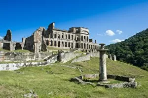
Background imageHaiti Collection: Palace Sans Souci, UNESCO World Heritage Site, Haiti, Caribbean, Central America

Palace Sans Souci, UNESCO World Heritage Site, Haiti, Caribbean, Central America

Background imageHaiti Collection: HAITI: MIRAGOANE. Workers unloading flour from ships and selling goods in Miragoane, Haiti

HAITI: MIRAGOANE. Workers unloading flour from ships and selling goods in Miragoane, Haiti. Photograph, c1909-1932

Background imageHaiti Collection: TOUSSAINT L OUVERTURE (1743-1803). Pierre Dominique Toussaint L Ouverture. Haitian general

TOUSSAINT L OUVERTURE (1743-1803). Pierre Dominique Toussaint L Ouverture. Haitian general and liberator. French lithograph, 19th century

Background imageHaiti Collection: Tropical Storm Bonnie

Tropical Storm Bonnies cloud-covered center south of Miami, Florida

Background imageHaiti Collection: A panoramic view of the island of Hispaniola in the foreground and Cuba extending

A panoramic view of the island of Hispaniola in the foreground and Cuba extending
August 19, 2008 - A panoramic view of the island of Hispaniola in the foreground and Cuba extending over the horizon. The sunglint is illuminating Haiti

Background imageHaiti Collection: A strong cold front moving through the eastern United States

A strong cold front moving through the eastern United States
April 5, 2011 - A strong cold front moving through the eastern United States. The cold front triggered severe thunderstorms (the line of brightest white are the highest thunderstorms)

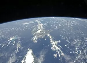
Background imageHaiti Collection: A view of the Caribbean island of Hispaniola from the International Space Station

A view of the Caribbean island of Hispaniola from the International Space Station
September 28, 2009 - A view of the Caribbean island of Hispaniola from the International Space Station. This island is comprised of Haiti (in the center left of the image)

Background imageHaiti Collection: Satellite image showing severe thunderstorms and tornados in the eastern United States

Satellite image showing severe thunderstorms and tornados in the eastern United States
April 27, 2011 - Satellite image showing severe thunderstorms and tornados in the eastern United States. The thunderstorms shown in this image began to rise over Louisiana midway through the day

Background imageHaiti Collection: View from space of Saharan dust blowing westward into the Atlantic Ocean

View from space of Saharan dust blowing westward into the Atlantic Ocean
July 15, 2012 - View from space of Saharan dust blowing westward from Africa out into the tropical Atlantic Ocean. The margin of the hazy air in this image reaches as far as Haiti (top center)

Background imageHaiti Collection: Hurricane Alex develops in the western Caribbean

Hurricane Alex develops in the western Caribbean
June 25, 2010 - System 93L (large area of clouds far left) in the western Caribbean Sea which will later become Hurricane Alex

Background imageHaiti Collection: Promise: Inspirational Quote and Motivational Poster

Promise: Inspirational Quote and Motivational Poster
Promise - Inspirational Quote and Motivational Poster. It reads: When you promise something, you must fulfill it. ~ Halle Gebrselassie

Background imageHaiti Collection: Two MV-22 Ospreys land on the flight deck of USS Nassau

Two MV-22 Ospreys land on the flight deck of USS Nassau
Port-au-Prince, Haiti, January 19, 2010 - Two MV-22 Ospreys land on the flight deck of the amphibious assault ship USS Nassau (LHA 4)

Background imageHaiti Collection: A U. S. Navy HH-60 Seahawk stirs up debris while taking off

A U. S. Navy HH-60 Seahawk stirs up debris while taking off
January 24, 2010 - U.S. Air Force combat controllers and U.S. Army pathfinders take off in a U.S. Navy HH-60 Seahawk helicopter to conduct a drop zone survey outside Port-au-Prince, Haiti


For sale as Licensed Images

Choose your image, Select your licence and Download the media

"Haiti: A Tapestry of History, Culture, and Resilience" Step back in time to 1883 with the Haiti and Dominican Republic map, witnessing the intertwined destinies of these Caribbean nations. Explore the legacy of Henri Christophe, a visionary leader who shaped Haiti's history. Marvel at the breathtaking view over Cap Haitien, where the vibrant spirit comes alive. Immerse yourself in Port-au-Prince's bustling market scene, where colors and aromas blend harmoniously. Travel through time to the 1870s Caribbean islands, discovering their enchanting beauty and rich heritage. Visit the iconic Old Barbancourt rum factory established in 1765; its walls whisper tales of craftsmanship passed down through generations. Unveil Toussaint L'Ouverture's portrait from Universal History—a symbol of courage and resistance that forever changed Haiti's destiny. Stand before the majestic Haiti Royal Palace as it stands tall amidst historical turbulence. Experience Wilson Bigaud's captivating vision of heaven painted on a tryptych panel in 1957—an artistic masterpiece that reflects both faith and hope within Port au Prince. Trace your fingers along an ancient map depicting Hispaniola—the island that holds secrets dating back centuries. Finally, let a 17th-century map guide you through the New World—uncovering stories untold and connecting dots across continents. Haiti beckons you with open arms to discover its tapestry woven by history, culture, resilience—a land where past meets present for an unforgettable journey into Central America's heart.