Haiti Collection (#7)

"Haiti: A Tapestry of History, Culture, and Resilience" Step back in time to 1883 with the Haiti and Dominican Republic map

Background imageHaiti Collection: Jamaica - Duke Street, Kingston

Jamaica - Duke Street, Kingston
Slide showing a photograph of Duke Street in Kingston. Kingston is the capital and largest city of Jamaica, located on the south-eastern coast of the island facing a natural harbour

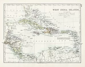
Background imageHaiti Collection: West indies map 1897

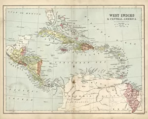
West indies map 1897
The World-Wide Atlas of Modern Geography, Political and Physical W. & A.K. Johnston - London 1897

Background imageHaiti Collection: Street scene, Port au Prince, Haiti, West Indies

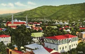
Street scene, Port au Prince, Haiti, West Indies
Street scene, approach to the Iron Market with its famous Moorish-style gate, Port au Prince, Haiti, West Indies. Date: circa 1930

Background imageHaiti Collection: Thomas Goodall

Thomas Goodall
THOMAS GOODALL Naval commander, Admiral in service in Haiti. Date: 1767 - 1832

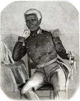
Background imageHaiti Collection: Nicholas-Fabre Geffrard

Nicholas-Fabre Geffrard
NICHOLAS-FABRE GEFFRARD Haitian general and politician; President of Haiti 1859-67 Date: 1806 - 1879

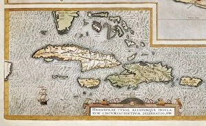
Background imageHaiti Collection: ORTELIUS, Abraham (1527-1598). Theatrum Orbis Terrarum

ORTELIUS, Abraham (1527-1598). Theatrum Orbis Terrarum. 1570. It is considered to be the first modern atlas. Map of the Caribbean Sea with the islands of Cuba, Cayman Islands

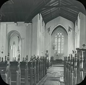
Background imageHaiti Collection: Jamaica - Spanish Town, The Cathedral Interior

Jamaica - Spanish Town, The Cathedral Interior
Slide showing a photograph of the inside of the cathedral, in Spanish Town. Spanish Town is the capital and the largest town in the parish of St. Catherine in the county of Middlesex, Jamaica
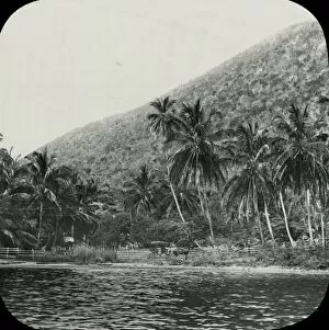
Background imageHaiti Collection: Jamaica - Brooks Hotel, Mandeville

Jamaica - Brooks Hotel, Mandeville
Slide showing a photograph of Brooks Hotel in Mandeville. Mandeville is the capital and largest town in the parish of Manchester in the county of Middlesex, Jamaica.. Part of Box 108
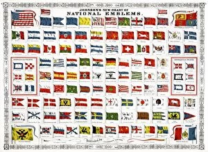
Background imageHaiti Collection: FLAGS, 1868. Johnsons New Chart of National Emblems. Engraving showing national

FLAGS, 1868. Johnsons New Chart of National Emblems. Engraving showing national, maritime and signal flags, 1868

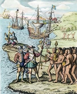
Background imageHaiti Collection: CHRISTOPHER COLUMBUS (1451-1506). Italian navigator. Landing on the island of Hispaniola, 1492

CHRISTOPHER COLUMBUS (1451-1506). Italian navigator. Landing on the island of Hispaniola, 1492. Etching, 1728

Background imageHaiti Collection: HENRI CHRISTOPHE (1767-1820). Haitian revolutionist and ruler. Portrait as King of Haiti

HENRI CHRISTOPHE (1767-1820). Haitian revolutionist and ruler. Portrait as King of Haiti. Oil on canvas, 1816, by Richard Evans

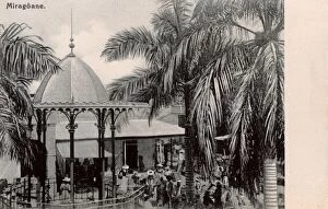
Background imageHaiti Collection: Haiti - Miragoane

Haiti - Miragoane, a coastal town in western Haiti and the capital of the Nippes Department. Date: circa 1904

Background imageHaiti Collection: Haiti - Port au Prince - The Cathedral

Haiti - Port au Prince - The Cathedral of Our Lady of the Assumption, destroyed by an earthquake in January 2010 Date: circa 1920

Background imageHaiti Collection: EXPL2A-00376

EXPL2A-00376
Native house on Hispaniola, 1500s. Hand-colored 19th-century woodcut reproduction from Oviedo, edition of 1547

Background imageHaiti Collection: EXPL2A-00089

EXPL2A-00089
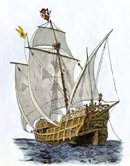
Caravel " Santa Maria, " the flagship of Columbus first voyage and which sank off Hispaniola in 1492. Hand-colored woodcut of a 19th-century illustration

Background imageHaiti Collection: City of Port-au-Prince. ca. 1940, Port-au-Prince, Haiti, City of Port-au-Prince

City of Port-au-Prince. ca. 1940, Port-au-Prince, Haiti, City of Port-au-Prince

Background imageHaiti Collection: Map of Haiti

Map of Haiti

Background imageHaiti Collection: Antique map of West Indies and Central America, 19th Century

Antique map of West Indies and Central America, 19th Century, 1873

Background imageHaiti Collection: Three Roman Catholic clergymen, Haiti, West Indies

Three Roman Catholic clergymen, Haiti, West Indies
Three Roman Catholic clergymen, including Archbishop (probably Julien-Jean-Guillaume Conan) and Assistant Bishop (probably Joseph-Marie Le Gouaze), Archdiocese of Port au Prince, Haiti, West Indies

Background imageHaiti Collection: Port au Prince, Haiti - The Cathedral Market

Port au Prince, Haiti - The Cathedral Market Date: circa 1909

Background imageHaiti Collection: Jean Pierre Boyer / Fricke

Jean Pierre Boyer / Fricke
JEAN PIERRE BOYER President of Haiti, 1818-1843 Date: 1776 - 1850

Background imageHaiti Collection: The town of Bombarde in Haiti

The town of Bombarde in Haiti.. Handcolored lithograph from Friedrich Wilhelm Goedsches Complete Gallery of Peoples in True Pictures, Meissen, circa 1835-1840

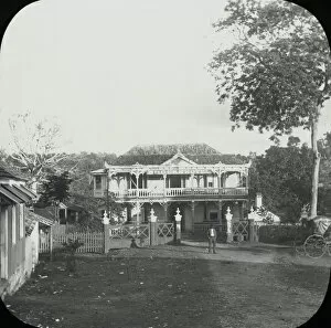
Background imageHaiti Collection: Jamaica - Bog Walk

Jamaica - Bog Walk
Slide showing a photograph of the countryside outside of Bog Walk. Bog Walk is a town in the parish of Saint Catherine, Jamaica

Background imageHaiti Collection: Jamaica - Spanish Town, The Cathedral

Jamaica - Spanish Town, The Cathedral
Slide showing a photograph of a cathedral, in Spanish Town. Spanish Town is the capital and the largest town in the parish of St. Catherine in the county of Middlesex, Jamaica.. Part of Box 108

Background imageHaiti Collection: Jamaica - The Treasury, Kingston

Jamaica - The Treasury, Kingston
Slide showing a photograph of The Treasury in Kingston. Kingston is the capital and largest city of Jamaica, located on the south-eastern coast of the island facing a natural harbour

Background imageHaiti Collection: Jamaica - Parish Church, Interior, Kingston

Jamaica - Parish Church, Interior, Kingston
Slide showing a photograph of the inside of a parish church in Kingston. Kingston is the capital and largest city of Jamaica

Background imageHaiti Collection: Jamaica - View of Camp, Newcastle

Jamaica - View of Camp, Newcastle
Slide showing a photograph of buildings on the side of a hill with a large group of soldiers sitting outside for the camera at Newcastle, Jamaica

Background imageHaiti Collection: Jamaica - View from Bridge, Newcastle

Jamaica - View from Bridge, Newcastle
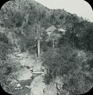
Slide showing a photograph, looking up hill to a building at Newcastle, Jamaica. Newcastle is a settlement in the Blue Mountains of Jamaica and became a military centre in the 1840s

Background imageHaiti Collection: Jamaica - The Waterfall, Newcastle

Jamaica - The Waterfall, Newcastle
Slide showing a photograph of a waterfall at Newcastle, Jamaica. Newcastle is a settlement in the Blue Mountains of Jamaica and became a military centre in the 1840s.. Part of Box 108

Background imageHaiti Collection: Jamaica - Parish Church, The Altar, Kingston

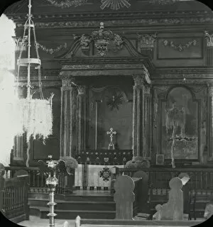
Jamaica - Parish Church, The Altar, Kingston
Slide showing a photograph of the inside of a parish church in Kingston showing the altar. Kingston is the capital and largest city of Jamaica

Background imageHaiti Collection: Jamaica - The Cemetery, Newcastle

Jamaica - The Cemetery, Newcastle
Slide showing a photograph of a cemetery at the foot of a hill with a settlement in the background up the hill at Newcastle, Jamaica

Background imageHaiti Collection: Jamaica - Distant View of Camp, Newcastle

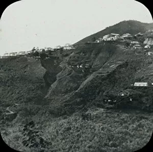
Jamaica - Distant View of Camp, Newcastle
Slide showing a photograph of buildings on the side of a hill taken from an opposite hill at Newcastle, Jamaica. Newcastle is a settlement in the Blue Mountains of Jamaica

Background imageHaiti Collection: Jamaica - Spanish Town, The Bishops House

Jamaica - Spanish Town, The Bishops House
Slide showing a photograph of The Bishops House, in Spanish Town. Spanish Town is the capital and the largest town in the parish of St. Catherine in the county of Middlesex, Jamaica

Background imageHaiti Collection: Jamaica - Victoria Market, Kingston

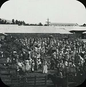
Jamaica - Victoria Market, Kingston
Slide showing a photograph of Victoria Market Kingston. Kingston is the capital and largest city of Jamaica, located on the south-eastern coast of the island facing a natural harbour

Background imageHaiti Collection: Jamaica - Gordons Town

Jamaica - Gordons Town
Slide showing a photograph of the small settlement of Gordon Town amongst the trees.. Part of Box 108. Boswell Collection. Slide number 28

Background imageHaiti Collection: Jamaica - The Conversorium, Kingston

Jamaica - The Conversorium, Kingston
Slide showing a photograph of the Conversorium, where shows and talks would be held. Kingston is the capital and largest city of Jamaica

Background imageHaiti Collection: Jamaica - Old Navy Yard, Rock Ford

Jamaica - Old Navy Yard, Rock Ford
Slide showing a photograph of a settlement at the foot of a hill, near to water. Possibly Rockfort near Kingston on the coast.. Part of Box 108. Boswell Collection. Slide number 45

Background imageHaiti Collection: Jamaica - On the Road to Mandeville, Williamsfield

Jamaica - On the Road to Mandeville, Williamsfield
Slide showing a photograph of the road heading to Mandeville. Pictured is the settlement of Williamsfield in the distance

Background imageHaiti Collection: Jamaica - On the Road to Mandeville Porous

Jamaica - On the Road to Mandeville Porous
Slide showing a photograph of the road heading to Mandeville. Pictured is a shack on the side of the road serving as a pub

Background imageHaiti Collection: Jamaica - Public Buildings, Kingston

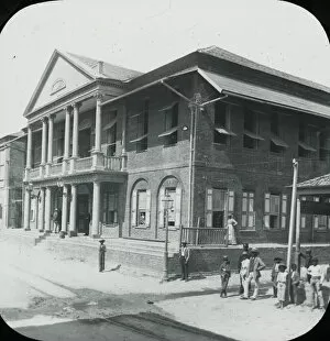
Jamaica - Public Buildings, Kingston
Slide showing a photograph of a public building in Kingston. Kingston is the capital and largest city of Jamaica, located on the south-eastern coast of the island facing a natural harbour

Background imageHaiti Collection: Jamaica - Panorama of Kingston

Jamaica - Panorama of Kingston
Slide showing a photograph looking out over the rooftops of Kingston. Kingston is the capital and largest city of Jamaica, located on the south-eastern coast of the island facing a natural harbour

Background imageHaiti Collection: Jamaica - Jacmel

Jamaica - Jacmel
Slide showing a photograph of Jacmel from the sea. Jacmel is a town on the coast in southern Haiti founded in 1698.. Part of Box 108. Boswell Collection. Slide number 3

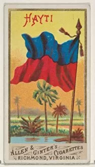
Background imageHaiti Collection: Haiti Flags Nations Series 1 N9 Allen & Ginter Cigarettes Brands

Haiti Flags Nations Series 1 N9 Allen & Ginter Cigarettes Brands
Artokoloro

Background imageHaiti Collection: Triclinium Excavated House Actaeon Pompeii ca

Triclinium Excavated House Actaeon Pompeii ca
Artokoloro

Background imageHaiti Collection: Haiti Natives Costume series N16 Allen & Ginter Cigarettes Brands

Haiti Natives Costume series N16 Allen & Ginter Cigarettes Brands
Artokoloro

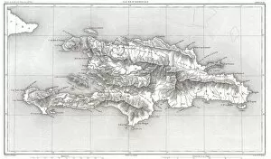
Background imageHaiti Collection: 1859, Dufour Map of Hispaniola or Santo Domingo, West Indies, Haiti, Dominican Republic

1859, Dufour Map of Hispaniola or Santo Domingo, West Indies, Haiti, Dominican Republic

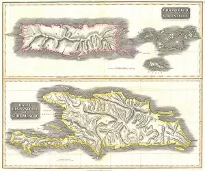
Background imageHaiti Collection: 1815, Thomson Map of Porto Rico, Virgin Islands, Haiti, Dominican Republic, John Thomson

1815, Thomson Map of Porto Rico, Virgin Islands, Haiti, Dominican Republic, John Thomson, 1777 - 1840, was a Scottish cartographer from Edinburgh, UK

Background imageHaiti Collection: 1800, Stockdale Map of Hispaniola or Santo Domingo, West Indies, Haiti, Dominican Republic

1800, Stockdale Map of Hispaniola or Santo Domingo, West Indies, Haiti, Dominican Republic


For sale as Licensed Images

Choose your image, Select your licence and Download the media

"Haiti: A Tapestry of History, Culture, and Resilience" Step back in time to 1883 with the Haiti and Dominican Republic map, witnessing the intertwined destinies of these Caribbean nations. Explore the legacy of Henri Christophe, a visionary leader who shaped Haiti's history. Marvel at the breathtaking view over Cap Haitien, where the vibrant spirit comes alive. Immerse yourself in Port-au-Prince's bustling market scene, where colors and aromas blend harmoniously. Travel through time to the 1870s Caribbean islands, discovering their enchanting beauty and rich heritage. Visit the iconic Old Barbancourt rum factory established in 1765; its walls whisper tales of craftsmanship passed down through generations. Unveil Toussaint L'Ouverture's portrait from Universal History—a symbol of courage and resistance that forever changed Haiti's destiny. Stand before the majestic Haiti Royal Palace as it stands tall amidst historical turbulence. Experience Wilson Bigaud's captivating vision of heaven painted on a tryptych panel in 1957—an artistic masterpiece that reflects both faith and hope within Port au Prince. Trace your fingers along an ancient map depicting Hispaniola—the island that holds secrets dating back centuries. Finally, let a 17th-century map guide you through the New World—uncovering stories untold and connecting dots across continents. Haiti beckons you with open arms to discover its tapestry woven by history, culture, resilience—a land where past meets present for an unforgettable journey into Central America's heart.