Hemisphere Collection (#6)

Discover the wonders of our world and beyond with these captivating glimpses into different hemispheres

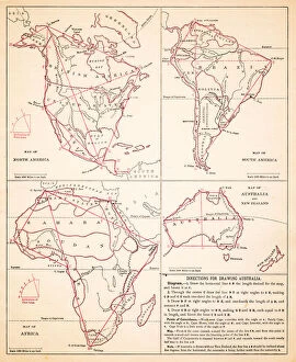
Background imageHemisphere Collection: Map drawing Africa North America Australia hemispheres 1881

Map drawing Africa North America Australia hemispheres 1881
Warrens Common School Geography

Background imageHemisphere Collection: World in zones hemispheres 1881

World in zones hemispheres 1881
Coltons Common School Geography 1881 New York Sheldon and Co

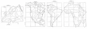
Background imageHemisphere Collection: Map drawing technique 1881

Map drawing technique 1881
Coltons Common School Geography 1881 New York Sheldon and Co

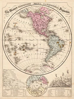
Background imageHemisphere Collection: Western Hemisphere map 1867

Western Hemisphere map 1867
Mitchells Modern Atlas - Published by E.H. Buttler & Co - Philadelphia 1867

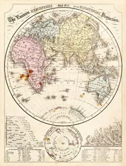
Background imageHemisphere Collection: Eastern Hemisphere map 1856

Eastern Hemisphere map 1856
Mitchells Modern Atlas - Published by E.H. Buttler & Co - Philadelphia 1867

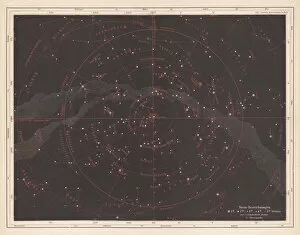
Background imageHemisphere Collection: Fixed stars of the northern sky, published in 1875

Fixed stars of the northern sky, published in 1875
Fixed stars of the northern sky, ancient map. Lithograph, published in 1875

Background imageHemisphere Collection: Map of the world 1897

Map of the world 1897
Map of the world in Mercator projection

Background imageHemisphere Collection: Map of the world horizontal projection 1856

Map of the world horizontal projection 1856
Colton and Fitchs Modern School Geography by George W. Fitch - New York 1856

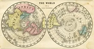
Background imageHemisphere Collection: Polar projection of the world map 1856

Polar projection of the world map 1856
Colton and Fitchs Modern School Geography by George W. Fitch - New York 1856

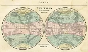
Background imageHemisphere Collection: Map of the world in zones 1856

Map of the world in zones 1856
Colton and Fitchs Modern School Geography by George W. Fitch - New York 1856

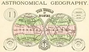
Background imageHemisphere Collection: Astronomical geography map 1875

Astronomical geography map 1875
The Independent Course Comprehensive Geography by James Monteith, A.S. Barnes & Co, New York & Chicago 1875

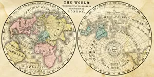
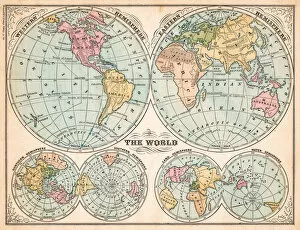
Background imageHemisphere Collection: The world in hemispheres map 1875

The world in hemispheres map 1875
The Independent Course Comprehensive Geography by James Monteith, A.S. Barnes & Co, New York & Chicago 1875

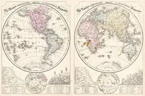
Background imageHemisphere Collection: Easter hemisphere map 1867

Easter hemisphere map 1867
Mitchellas Modern Atlas - Published by E.H. Butler and Co - Philadelphia 1867

Background imageHemisphere Collection: Saint Isaacs Cathedral in St. Petersburg, Russia

Saint Isaacs Cathedral in St. Petersburg, Russia
Antique illustration of a Saint Isaacs Cathedral in St. Petersburg, Russia

Background imageHemisphere Collection: White house

White house
United States Capitol in Washington DC

Background imageHemisphere Collection: Saint Peters Basilica interior, Rome, Italy

Saint Peters Basilica interior, Rome, Italy

Background imageHemisphere Collection: Orthodox monastery Studenica, Serbia

Orthodox monastery Studenica, Serbia
Antique illustration of the Orthodox monastery Studenica, Serbia, UNESCO world heritage site. It is best known for its unique collection of 13th century frescoes

Background imageHemisphere Collection: Church of the Holy Apostles in Thessaloniki, Greece

Church of the Holy Apostles in Thessaloniki, Greece

Background imageHemisphere Collection: The Pantheon in Paris

The Pantheon in Paris
The Pantheon, vintage engraved illustration

Background imageHemisphere Collection: The Castle Howard, Yorkshire, England, UK

The Castle Howard, Yorkshire, England, UK
Antique illustration of a The Castle Howard, Yorkshire, England, UK

Background imageHemisphere Collection: World globe with directional arrows showing trade wind patterns

World globe with directional arrows showing trade wind patterns

Background imageHemisphere Collection: Illustration of the planet Mercury and its iron core

Illustration of the planet Mercury and its iron core

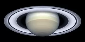
Background imageHemisphere Collection: Saturns rings

Saturns rings
A series of Hubble Space Telescope images, captured from 1996 to 2000, show Saturns rings open up from just past edge-on to nearly fully open as it moves from autumn towards winter in its Northern

Background imageHemisphere Collection: Venus

Venus
October 29, 1991 - The northern hemisphere is displayed in this global view of the surface of Venus. The north pole is at the center of the image, with 0 degrees, 90 degrees, 180 degrees

Background imageHemisphere Collection: Full view of the Earth highlighting Antarctica and its surrounding sea ice in the

Full view of the Earth highlighting Antarctica and its surrounding sea ice in the southern hemisphere

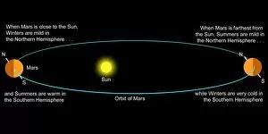
Background imageHemisphere Collection: An explanation of how Mars seasons work

An explanation of how Mars seasons work

Background imageHemisphere Collection: Winter Snow Cover in the Northern Hemisphere

Winter Snow Cover in the Northern Hemisphere

Background imageHemisphere Collection: Source Size = 2116 x 1642

Source Size = 2116 x 1642
The Comet in the Southern Hemisphere, as Viewed from the Wellington, in Queen Charlottes Sound, 1880

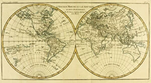
Background imageHemisphere Collection: Map of the World in two Hemispheres, from Atlas de Toutes les Parties Connues

Map of the World in two Hemispheres, from Atlas de Toutes les Parties Connues
KW205841 Map of the World in two Hemispheres, from Atlas de Toutes les Parties Connues du Globe Terrestre by Guillaume Raynal (1713-96) published Geneva, 1780 (coloured engraving) by Bonne

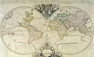
Background imageHemisphere Collection: Geo-Hydrographic Mappamonde (coloured engraving)

Geo-Hydrographic Mappamonde (coloured engraving)
XIR214121 Geo-Hydrographic Mappamonde (coloured engraving) by French School, (18th century); Bibliotheque Nationale, Paris, France; French, out of copyright

Background imageHemisphere Collection: OTTO von GUERICKE, 1672. Title-page of the first edition of Otto von Guerickes Experimenta Nova

OTTO von GUERICKE, 1672. Title-page of the first edition of Otto von Guerickes Experimenta Nova, Amsterdam, 1672, containing his accounts of the invention of the air pump

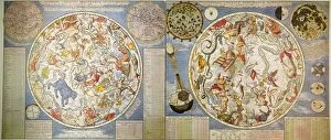
Background imageHemisphere Collection: CELESTIAL PLANISPHERE. Celestial Planisphere of the Northern Hemisphere (left)

CELESTIAL PLANISPHERE. Celestial Planisphere of the Northern Hemisphere (left) and Southern Hemisphere (right), c1700, by Carel Allard, Amsterdam

Background imageHemisphere Collection: WESTERN HEMISPHERE, 1596. Theodore de Brys map of the western hemisphere, 1596

WESTERN HEMISPHERE, 1596. Theodore de Brys map of the western hemisphere, 1596, surrounded by the explorers (clockwise from top left) Columbus, Vespucci, Pizarro, and Magellan

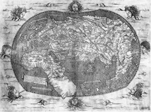
Background imageHemisphere Collection: WORLD MAP, c1486-93. World map, showing only the Eastern Hemisphere

WORLD MAP, c1486-93. World map, showing only the Eastern Hemisphere. Attributed to the German Ptolemy, c1486-93

Background imageHemisphere Collection: WORLD MAP, c1492. World map showing only the Eastern Hemisphere

WORLD MAP, c1492. World map showing only the Eastern Hemisphere. One of the first maps to depict the Cape of Good Hope, Madagascar and Zanzibar

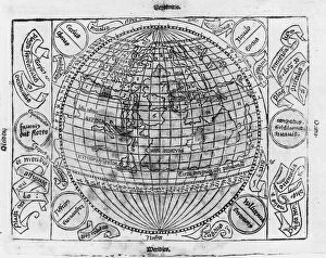
Background imageHemisphere Collection: DURER: GLOBE, c1512-1515. The Eastern Hemisphere (left) of the Terrestrial Globe (Mappa mundi)

DURER: GLOBE, c1512-1515. The Eastern Hemisphere (left) of the Terrestrial Globe (Mappa mundi). Woodcut, c1512-1515, by Albrecht Durer for the Viennese cartographer Johannes Stabius

Background imageHemisphere Collection: Life in Peru Cuzco in the mountains at Saqsaywaman Ruins in high elevation

Life in Peru Cuzco in the mountains at Saqsaywaman Ruins in high elevation

Background imageHemisphere Collection: Life in Brazil world famous Copabana walkway in Rio de Janeiro holiday

Life in Brazil world famous Copabana walkway in Rio de Janeiro holiday

Background imageHemisphere Collection: Picture No. 10889135

Picture No. 10889135
Aconcagua - at sunrise - glacier covered flank of Mount Aconcagua which is at a height of 6960 m above sea level the highest mountain of the western hemisphere Date:

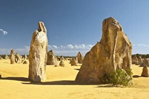
Background imageHemisphere Collection: pinnacles

pinnacles

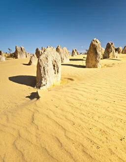
Background imageHemisphere Collection: pinnacles

pinnacles

Background imageHemisphere Collection: pinnacles

pinnacles

Background imageHemisphere Collection: pinnacles

pinnacles

Background imageHemisphere Collection: pinnacles

pinnacles

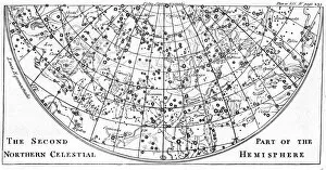
Background imageHemisphere Collection: Second part of the star chart of the Northern Celestial Hemisphere showing constellations

Second part of the star chart of the Northern Celestial Hemisphere showing constellations. Engraving of 1747

Background imageHemisphere Collection: Common Silverweed (Argentina anserina or Potentilla anserina) Ceeping herbaceous

Common Silverweed (Argentina anserina or Potentilla anserina) Ceeping herbaceous plant of temperate regions of the Northern Hemisphere. From Amedee Masclef Atlas des Plantes de France, Paris, 1893

Background imageHemisphere Collection: First part of the star chart of the Northern Celestial Hemisphere showing constellations

First part of the star chart of the Northern Celestial Hemisphere showing constellations. Engraving of 1747

Background imageHemisphere Collection: First part of the star chart of the Southern Celestial Hemisphere showing constellations

First part of the star chart of the Southern Celestial Hemisphere showing constellations. Engraving of 1747


For sale as Licensed Images

Choose your image, Select your licence and Download the media

Discover the wonders of our world and beyond with these captivating glimpses into different hemispheres. 🌍✨ Step back in time to the 17th century as you explore a vintage world map, meticulously crafted by skilled cartographers. Marvel at how they envisioned Earth's continents and oceans before satellite imagery revolutionized our understanding. Zoom out from this historical perspective and witness Earth's breathtaking beauty from space, captured by satellites orbiting high above. Behold the mesmerizing blue planet we call home, its delicate features visible even from afar. Focus your gaze on North America at night, where dazzling city lights illuminate the darkness like a constellation of stars. This satellite image showcases human activity intertwined with nature's grandeur—a testament to our interconnectedness. Venture beyond Earth itself and delve into celestial realms with Andreas Cellarius' Atlas Coelestis. Lose yourself in intricate star charts that guided ancient astronomers across the Northern Hemisphere, unlocking secrets of the cosmos. Embark on an extraterrestrial journey to Mars through composite satellite images revealing its enigmatic landscapes. Witness rugged terrains and mysterious formations that ignite curiosity about what lies beyond our own planet. Shift your focus closer to home again—this time exploring Australia through a stunning satellite image. Admire its vastness and diverse ecosystems that make it truly unique among continents. Delve deeper into planetary exploration as you examine Venus' radar map showcasing its icy North Pole—an otherworldly sight unlike anything found on Earth. Uncover hidden mysteries lurking within this neighboring planet's polar region. Transport yourself further back in time with Carel Allard's Celestial Planisphere of the Northern Hemisphere from 1700s Amsterdam. Immerse yourself in an era when maps were works of art, intricately depicting cosmic wonders awaiting discovery. Return once more to South America at night—a radiant tapestry woven by urban centers nestled amidst lush rainforests and towering mountains. This satellite image captures the vibrant spirit of a continent that never sleeps.