Human Settlement Collection (#27)

"Exploring the Tapestry of Human Settlement: From Victorian London's Shady Lanes to Ancient Anatolia and Beyond" Step into the shadows of Victorian London

Background imageHuman Settlement Collection: Italy, Milan, Landscape

Italy, Milan, Landscape
Giorgio Morandi (1890-1964), Landscape, 1916

Background imageHuman Settlement Collection: Austria, Vienna, Street musicians in Vienna

Austria, Vienna, Street musicians in Vienna 18th century, Historisches Museum der Stadt Wien (History Museum)

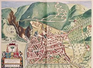
Background imageHuman Settlement Collection: Map of Spoleto from Theatrum civitatum et admirandorum Italiae, by Joan Blaeu, engraving

Map of Spoleto from Theatrum civitatum et admirandorum Italiae, by Joan Blaeu, engraving
Cartography, Italy, 17th century. Map of Spoleto, from Theatrum civitatum et admirandorum Italiae by Joan Blaeu. Engraving

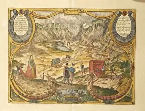
Background imageHuman Settlement Collection: Solfatara at Campi Flegrei in Pozzuoli, Naples province, Italy

Solfatara at Campi Flegrei in Pozzuoli, Naples province, Italy, from Civitates Orbis Terrarum by Georg Braun
Cartography, Italy, 16th century. Solfatara at Campi Flegrei in Pozzuoli, Naples province. From Civitates Orbis Terrarum by Georg Braun (1541-1622) and Franz Hogenberg (1540-1590), Cologne. Engraving

Background imageHuman Settlement Collection: Maps of Urbino and Sulmona, Abruzzo and Marches regions, Italy

Maps of Urbino and Sulmona, Abruzzo and Marches regions, Italy, from Civitates Orbis Terrarum by Georg Braun
Cartography, Italy, 16th century. Maps of Urbino and Sulmona, Abruzzo and Marche regions. From Civitates Orbis Terrarum by Georg Braun (1541-1622) and Franz Hogenberg (1540-1590), Cologne. Engraving

Background imageHuman Settlement Collection: Map of the City of Ferrara

Map of the City of Ferrara
Cartography, Italy. Map of the City of Ferrara

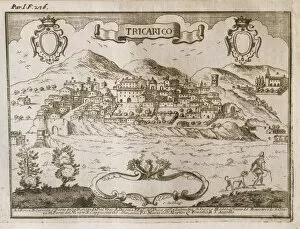
Background imageHuman Settlement Collection: Map of Tricario, Matera

Map of Tricario, Matera
Cartography, Italy, 17th century. Map of Tricario, Matera

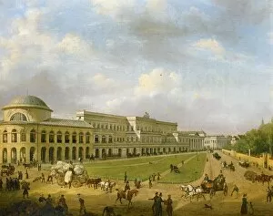
Background imageHuman Settlement Collection: Poland, Warsaw, Mikolaj Kopernik (Nicolaus Copernicus) Square

Poland, Warsaw, Mikolaj Kopernik (Nicolaus Copernicus) Square
Poland - Warsaw - 19th century. Mikolaj Kopernik (Nicolaus Copernicus) Square

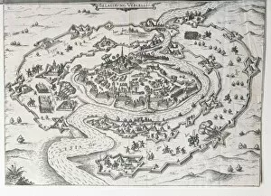
Background imageHuman Settlement Collection: Map of the siege on Vercelli

Map of the siege on Vercelli
Cartography, Italy, 17th century. Map of the siege on the city of Vercelli

Background imageHuman Settlement Collection: Poland, Warsaw, View of Bankowy Square

Poland, Warsaw, View of Bankowy Square
Poland - Warsaw - 19th century. Bankowa Square

Background imageHuman Settlement Collection: Holland, The Hague, Moon Night II

Holland, The Hague, Moon Night II
Jan Sluyters (1881-1957), Moon Night II, 1911

Background imageHuman Settlement Collection: Map of Candy City, engraving

Map of Candy City, engraving
Cartography, 17th century. Ceylon (present day Sri Lanka), map of Candy City. Engraving

Background imageHuman Settlement Collection: Map of Kampen, Netherlands, from Civitates Orbis Terrarum by Georg Braun

Map of Kampen, Netherlands, from Civitates Orbis Terrarum by Georg Braun, 1541-1622 and Franz Hogenberg, 1540-1590
Cartography, Netherlands, 16th century. Map of Kampen. From Civitates Orbis Terrarum by Georg Braun (1541-1622) and Franz Hogenberg (1540-1590), Cologne. Engraving

Background imageHuman Settlement Collection: Italy, trieste, Bucolic Landscape

Italy, trieste, Bucolic Landscape
Michele Marieschi (1710-1743), Bucolic Landscape

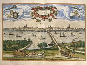
Background imageHuman Settlement Collection: Map of Amsterdam, Netherlands, from Civitates Orbis Terrarum by Georg Braun

Map of Amsterdam, Netherlands, from Civitates Orbis Terrarum by Georg Braun, 1541-1622 and Franz Hogenberg, 1540-1590
Cartography, Netherlands, 16th century. Map of Rotterdam. From Civitates Orbis Terrarum by Georg Braun (1541-1622) and Franz Hogenberg (1540-1590), Cologne. Engraving

Background imageHuman Settlement Collection: Map of Milan and canals

Map of Milan and canals
Cartography, Italy, 17th century. Milan and its canals

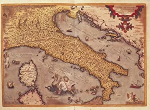
Background imageHuman Settlement Collection: Map of Italy from Theatrum Orbis Terrarum, by Abraham Ortelius, 1528-1598, engraving, 1570

Map of Italy from Theatrum Orbis Terrarum, by Abraham Ortelius, 1528-1598, engraving, 1570
Cartography, Italy, 16th century. Map of Italy, by Abraham Ortelius (1528-1598), from Theatrum Orbis Terrarum, 1570

Background imageHuman Settlement Collection: Map of Trinity Island in the Antilles, from Universal cosmography by Andre Thevet, 1575

Map of Trinity Island in the Antilles, from Universal cosmography by Andre Thevet, 1575
Cartography, 16th century. Trinity Island in the Antilles. From Universal cosmography by AndrA

Background imageHuman Settlement Collection: Map of Naviglio Grande Canal, Pavia and surroundings

Map of Naviglio Grande Canal, Pavia and surroundings
Cartography, Italy, 17th century. Naviglio Grande Canal, Pavia and surroundings

Background imageHuman Settlement Collection: Nautical chart showing Iceland from Nautical Atlas by Giorgio Sideri

Nautical chart showing Iceland from Nautical Atlas by Giorgio Sideri
Cartography, 16th century. Nautical chart from the Nautical Atlas by Giorgio Sideri known as Callapoda or Calopodio da Candia. Details of Iceland

Background imageHuman Settlement Collection: Map of Muro Lucano, Potenza

Map of Muro Lucano, Potenza
Cartography, Italy, 17th century. Map of Muro Lucano, Potenza

Background imageHuman Settlement Collection: Map of Greece, Rhodes Island, from the Latin manuscript, by Insularium Arcipelagi

Map of Greece, Rhodes Island, from the Latin manuscript, by Insularium Arcipelagi
Cartography, Greece, 15th century. Rhodes Island. From the Latin manuscript, Insularium Arcipelagi

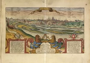
Background imageHuman Settlement Collection: Map of Munich, Germany, from Civitates Orbis Terrarum by Georg Braun

Map of Munich, Germany, from Civitates Orbis Terrarum by Georg Braun, 1541-1622 and Franz Hogenberg, 1540-1590
Cartography, Germany, 16th century. Map of Munich. From Civitates Orbis Terrarum by Georg Braun (1541-1622) and Franz Hogenberg (1540-1590), Cologne. Engraving

Background imageHuman Settlement Collection: France, Versailles, Bird eye view of the menagerie designed by Louis Le Van (1612-1670)

France, Versailles, Bird eye view of the menagerie designed by Louis Le Van (1612-1670), engraving, 1663-64 17th century, Musee Lambinet

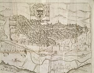
Background imageHuman Settlement Collection: Map of Benevento of Sannio in county of Molise and Ultra principality

Map of Benevento of Sannio in county of Molise and Ultra principality
Cartography, Italy, 17th century. Map of Benevento, of Sannio in the county of Molise and Ultra principality

Background imageHuman Settlement Collection: Map of Acireale, Catania

Map of Acireale, Catania
Cartography, Italy. Map of Acireale, Catania

Background imageHuman Settlement Collection: Map of Genoa with encampments erected during 1747 siege and surrounding lands and valleys

Map of Genoa with encampments erected during 1747 siege and surrounding lands and valleys
Cartography, Italy, 18th century. Map of the city of Genoa and the lands and valleys surrounding it. The encampments erected during the 1747 siege are indicated

Background imageHuman Settlement Collection: Map of Novara, from Civitates Orbis Terrarum by Georg Braun, 1541-1622 and Franz Hogenberg

Map of Novara, from Civitates Orbis Terrarum by Georg Braun, 1541-1622 and Franz Hogenberg, 1540-1590, engraving
Cartography, Italy, 16th century. The City of Novara, from Civitates Orbis Terrarum by Georg Braun (1541-1622) and Franz Hogenberg (1540-1590), Cologne. Engraving

Background imageHuman Settlement Collection: Dominican Republic, Santo Domingo, engraving from atlas

Dominican Republic, Santo Domingo, engraving from atlas
Cartography, Dominican Republic, 17th century. Santo Domingo. Engraving from an atlas from the 17th century

Background imageHuman Settlement Collection: Map of Siena, from Civitates Orbis Terrarum by Georg Braun, 1541-1622 and Franz Hogenberg

Map of Siena, from Civitates Orbis Terrarum by Georg Braun, 1541-1622 and Franz Hogenberg, 1540-1590, engraving
Cartography, Italy, 16th century. The City of Siena. From Civitates Orbis Terrarum by Georg Braun (1541-1622) and Franz Hogenberg (1540-1590), Cologne. Engraving

Background imageHuman Settlement Collection: Map of Boccadifalco area, Palermo, Italy

Map of Boccadifalco area, Palermo, Italy
Cartography, Italy. Map of Boccadifalco area, Palermo

Background imageHuman Settlement Collection: Map of Benevento, engraving from design by Piperno with dedication to Archbishop Foppa

Map of Benevento, engraving from design by Piperno with dedication to Archbishop Foppa
Cartography, Italy, 17th century. Map of Benevento. Engraving from a design by Piperno with a dedication to the Archbishop Foppa

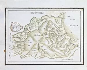
Background imageHuman Settlement Collection: Map of Comacchio and surrounding valleys

Map of Comacchio and surrounding valleys
Cartography, Italy. Map of Comacchio and the surrounding valleys

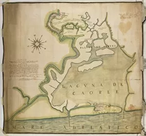
Background imageHuman Settlement Collection: Map of Caorle Lagoon, Venice, Italy, 1596

Map of Caorle Lagoon, Venice, Italy, 1596
Cartography, Italy, 16th century. Map of the Caorle Lagoon, Venice, 1596

Background imageHuman Settlement Collection: Saluzzo city and castle, from Military Architecture by Amedeo Peloja, 1550

Saluzzo city and castle, from Military Architecture by Amedeo Peloja, 1550
Cartography, Italy, 17th century. Saluzzo city and castle. From Military Architecture by Amedeo Peloja, 1550

Background imageHuman Settlement Collection: Map of Arignano, Italy, from the atlas Atlante delle Locazioni, by Antonio and Nunzio Michele

Map of Arignano, Italy, from the atlas Atlante delle Locazioni, by Antonio and Nunzio Michele, 1687-1697
Cartography, Italy, 17th century. Map of Arignano. From the atlas Atlante delle Locazioni, by Antonio and Nunzio Michele, 1687-1697

Background imageHuman Settlement Collection: Poland, Warsaw, View of Freta Street in Warsaw

Poland, Warsaw, View of Freta Street in Warsaw
Poland - Warsaw - 19th century. View of Freta Street in a painting by Marcin Zaleski (1796-1877)

Background imageHuman Settlement Collection: Map of Val Baganza, Parma

Map of Val Baganza, Parma
Cartography, Italy. Map of Val Baganza, Parma

Background imageHuman Settlement Collection: Belgium, Brussels, The Happy Donor

Belgium, Brussels, The Happy Donor
RenA

Background imageHuman Settlement Collection: The city of Damascus from Civitates Orbis Terrarum by Georg Braun, 1541-1622 and Franz Hogenberg

The city of Damascus from Civitates Orbis Terrarum by Georg Braun, 1541-1622 and Franz Hogenberg, 1540-1590, engraving
Cartography, Syria, 16th century. The city of Damascus. From Civitates Orbis Terrarum by Georg Braun (1541-1622) and Franz Hogenberg (1540-1590), Cologne. Engraving

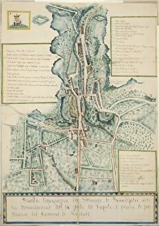
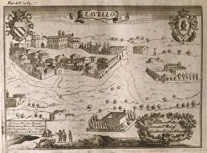
Background imageHuman Settlement Collection: Map of Lavello, Potenza

Map of Lavello, Potenza
Cartography, Italy, 17th century. Map of Lavello, Potenza

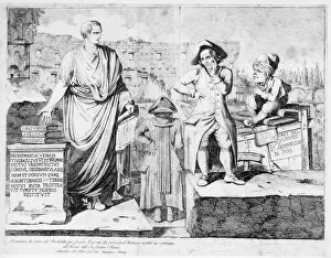
Background imageHuman Settlement Collection: Italy, Rome, Dispute over excavations in area of the Colosseum, 19th century

Italy, Rome, Dispute over excavations in area of the Colosseum, 19th century
Italy, 19th century. Dispute over the excavations in the area of the Colosseum

Background imageHuman Settlement Collection: France, Paris, frontispiece of Fables (The dairywoman and the pot of milk) by Jean de La Fontaine

France, Paris, frontispiece of Fables (The dairywoman and the pot of milk) by Jean de La Fontaine, engraving
French literature, 17th century - Jean de La Fontaine (1621-1695). Fables, The dairywoman and the pot of milk. Frontispiece, engraving

Background imageHuman Settlement Collection: Egypt, Luxor, Deir el-Medina, artisans and state workers village

Egypt, Luxor, Deir el-Medina, artisans and state workers village
Egypt - Ancient Thebes (UNESCO World Heritage List, 1979). Luxor. Dayr al-Madinah (Deir el-Medina). New Kingdom, artisans and state workers village

Background imageHuman Settlement Collection: Italy, Latium region, Tivoli, Hadrians villa, plastic model of villa

Italy, Latium region, Tivoli, Hadrians villa, plastic model of villa
Italy - Latium region - Tivoli - Hadrians villa. Plastic model of the villa

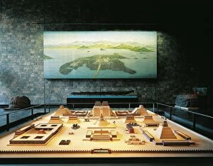
Background imageHuman Settlement Collection: Mexico, Mexico City, National Museum of Anthropology, Mexica Hall

Mexico, Mexico City, National Museum of Anthropology, Mexica Hall, model and reconstruction of the city of Tenochtitlan
Mexico - Mexico City - National Museum of Anthropology. Mexica Hall. Model and reconstruction of the city of Tenochtitlan

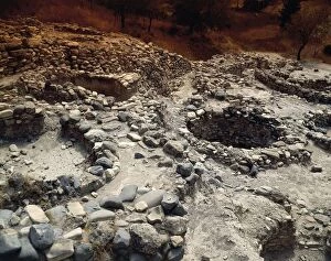
Background imageHuman Settlement Collection: Cyprus, Larnaca District, circular stone dwellings, Khirokitia remains of Neolithic settlement

Cyprus, Larnaca District, circular stone dwellings, Khirokitia remains of Neolithic settlement
Cyprus - Larnaca District. Khirokitia (UNESCO World Heritage List, 1998). Remains of Neolithic settlement, circular dwellings made from stone

Background imageHuman Settlement Collection: Italy, Milan, States of Mind Those Who Go

Italy, Milan, States of Mind Those Who Go
Umberto Boccioni (1882-1916), States of Mind. Those Who Go, 1911


For sale as Licensed Images

Choose your image, Select your licence and Download the media

"Exploring the Tapestry of Human Settlement: From Victorian London's Shady Lanes to Ancient Anatolia and Beyond" Step into the shadows of Victorian London, a city teeming with intrigue and mystery. Its dimly lit streets hold secrets untold, inviting you to unravel tales of bygone eras. Venturing across continents, discover Buenos Aires on a map that reveals its vibrant soul. Overlayed with illustrations of sea gulls, penguins, elephant seals, shrimp, and buildings - witness the harmonious coexistence between nature and human settlement in this bustling metropolis. Journey back in time to Catal Huyuk in ancient Anatolia; an archaeological marvel from 6500 BC. Marvel at the ingenuity of our ancestors as they built a thriving community amidst challenging landscapes. Find solace along Northern Ireland's picturesque coastline adorned with wide sandy beaches in Ballycastle. Let the tranquil waves whisper stories of resilience and beauty shaped by centuries of human habitation. Unveil history through a 19th-century map showcasing Madras (Chennai), India. Witness how this vibrant city has evolved over time while retaining its rich cultural heritage. Stand atop Hags Head at Cliffs of Moher in County Clare, Ireland; let your gaze wander across breathtaking vistas that have inspired generations. Feel the connection between humans and their surroundings etched into every cliff face. Immerse yourself in Connemara's enchanting landscape within County Galway; where Clifden stands as a testament to man's ability to thrive amidst rugged terrain. Admire how they are seamlessly blend with nature's grandeur. Gaze upon gargoyles adorning Notre Dame Cathedral in Paris; these stone guardians symbolize humanity's desire for protection against unseen forces while adding an air of mystique to architectural wonders. Explore Hull on a map that unravels its urban tapestry - tracing paths forged by countless individuals who have called this city home.