
Jamaica Collection (page 3)

Discover the vibrant beauty and rich history of Jamaica, an enchanting Caribbean gem

Background imageJamaica Collection: Rafting on the Martha Brae River

Rafting on the Martha Brae River, Jamaica, Caribbean, West Indies

Background imageJamaica Collection: Glasgow / Jamaica Bridge

Glasgow / Jamaica Bridge
Glasgow: Jamaica Bridge and Jamaica Street

Background imageJamaica Collection: Jamaica Pepper

Jamaica Pepper
MYRTUS PIMENTA Jamaica pepper

Background imageJamaica Collection: Jamaica / Port Royal / 1865

Jamaica / Port Royal / 1865
The dramatic harbour setting of the town of Port Royal, Jamaica

Background imageJamaica Collection: Bob Marley Burial Place, Mount Zion, Bob Marley Mausoleum Complex, Nine Mile

Bob Marley Burial Place, Mount Zion, Bob Marley Mausoleum Complex, Nine Mile, Saint Ann Parish, Jamaica

Background imageJamaica Collection: Sea chart of the south coast of Cuba and Jamaica, Jan Luyken, Claes Jansz Voogt

Sea chart of the south coast of Cuba and Jamaica, Jan Luyken, Claes Jansz Voogt, Johannes van Keulen (I), 1684 - 1799

Background imageJamaica Collection: Manchester Parish Court, Mandeville, Manchester Parish, Jamaica

Manchester Parish Court, Mandeville, Manchester Parish, Jamaica

Background imageJamaica Collection: Saint James Parish Church, Montego Bay, Saint James Parish, Jamaica

Saint James Parish Church, Montego Bay, Saint James Parish, Jamaica

Background imageJamaica Collection: Courthouse in Falmouth, Trelawny Parish, Jamaica

Courthouse in Falmouth, Trelawny Parish, Jamaica

Background imageJamaica Collection: Bob Marley House, Bob Marley Mausoleum Complex, Nine Mile, Saint Ann Parish, Jamaica

Bob Marley House, Bob Marley Mausoleum Complex, Nine Mile, Saint Ann Parish, Jamaica

Background imageJamaica Collection: Reach Falls, St. Thomas Parish, Jamaica, Caribbean

Reach Falls, St. Thomas Parish, Jamaica, Caribbean

Background imageJamaica Collection: Ackee & Coconuts, Morant Bay, St. Thomas Parish, Jamaica, Caribbean

Ackee & Coconuts, Morant Bay, St. Thomas Parish, Jamaica, Caribbean

Background imageJamaica Collection: Conch Shells, Cornwall Beach, Montego Bay, Jamaica, Caribbean

Conch Shells, Cornwall Beach, Montego Bay, Jamaica, Caribbean

Background imageJamaica Collection: The British Empire, 1920s: The British West Indies (colour litho)

The British Empire, 1920s: The British West Indies (colour litho)
8657394 The British Empire, 1920s: The British West Indies (colour litho) by English School, (20th century); Private Collection; (add.info.: The British West Indies)

Background imageJamaica Collection: Sea Adventure: The buccaneers at Porto Bello (colour litho)

Sea Adventure: The buccaneers at Porto Bello (colour litho)
8668732 Sea Adventure: The buccaneers at Porto Bello (colour litho) by English School, (20th century); Private Collection; (add.info.: The buccaneers at Porto Bello)

Background imageJamaica Collection: Map of Jamaica, 19th century (print)

Map of Jamaica, 19th century (print)
7340446 Map of Jamaica, 19th century (print) by Unknown Artist, (19th century); National Maritime Museum, London, UK; (add.info.: Creator)

Background imageJamaica Collection: England East Coast: Harwich to Kingston Upon Hull, 1857 (print)

England East Coast: Harwich to Kingston Upon Hull, 1857 (print)
7340600 England East Coast: Harwich to Kingston Upon Hull, 1857 (print) by Hobbs, J.S. (19th century); 81x65.5 cm; National Maritime Museum, London, UK; (add.info.: Creator: J.S)

Background imageJamaica Collection: The windward passage from Jamaica, betwene the east end of Cuba, and the west end of Hispaniola

The windward passage from Jamaica, betwene the east end of Cuba, and the west end of Hispaniola, 1675 (engraving)
7340052 The windward passage from Jamaica, betwene the east end of Cuba, and the west end of Hispaniola, 1675 (engraving) by Seller, John (1632-97); 43x54 cm; National Maritime Museum, London

Background imageJamaica Collection: A correct chart of the east coast, from Hasbrough or Haisbrough Sand to Kingston upon Hull

A correct chart of the east coast, from Hasbrough or Haisbrough Sand to Kingston upon Hull, 1797 (print)
7340042 A correct chart of the east coast, from Hasbrough or Haisbrough Sand to Kingston upon Hull, 1797 (print) by Diston, John (fl.1797); 53.5x75 cm; National Maritime Museum, London

Background imageJamaica Collection: 18th century map, Central America and Gulf of Mexico

18th century map, Central America and Gulf of Mexico
5322624 18th century map, Central America and Gulf of Mexico.; (add.info.: 18th century map of Central America and the Gulf of Mexico engraved by Balthasar Ruyter.).

Background imageJamaica Collection: A schooner off Port Royal, at the entrance to Kingston (Jamaica). Oil on canvas, 1834

A schooner off Port Royal, at the entrance to Kingston (Jamaica). Oil on canvas, 1834
MMM5460223 A schooner off Port Royal, at the entrance to Kingston (Jamaica). Oil on canvas, 1834, by John Lynn (active in the early 19th century)

Background imageJamaica Collection: Kingston, Jamaica: Mandeville, Manchester (colour photo)

Kingston, Jamaica: Mandeville, Manchester (colour photo)
8644428 Kingston, Jamaica: Mandeville, Manchester (colour photo) by English Photographer, (20th century); Private Collection; (add.info.: Mandeville, Manchester)

Background imageJamaica Collection: Kingston, Jamaica: Bird's-Eye view of Port Antonio (colour photo)

Kingston, Jamaica: Bird's-Eye view of Port Antonio (colour photo)
8644419 Kingston, Jamaica: Bird's-Eye view of Port Antonio (colour photo) by English Photographer, (20th century); Private Collection; (add.info.: Bird's-Eye view of Port Antonio)

Background imageJamaica Collection: Kingston, Jamaica: Castleton Garden, 19 miles from Kingston (colour photo)

Kingston, Jamaica: Castleton Garden, 19 miles from Kingston (colour photo)
8644412 Kingston, Jamaica: Castleton Garden, 19 miles from Kingston (colour photo) by English Photographer, (20th century); Private Collection; (add.info.: Castleton Garden, 19 miles from Kingston)

Background imageJamaica Collection: Bird's-eye view of Port Antonio (coloured photo)

Bird's-eye view of Port Antonio (coloured photo)
8649170 Bird's-eye view of Port Antonio (coloured photo) by English Photographer, (20th century); Private Collection; (add.info.: Bird's-eye view of Port Antonio)

Background imageJamaica Collection: Going to market (coloured photo)

Going to market (coloured photo)
8649154 Going to market (coloured photo) by English Photographer, (20th century); Private Collection; (add.info.: Going to market)

Background imageJamaica Collection: The Mango Tree (b/w photo)

The Mango Tree (b/w photo)
8674357 The Mango Tree (b/w photo) by English Photographer, (20th century); Private Collection; (add.info.: The Mango Tree)

Background imageJamaica Collection: New Borough Asylum, Kingston upon Hull (litho)

New Borough Asylum, Kingston upon Hull (litho)
8667900 New Borough Asylum, Kingston upon Hull (litho) by English School, (19th century); Private Collection; (add.info.: New Borough Asylum, Kingston upon Hull)

Background imageJamaica Collection: Vine House, Kingston, The Brick Piers (b/w photo)

Vine House, Kingston, The Brick Piers (b/w photo)
8667155 Vine House, Kingston, The Brick Piers (b/w photo) by English Photographer, (20th century); Private Collection; (add.info.: Vine House, Kingston, The Brick Piers)

Background imageJamaica Collection: Map of islands of the Caribbean Sea (or Caribbean Sea, Central America), circa 1870

Map of islands of the Caribbean Sea (or Caribbean Sea, Central America), circa 1870. Color lithography, 19th century
NWI4849885 Map of islands of the Caribbean Sea (or Caribbean Sea, Central America), circa 1870. Color lithography, 19th century.; (add.info.: Map of islands of the Caribbean Sea (or Caribbean Sea)

Background imageJamaica Collection: Geography Atlas: representation of the Caribbean Sea region, the Caribbean (Cuba, Jamaica)

Geography Atlas: representation of the Caribbean Sea region, the Caribbean (Cuba, Jamaica, Hispaniola, Jamaica)
VEN5030043 Geography Atlas: representation of the Caribbean Sea region, the Caribbean (Cuba, Jamaica, Hispaniola, Jamaica), the Bahamas Islands, the Lesser Antilles

Background imageJamaica Collection: Geography Atlas: description of the Caribbean Sea, Caribbean Sea (Cuba, Jamaica, Hispaniola)

Geography Atlas: description of the Caribbean Sea, Caribbean Sea (Cuba, Jamaica, Hispaniola, Jamaica)
VEN5030036 Geography Atlas: description of the Caribbean Sea, Caribbean Sea (Cuba, Jamaica, Hispaniola, Jamaica), the Bahamas Islands and the Lesser Antilles with map

Background imageJamaica Collection: White sassafras, Sassafras albidum, and allspice or Jamaica pepper, Pimenta dioica

White sassafras, Sassafras albidum, and allspice or Jamaica pepper, Pimenta dioica
FLO4574159 White sassafras, Sassafras albidum, and allspice or Jamaica pepper, Pimenta dioica. Handcoloured copperplate engraving from Bertuch's " Bilderbuch fur Kinder"

Background imageJamaica Collection: Bamboo walking stick insect from Jamaica. Illustration copied from George Edwards

Bamboo walking stick insect from Jamaica. Illustration copied from George Edwards
FLO4641497 Bamboo walking stick insect from Jamaica. Illustration copied from George Edwards. Handcoloured copperplate engraving from " The Naturalist's Pocket Magazine," Harrison

Background imageJamaica Collection: Portrait of Alexander II. 19th century (engraving)

Portrait of Alexander II. 19th century (engraving)
672798 Portrait of Alexander II. 19th century (engraving); Universal History Archive/UIG.

Background imageJamaica Collection: Chart of the West Indies, 1796

Chart of the West Indies, 1796
2902871 Chart of the West Indies, 1796; (add.info.: Chart of the West Indies, 1796.); Buyenlarge Archive/UIG.

Background imageJamaica Collection: West Indies, 1849

West Indies, 1849
2902888 West Indies, 1849; (add.info.: West Indies, 1849.); Buyenlarge Archive/UIG.

Background imageJamaica Collection: Laelia lyonsii orchid (Schomburgkia lyonsi). Handcoloured lithograph from Louis van Houtte

Laelia lyonsii orchid (Schomburgkia lyonsi). Handcoloured lithograph from Louis van Houtte
FLO4628420 Laelia lyonsii orchid (Schomburgkia lyonsi). Handcoloured lithograph from Louis van Houtte and Charles Lemaire's Flowers of the Gardens and Hothouses of Europe

Background imageJamaica Collection: Jamaican woodpecker, Melanerpes radiolatus. Handcoloured copperplate engraving after an original

Jamaican woodpecker, Melanerpes radiolatus. Handcoloured copperplate engraving after an original illustration by George
FLO4640697 Jamaican woodpecker, Melanerpes radiolatus. Handcoloured copperplate engraving after an original illustration by George Edwards from "The Naturalist's Pocket Magazine,"

Background imageJamaica Collection: The 'Alabama' at Port Royal, Jamaica, 1850

The 'Alabama' at Port Royal, Jamaica, 1850
3359480 The 'Alabama' at Port Royal, Jamaica, 1850; (add.info.: Engraving depicting the 'Alabama' at Port Royal, Jamaica. Dated 19th Century.); Universal History Archive/UIG.

Background imageJamaica Collection: Map of Jamaica, circa 1870 - Lithography - (Map of Jamaica, 1870s. Color lithograph)

Map of Jamaica, circa 1870 - Lithography - (Map of Jamaica, 1870s. Color lithograph)
NWI4866898 Map of Jamaica, circa 1870 - Lithography - (Map of Jamaica, 1870s. Color lithograph); (add.info.: Map of Jamaica, circa 1870 - Lithography - (Map of Jamaica, 1870s)

Background imageJamaica Collection: Geography map: representation of the island of Cuba, Jamaica, Bahamas, South Florida

Geography map: representation of the island of Cuba, Jamaica, Bahamas, South Florida
VEN5030476 Geography map: representation of the island of Cuba, Jamaica, Bahamas, South Florida and Yucatan in the Gulf of Mexico from an Atlas made by the Italian cartographer Antonio Francesco

Background imageJamaica Collection: Geography map: double page of an Atlas showing maps and descriptive texts of the islands of Jamaica

Geography map: double page of an Atlas showing maps and descriptive texts of the islands of Jamaica
VEN5030435 Geography map: double page of an Atlas showing maps and descriptive texts of the islands of Jamaica and Cuba in the Caribbean. Engraving of the 17th century

Background imageJamaica Collection: Geography Atlas: description of the Caribbean Sea, Caribbean Sea (Cuba, Jamaica, Hispaniola)

Geography Atlas: description of the Caribbean Sea, Caribbean Sea (Cuba, Jamaica, Hispaniola, Jamaica)
VEN5031247 Geography Atlas: description of the Caribbean Sea, Caribbean Sea (Cuba, Jamaica, Hispaniola, Jamaica), the Bahamas Islands and the Lesser Antilles with map

Background imageJamaica Collection: New Map of the English Empire in the Ocean of America or West Indies: Jamaica, Antigua, Tobago, St

New Map of the English Empire in the Ocean of America or West Indies: Jamaica, Antigua, Tobago, St
VEN5031184 New Map of the English Empire in the Ocean of America or West Indies: Jamaica, Antigua, Tobago, St. Kitts Island, Barbados. Plate taken from an Atlas by John Senex (1678-1740), ca. 1720

Background imageJamaica Collection: Geography Atlas: representation of the region of the Caribbean Sea, the Greater Antilles (Cuba)

Geography Atlas: representation of the region of the Caribbean Sea, the Greater Antilles (Cuba, Jamaica)
VEN5030081 Geography Atlas: representation of the region of the Caribbean Sea, the Greater Antilles (Cuba, Jamaica, Hispaniola) and the small Antilles with colours indicating membership to France

Background imageJamaica Collection: Geography Atlas: representation of the Caribbean Sea region, the Caribbean (Cuba, Jamaica)

Geography Atlas: representation of the Caribbean Sea region, the Caribbean (Cuba, Jamaica)
VEN5030071 Geography Atlas: representation of the Caribbean Sea region, the Caribbean (Cuba, Jamaica, Hispaniola) and the Lesser Antilles. Map from an Atlas of 1637

Background imageJamaica Collection: Geography Atlas: representation of the Caribbean archipelago (Cuba, Hispaniola, Puerto Rico)

Geography Atlas: representation of the Caribbean archipelago (Cuba, Hispaniola, Puerto Rico), the Bahamas Islands
VEN5030034 Geography Atlas: representation of the Caribbean archipelago (Cuba, Hispaniola, Puerto Rico), the Bahamas Islands. Map from a Spanish Atlas of 1825


For sale as Licensed Images

Choose your image, Select your licence and Download the media

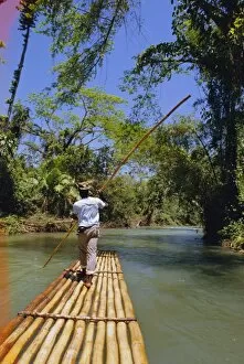
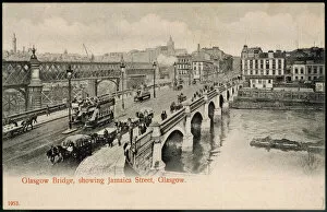
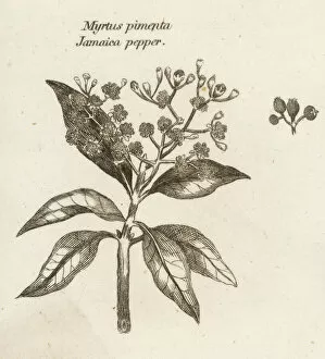
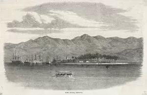
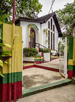
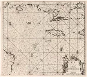
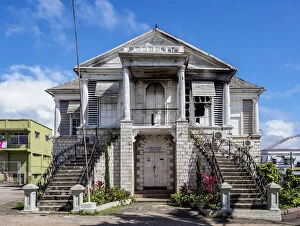
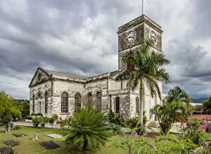
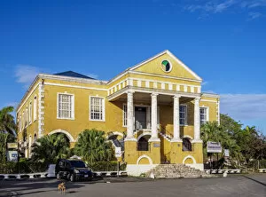
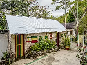
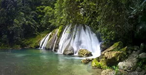
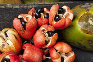
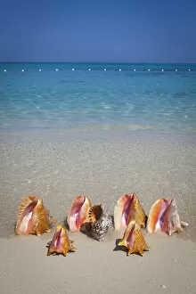
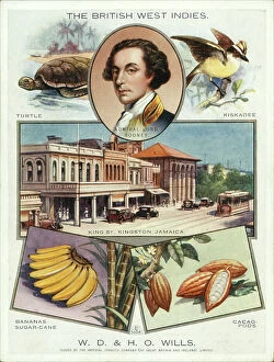
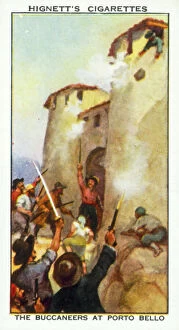
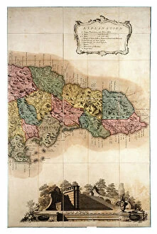
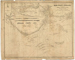
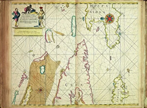
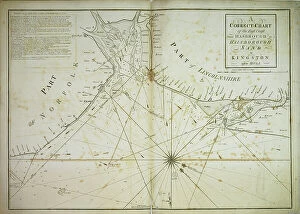
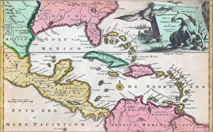
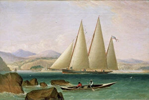
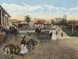
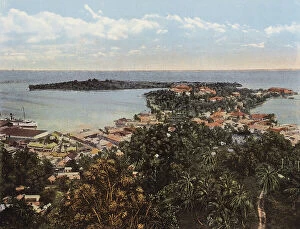
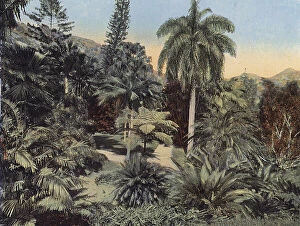
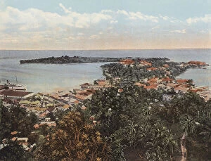
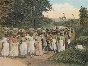
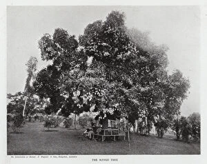
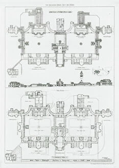
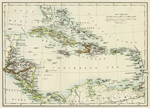
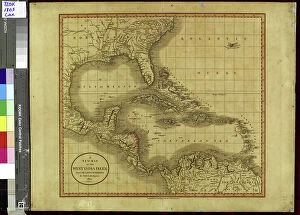
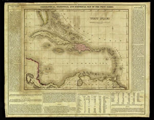
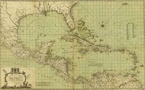
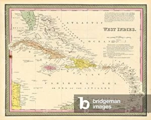
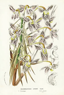
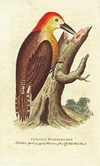
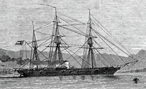
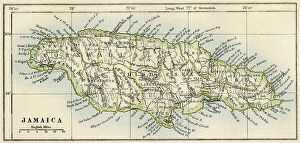
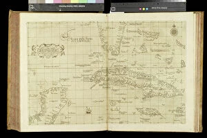
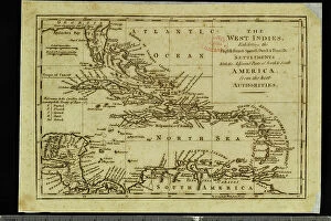
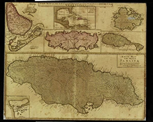
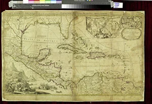
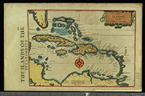
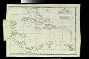
Discover the vibrant beauty and rich history of Jamaica, an enchanting Caribbean gem. Immerse yourself in the allure of this tropical paradise as you explore its diverse landscapes and cultural heritage. Unfold a map of Jamaica, tracing your finger along its captivating contours. From the iconic Dunns River Falls in Ocho Rios to the picturesque shores of Negril, every corner reveals breathtaking wonders waiting to be discovered. Transport yourself back in time with Daphne Du Maurier's captivating novel "Jamaica Inn, " set amidst the hauntingly beautiful Bodmin Moor in Cornwall. Feel a connection between distant lands as you admire British maps from 1893, showcasing their colonial influence on this island nation. Indulge your senses at Ricks Cafe, where cliff diving meets stunning sunsets over crystal-clear waters. Sip on refreshing cocktails at Margaritaville Pub on the Hip Strip while immersing yourself in the lively Jamaican culture that pulses through every street corner. Marvel at colorful buildings adorning Turks and Caicos islands, reminiscent of a vibrant painting come to life. As you soak up these sights, reflect upon historical imagery like "The Devilfish in Egyptian Waters, " which symbolizes England's imperialistic reach across continents during the late 19th century. Let Jamaica's warmth embrace you as you bask under golden rays on pristine beaches or embark on thrilling adventures up Dunns River Falls. This Caribbean jewel beckons explorers seeking both tranquility and excitement within its borders. As night falls, feel the rhythm pulsate through your veins as reggae beats fill the air. Dance alongside locals who embody Jamaica's infectious spirit for life – an energy that has captivated hearts since ancient times. Intrigue awaits around every corner; let Jamaica unveil its secrets to those willing to wander off well-trodden paths. Uncover hidden treasures amidst lush jungles and turquoise waters – for it is here that the true essence comes alive.